
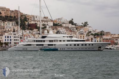
AXIOMA
Yacht
Current Trip
| Time Travelled | 8 days |
|---|---|
| Remaining Time | --- |
| Distance Travelled | 149.53 nm |
| Remaining Distance | --- |
| AVG Speed | 9.8 Knop |
| MAX Speed | 14.4 Knop |
| AVG Wind | 9.1 knots |
| MAX Wind | 30 knots |
| MIN Temp | 14.6°C / 58.28°F |
| MAX Temp | 22.8°C / 73.04°F |
| Djupgående | 3.9 m |
| Position mottagen | 3 m sen |
Current Position
| Longitud | 7.46617° |
|---|---|
| Latitude | 43.74236° |
| Status | At anchor |
| Fart | 0.3 Knop |
| Kurs | 295° |
| Område | Mediterranean Sea - Western Basin |
| Station | T-AIS |
| Position mottagen | 3 m sen |
Information
The current position of AXIOMA is in Mediterranean Sea - Western Basin with coordinates 43.74236° / 7.46617° as reported on 2025-05-25 23:30 by AIS to our vessel tracker app. The vessel's current speed is 0.3 Knop
The vessel AXIOMA (IMO: 9571143, MMSI: 229894000) is a Yacht that was built in 2013 ( 12 År gammal ). It's sailing under the flag of [MT] Malta.
In this page you can find informations about the vessels current position, last detected port calls, and current voyage information. If the vessels is not in coverage by AIS you will find the latest position.
The current position of AXIOMA is detected by our AIS receivers and we are not responsible for the reliability of the data. The last position was recorded while the vessel was in Coverage by the Ais receivers of our vessel tracking app.
The current draught of AXIOMA as reported by AIS is 3.9 meters
Weather
| Temperature | 17.9°C / 64.22°F |
|---|---|
| Wind Speed | 9 knots |
| Direction | 58° ENE |
| Pressure | 1015.1 hPa |
| Humidity | 77 % |
| Cloud Coverage | 78 % |
Featured Company
Last Trips
Events
| Tid | Event | Detaljer | Position / Dest | Information |
|---|---|---|---|---|
| 2025-05-23 13:16 | Status ändrad | At anchor Under way using engine |
43.74302 / 7.47615
FRCEQ
|
Fart: 0.8 kn Kurs: 278° |
| 2025-05-23 12:57 | STOPPAR förflyttning | 2.47 nm, East of MONACO |
43.74300 / 7.47512
FRCEQ
|
Fart: 0.1 kn Kurs: 311° |
| 2025-05-23 12:43 | Byter havsområde | French part of the Mediterranean Sea - Western Basin Monégasque part of the Mediterranean Sea - Western Basin |
43.73350 / 7.46148
Mediterranean Sea - Western Basin
|
Fart: 7.8 kn Kurs: 54.4° |
| 2025-05-23 12:34 | Byter havsområde | Monégasque part of the Mediterranean Sea - Western Basin French part of the Mediterranean Sea - Western Basin |
43.71088 / 7.43322
Mediterranean Sea - Western Basin
|
Fart: 13.3 kn Kurs: 40.7° |
| 2025-05-23 10:26 | STARTAR förflyttning | 0.58 nm, South West of CANNES |
43.53836 / 7.01364
FRCEQ
|
Fart: 6.5 kn Kurs: 192.5° |
| 2025-05-23 10:24 | Status ändrad | Under way using engine At anchor |
43.54063 / 7.01466
FRCEQ
|
Fart: Kurs: 211° |
| 2025-05-23 09:53 | Status ändrad | At anchor Under way using engine |
43.54056 / 7.01481
FRCEQ
|
Fart: 0.8 kn Kurs: 148° |
| 2025-05-22 19:09 | STOPPAR förflyttning | 0.49 nm, South West of CANNES |
43.54017 / 7.01483
FRCEQ
|
Fart: 0.3 kn Kurs: 343° |
| 2025-05-22 19:00 | STARTAR förflyttning | 0.51 nm, South West of CANNES |
43.53625 / 7.01894
FRCEQ
|
Fart: 4.4 kn Kurs: 332° |
| 2025-05-22 18:56 | Status ändrad | Under way using engine At anchor |
43.53410 / 7.02001
FRCEQ
|
Fart: 0.4 kn Kurs: 33° |