
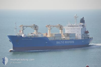
BALTIC HOLLYHOCK
Reefer
Current Trip
| Time Travelled | 11 h, 46 mins |
|---|---|
| Remaining Time | 1 day |
| Distance Travelled | 149.61 nm |
| Remaining Distance | 865.90 nm |
| AVG Speed | 16.4 Knop |
| MAX Speed | 18.9 Knop |
| AVG Wind | 15.2 knots |
| MAX Wind | 19.9 knots |
| MIN Temp | 11°C / 51.8°F |
| MAX Temp | 14.1°C / 57.38°F |
| Djupgående | 7.8 m |
| Position mottagen | 9 h, 47 m sen |
Current Position
| Longitud | -9.17114° |
|---|---|
| Latitude | 42.50357° |
| Status | Under way using engine |
| Fart | 18.5 Knop |
| Kurs | 317.8° |
| Område | North Atlantic Ocean |
| Station | T-AIS |
| Position mottagen | 9 h, 47 m sen |
Info
Information
The current position of BALTIC HOLLYHOCK is in North Atlantic Ocean with coordinates 42.50357° / -9.17114° as reported on 2025-02-12 21:07 by AIS to our vessel tracker app. The vessel's current speed is 18.5 Knop and is heading at the port of ROTTERDAM. The estimated time of arrival as calculated by MyShipTracking vessel tracking app is 2025-02-15 05:02 LT
The vessel BALTIC HOLLYHOCK (IMO: 9189902, MMSI: 311000977) is a Reefer that was built in 1999 ( 26 År gammal ). It's sailing under the flag of [BS] Bahamas.
In this page you can find informations about the vessels current position, last detected port calls, and current voyage information. If the vessels is not in coverage by AIS you will find the latest position.
The current position of BALTIC HOLLYHOCK is detected by our AIS receivers and we are not responsible for the reliability of the data. The last position was recorded while the vessel was in Coverage by the Ais receivers of our vessel tracking app.
The current draught of BALTIC HOLLYHOCK as reported by AIS is 7.8 meters
Weather
| Temperature | 13.6°C / 56.48°F |
|---|---|
| Wind Speed | 19 knots |
| Direction | 215° SW |
| Pressure | 1015.4 hPa |
| Humidity | 93.9 % |
| Cloud Coverage | 100 % |
Featured Company
Last Port Calls
| Port | Arrival | Departure | Time In Port |
|---|---|---|---|
| 2025-02-11 08:53 | 2025-02-12 19:09 | 1 d | |
| 2025-01-28 18:32 | 2025-02-03 15:37 | 5 d | |
| 2025-01-17 12:07 | 2025-01-24 18:35 | 7 d | |
| 2025-01-07 23:01 | 2025-01-11 04:11 | 3 d | |
| 2025-01-04 10:11 | 2025-01-05 01:48 | 15 h | |
| 2025-01-02 11:43 | 2025-01-03 23:00 | 1 d | |
| 2024-12-30 11:48 | 2024-12-31 06:18 | 18 h | |
| 2024-12-17 18:37 | 2024-12-22 20:32 | 5 d | |
| 2024-12-09 02:05 | 2024-12-13 14:14 | 4 d | |
| 2024-12-06 11:28 | 2024-12-07 15:00 | 1 d |
Last Trips
| Origin | Departure | Destination | Arrival | Distance | |
|---|---|---|---|---|---|
| 2025-02-03 12:37 | 2025-02-11 09:53 | 3234.42 nm | |||
| 2025-01-24 18:35 | 2025-01-28 15:32 | 1626.83 nm | |||
| 2025-01-11 05:11 | 2025-01-17 12:07 | 2631.85 nm | |||
| 2025-01-05 01:48 | 2025-01-08 00:01 | 151.62 nm | |||
| 2025-01-04 00:00 | 2025-01-04 10:11 | 143.09 nm | |||
| 2024-12-31 07:18 | 2025-01-02 12:43 | 909.11 nm | |||
| 2024-12-22 17:32 | 2024-12-30 12:48 | 3234.69 nm | |||
| 2024-12-13 11:14 | 2024-12-17 15:37 | 724.73 nm | |||
| 2024-12-07 12:00 | 2024-12-08 23:05 | 571.00 nm | |||
| 2024-11-20 21:56 | 2024-12-06 08:28 | 5527.35 nm |
Events
| Tid | Event | Detaljer | Position / Dest | Information |
|---|---|---|---|---|
| 2025-02-12 21:07 | Status ändrad | Default Under way using engine |
42.50407 / -9.17178
NLRTM
|
Fart: 18.5 kn Kurs: 317.8° |
| 2025-02-12 21:07 | UTANFÖR täckningsområde |
42.50357 / -9.17114
North Atlantic Ocean
NLRTM
|
Fart: 18.5 kn Kurs: 317.8° |
|
| 2025-02-12 21:02 | Status ändrad | Under way using engine Default |
42.48147 / -9.14948
NLRTM
|
Fart: 18.3 kn Kurs: 321° |
| 2025-02-12 20:59 | Status ändrad | Default Under way using engine |
42.47007 / -9.13745
NLRTM
|
Fart: 17.6 kn Kurs: 319.2° |
| 2025-02-12 19:56 | ETA ändrat | 2025/02/14 22:00 2025/02/11 09:00 |
42.34099 / -8.88368
NLRTM
|
Fart: 12.2 kn Kurs: 230.4° |
| 2025-02-12 19:16 | Djupgående ändrat | 7.8 7.9 |
42.39529 / -8.73040
NLRTM
|
Fart: 6.9 kn Kurs: 240° |
| 2025-02-12 19:16 | Destination ändrad | NLRTM ESMPG |
42.39529 / -8.73040
NLRTM
|
Fart: 6.9 kn Kurs: 240° |
| 2025-02-12 19:09 | STARTAR förflyttning | 0.63 nm, West of MARIN |
42.40137 / -8.71526
ESMPG
|
Fart: 7.1 kn Kurs: 247° |
| 2025-02-12 19:09 | AVGÅTT HAMN |
|
42.40137 / -8.71526
ESMPG
|
Fart: 1.5 kn Kurs: 256° |
| 2025-02-12 18:58 | I täckningsområde |
42.40066 / -8.70120
North Atlantic Ocean
[ES] MARIN
|
Fart: 2.2 kn Kurs: 324.5° |