
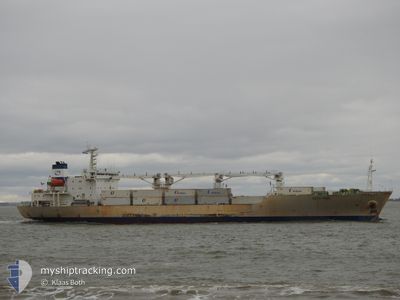
BALTIC PEARL
Reefer
Current Trip
| Time Travelled | 6 days |
|---|---|
| Remaining Time | 14 h, 59 mins |
| Distance Travelled | 1623.45 nm |
| Remaining Distance | 500.86 nm |
| AVG Speed | 14.6 Knop |
| MAX Speed | 17.7 Knop |
| AVG Wind | 12.1 knots |
| MAX Wind | 24 knots |
| MIN Temp | 22.2°C / 71.96°F |
| MAX Temp | 31.6°C / 88.88°F |
| Djupgående | 6.4 m |
| Position mottagen | 2 d sen |
Current Position
| Longitud | -79.43245° |
|---|---|
| Latitude | 9.90076° |
| Status | Under way using engine |
| Fart | 15.6 Knop |
| Kurs | 53° |
| Område | Caribbean Sea |
| Station | T-AIS |
| Position mottagen | 2 d sen |
Info
Information
The current position of BALTIC PEARL is in Caribbean Sea with coordinates 9.90076° / -79.43245° as reported on 2025-02-06 10:36 by AIS to our vessel tracker app. The vessel's current speed is 15.6 Knop and is heading at the port of CRISTOBAL. The estimated time of arrival as calculated by MyShipTracking vessel tracking app is 2025-02-09 04:00 LT
The vessel BALTIC PEARL (IMO: 9008732, MMSI: 309841000) is a Reefer that was built in 1991 ( 34 År gammal ). It's sailing under the flag of [BS] Bahamas.
In this page you can find informations about the vessels current position, last detected port calls, and current voyage information. If the vessels is not in coverage by AIS you will find the latest position.
The current position of BALTIC PEARL is detected by our AIS receivers and we are not responsible for the reliability of the data. The last position was recorded while the vessel was in Coverage by the Ais receivers of our vessel tracking app.
The current draught of BALTIC PEARL as reported by AIS is 6.4 meters
Weather
| Temperature | 26.1°C / 78.98°F |
|---|---|
| Wind Speed | 17 knots |
| Direction | 69° ENE |
| Pressure | 1016.8 hPa |
| Humidity | 74.2 % |
| Cloud Coverage | 2 % |
Featured Company
Last Port Calls
| Port | Arrival | Departure | Time In Port |
|---|---|---|---|
| 2025-01-30 00:07 | 2025-02-02 09:45 | 3 d | |
| 2025-01-20 19:40 | 2025-01-20 20:18 | 38 m | |
| 2025-01-06 17:32 | 2025-01-08 03:48 | 1 d | |
| 2024-12-28 23:31 | 2025-01-04 00:08 | 6 d | |
| 2024-12-26 19:24 | 2024-12-27 11:19 | 15 h | |
| 2024-12-22 10:33 | 2024-12-24 09:38 | 1 d | |
| 2024-12-16 09:29 | 2024-12-18 20:30 | 2 d |
Last Trips
| Origin | Departure | Destination | Arrival | Distance | |
|---|---|---|---|---|---|
| 2025-01-20 15:18 | 2025-01-29 19:07 | 2845.30 nm | |||
| 2025-01-08 00:48 | 2025-01-20 14:40 | 4432.63 nm | |||
| 2025-01-03 21:08 | 2025-01-06 14:32 | 101.81 nm | |||
| 2024-12-27 06:19 | 2024-12-28 20:31 | 616.68 nm | |||
| 2024-12-24 04:38 | 2024-12-26 14:24 | 517.58 nm | |||
| 2024-12-18 15:30 | 2024-12-22 05:33 | 5.15 nm | |||
| 2024-11-17 21:12 | 2024-12-16 04:29 | 8527.16 nm |
Events
| Tid | Event | Detaljer | Position / Dest | Information |
|---|---|---|---|---|
| 2025-02-06 10:44 | Status ändrad | Default Under way using engine |
9.92451 / -79.40067
PA CTB
|
Fart: 15.6 kn Kurs: 53° |
| 2025-02-06 10:36 | UTANFÖR täckningsområde |
9.90076 / -79.43245
Caribbean Sea
|
Fart: 15.6 kn Kurs: 53° |
|
| 2025-02-06 10:23 | Status ändrad | Under way using engine Default |
9.86912 / -79.47683
PA CTB
|
Fart: 14 kn Kurs: 54° |
| 2025-02-06 10:05 | Status ändrad | Default Under way using engine |
9.82329 / -79.53976
PA CTB
|
Fart: 15.7 kn Kurs: 53.3° |
| 2025-02-06 09:49 | Status ändrad | Under way using engine Default |
9.78201 / -79.59892
PA CTB
|
Fart: 16.3 kn Kurs: 55° |
| 2025-02-06 09:46 | Status ändrad | Default Under way using engine |
9.77433 / -79.61046
PA CTB
|
Fart: 14.8 kn Kurs: 56.2° |
| 2025-02-06 09:36 | Status ändrad | Under way using engine Default |
9.75019 / -79.64635
PA CTB
|
Fart: 15.6 kn Kurs: 55° |
| 2025-02-06 09:26 | Status ändrad | Default Under way using engine |
9.72382 / -79.67506
PA CTB
|
Fart: 15.4 kn Kurs: 41.5° |
| 2025-02-06 07:37 | Byter havsområde | Panamanian part of the Caribbean Sea Panamanian part of the North Pacific Ocean |
9.37472 / -79.91917
Caribbean Sea
|
Fart: 12 kn Kurs: 359.3° |
| 2025-02-06 06:53 | STARTAR förflyttning | 4.07 nm, South of CRISTOBAL |
9.27935 / -79.92185
PA CTB
|
Fart: 3.2 kn Kurs: 8° |