
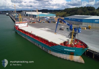
BARBARA-B
General Cargo
Current Trip
| Time Travelled | 7 days |
|---|---|
| Remaining Time | 8 h, 23 mins |
| Distance Travelled | 986.07 nm |
| Remaining Distance | 519.76 nm |
| AVG Speed | 8.1 Knop |
| MAX Speed | 11.2 Knop |
| AVG Wind | 14.7 knots |
| MAX Wind | 32.8 knots |
| MIN Temp | 9.3°C / 48.74°F |
| MAX Temp | 18.5°C / 65.3°F |
| Djupgående | 5 m |
| Position mottagen | 2 d sen |
Current Position
| Longitud | -9.22035° |
|---|---|
| Latitude | 41.40748° |
| Status | Under way using engine |
| Fart | 7.2 Knop |
| Kurs | 352.5° |
| Område | North Atlantic Ocean |
| Station | T-AIS |
| Position mottagen | 2 d sen |
Info
Information
The current position of BARBARA-B is in North Atlantic Ocean with coordinates 41.40748° / -9.22035° as reported on 2025-02-02 07:20 by AIS to our vessel tracker app. The vessel's current speed is 7.2 Knop and is heading at the port of LA PALLICE. The estimated time of arrival as calculated by MyShipTracking vessel tracking app is 2025-02-04 20:08 LT
The vessel BARBARA-B (IMO: 9177399, MMSI: 304588000) is a General Cargo that was built in 1997 ( 28 År gammal ). It's sailing under the flag of [AG] Antigua Barbuda.
In this page you can find informations about the vessels current position, last detected port calls, and current voyage information. If the vessels is not in coverage by AIS you will find the latest position.
The current position of BARBARA-B is detected by our AIS receivers and we are not responsible for the reliability of the data. The last position was recorded while the vessel was in Coverage by the Ais receivers of our vessel tracking app.
The current draught of BARBARA-B as reported by AIS is 5 meters
Weather
| Temperature | 11.9°C / 53.42°F |
|---|---|
| Wind Speed | 8 knots |
| Direction | 176° S |
| Pressure | 1025.5 hPa |
| Humidity | 79.1 % |
| Cloud Coverage | --- |
Featured Company
Last Port Calls
| Port | Arrival | Departure | Time In Port |
|---|---|---|---|
| 2025-01-27 13:20 | 2025-01-27 18:11 | 4 h | |
| 2025-01-25 01:21 | 2025-01-26 03:05 | 1 d | |
| 2025-01-13 23:53 | 2025-01-15 01:48 | 1 d | |
| 2025-01-06 14:29 | 2025-01-13 17:08 | 7 d | |
| 2024-12-16 04:44 | 2024-12-19 07:47 | 3 d |
Last Trips
| Origin | Departure | Destination | Arrival | Distance | |
|---|---|---|---|---|---|
| 2025-01-26 03:05 | 2025-01-27 13:20 | 264.09 nm | |||
| 2025-01-15 01:48 | 2025-01-25 01:21 | 1135.89 nm | |||
| 2025-01-13 17:08 | 2025-01-13 23:53 | 57.25 nm | |||
| 2024-12-19 07:47 | 2025-01-06 14:29 | 2271.66 nm | |||
| 2024-11-29 00:16 | 2024-12-16 04:44 | 3168.88 nm |
Events
| Tid | Event | Detaljer | Position / Dest | Information |
|---|---|---|---|---|
| 2025-02-02 07:39 | Status ändrad | Default Under way using engine |
41.44288 / -9.22199
FRLPE
|
Fart: 7.2 kn Kurs: 352.5° |
| 2025-02-02 07:20 | Status ändrad | Under way using engine Default |
41.40748 / -9.22035
FRLPE
|
Fart: 7.4 kn Kurs: 351° |
| 2025-02-02 07:20 | UTANFÖR täckningsområde |
41.40748 / -9.22035
North Atlantic Ocean
FRLPE
|
Fart: 7.2 kn Kurs: 352.5° |
|
| 2025-02-02 07:15 | Status ändrad | Default Under way using engine |
41.39584 / -9.21875
FRLPE
|
Fart: 7.5 kn Kurs: 342.7° |
| 2025-02-02 03:49 | Status ändrad | Under way using engine Default |
40.91297 / -9.13378
FRLPE
|
Fart: 8.8 kn Kurs: 2° |
| 2025-02-02 03:46 | I täckningsområde |
40.91297 / -9.13378
North Atlantic Ocean
FRLPE
|
Fart: 8.7 kn Kurs: 3.6° |
|
| 2025-02-01 20:27 | Status ändrad | Default Under way using engine |
39.93469 / -9.69021
FRLPE
|
Fart: 8.6 kn Kurs: 26.7° |
| 2025-02-01 20:22 | Status ändrad | Under way using engine Default |
39.92271 / -9.69833
FRLPE
|
Fart: 8.6 kn Kurs: 26° |
| 2025-02-01 20:22 | UTANFÖR täckningsområde |
39.92271 / -9.69833
North Atlantic Ocean
FRLPE
|
Fart: 8.6 kn Kurs: 26.7° |
|
| 2025-02-01 19:39 | Status ändrad | Default Under way using engine |
39.83522 / -9.76631
FRLPE
|
Fart: 8.6 kn Kurs: 20.6° |