
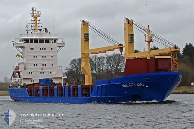
BBC ICELAND
General Cargo
Current Trip
| Trip Time | 25 days |
|---|---|
| Trip Distance | 7524.92 nm |
| AVG Speed | 11.8 Knop |
| MAX Speed | 14.2 Knop |
| Djupgående | 7.8 m |
| AVG Wind | 14.7 knots |
| MAX Wind | 26.5 knots |
| MIN Temp | 18.1°C / 64.58°F |
| MAX Temp | 27.5°C / 81.5°F |
| Position mottagen | 1 m sen |
Current Position
| Longitud | 18.42718° |
|---|---|
| Latitude | -33.91065° |
| Status | Moored |
| Fart | |
| Kurs | 312° |
| Område | South Atlantic Ocean |
| Station | T-AIS |
| Position mottagen | 1 m sen |
Info
Information
The current position of BBC ICELAND is in South Atlantic Ocean with coordinates -33.91065° / 18.42718° as reported on 2025-02-28 08:57 by AIS to our vessel tracker app. The vessel's current speed is 0 Knop and is currently inside the port of CAPE TOWN.
The vessel BBC ICELAND (IMO: 9605906, MMSI: 305657000) is a General Cargo that was built in 2013 ( 12 År gammal ). It's sailing under the flag of [AG] Antigua Barbuda.
In this page you can find informations about the vessels current position, last detected port calls, and current voyage information. If the vessels is not in coverage by AIS you will find the latest position.
The current position of BBC ICELAND is detected by our AIS receivers and we are not responsible for the reliability of the data. The last position was recorded while the vessel was in Coverage by the Ais receivers of our vessel tracking app.
The current draught of BBC ICELAND as reported by AIS is 7.8 meters
Weather
| Temperature | 23.4°C / 74.12°F |
|---|---|
| Wind Speed | 3 knots |
| Direction | 304° NW |
| Pressure | 1012.1 hPa |
| Humidity | 63.6 % |
| Cloud Coverage | 3 % |
Featured Company
Events
| Tid | Event | Detaljer | Position / Dest | Information |
|---|---|---|---|---|
| 2025-02-27 23:24 | Status ändrad | Moored Under way using engine |
-33.91062 / 18.42719
[ZA] CAPE TOWN
|
Fart: Kurs: 311° |
| 2025-02-27 23:22 | STOPPAR förflyttning |
-33.91060 / 18.42725
[ZA] CAPE TOWN
|
Fart: 0.3 kn Kurs: 309° |
|
| 2025-02-27 23:01 | ANLÄNDER HAMN |
|
-33.89957 / 18.43747
[ZA] CAPE TOWN
|
Fart: 5.3 kn Kurs: 188.4° |
| 2025-02-27 22:29 | STARTAR förflyttning | 3.85 nm, North of CAPE TOWN |
-33.84890 / 18.46140
ZACPT
|
Fart: 3.1 kn Kurs: 205° |
| 2025-02-27 21:49 | Status ändrad | Under way using engine At anchor |
-33.85162 / 18.46250
ZACPT
|
Fart: 0.3 kn Kurs: 85° |
| 2025-02-27 17:48 | Status ändrad | At anchor Under way using engine |
-33.85135 / 18.46112
ZACPT
|
Fart: 0.6 kn Kurs: 100° |
| 2025-02-27 17:37 | STOPPAR förflyttning | 3.7 nm, North of CAPE TOWN |
-33.85202 / 18.46263
ZACPT
|
Fart: 0.3 kn Kurs: 75° |
| 2025-02-27 14:40 | Djupgående ändrat | 7.8 8.2 |
-33.76133 / 18.20160
ZACPT
|
Fart: 4.5 kn Kurs: 145° |
| 2025-02-27 14:40 | ETA ändrat | 2025/02/27 16:00 2025/02/27 06:00 |
-33.76133 / 18.20160
ZACPT
|
Fart: 4.5 kn Kurs: 145° |
| 2025-02-27 14:07 | Byter havsområde | South African part of the South Atlantic Ocean Saint Lucia part of the Caribbean Sea |
-33.70779 / 18.14401
South Atlantic Ocean
|
Fart: 12.3 kn Kurs: 136.9° |