
BERKAY N
General Cargo
Current Trip
| Time Travelled | 3 days |
|---|---|
| Remaining Time | 15 h, 7 mins |
| Distance Travelled | 766.40 nm |
| Remaining Distance | 176.55 nm |
| AVG Speed | 10.4 Knop |
| MAX Speed | 12.1 Knop |
| AVG Wind | 5.6 knots |
| MAX Wind | 30 knots |
| MIN Temp | 10.5°C / 50.9°F |
| MAX Temp | 17.2°C / 62.96°F |
| Djupgående | 9.3 m |
| Position mottagen | 1 h, 10 m sen |
Current Position
| Longitud | 8.43464° |
|---|---|
| Latitude | 41.64652° |
| Status | Under way using engine |
| Fart | 11 Knop |
| Kurs | 323.6° |
| Område | Mediterranean Sea - Western Basin |
| Station | T-AIS |
| Position mottagen | 1 h, 10 m sen |
Info
Information
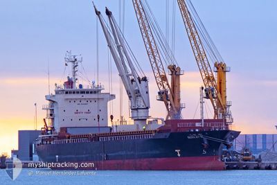
The current position of BERKAY N is in Mediterranean Sea - Western Basin with coordinates 41.64652° / 8.43464° as reported on 2025-12-16 08:09 by AIS to our vessel tracker app. The vessel's current speed is 11 Knop and is heading at the port of MARSEILLE. The estimated time of arrival as calculated by MyShipTracking vessel tracking app is 2025-12-17 01:26 LT
The vessel BERKAY N (IMO: 9524827, MMSI: 314496000) is a General Cargo that was built in 2008 ( 17 År gammal ). It's sailing under the flag of [BB] Barbados.
In this page you can find informations about the vessels current position, last detected port calls, and current voyage information. If the vessels is not in coverage by AIS you will find the latest position.
The current position of BERKAY N is detected by our AIS receivers and we are not responsible for the reliability of the data. The last position was recorded while the vessel was in Coverage by the Ais receivers of our vessel tracking app.
The current draught of BERKAY N as reported by AIS is 9.3 meters
Weather
| Temperature | 16.3°C / 61.34°F |
|---|---|
| Wind Speed | 9 knots |
| Direction | 145° SE |
| Pressure | 1012.1 hPa |
| Humidity | 83 % |
| Cloud Coverage | 100 % |
Featured Company
Last Port Calls
| Port | Arrival | Departure | Time In Port |
|---|---|---|---|
| 2025-12-09 08:38 | 2025-12-13 10:26 | 4 d | |
| 2025-12-03 06:52 | 2025-12-04 06:48 | 23 h | |
| 2025-11-10 09:17 | 2025-11-15 18:44 | 5 d | |
| 2025-11-02 08:35 | 2025-11-05 16:35 | 3 d | |
| 2025-10-27 08:56 | 2025-10-30 08:20 | 2 d |
Most Visited Ports (Last year)
| Port | Arrivals | |
|---|---|---|
| 3 | ||
| 2 | ||
| 2 | ||
| 2 | ||
| 2 | ||
| 2 |
Last Trips
| Origin | Departure | Destination | Arrival | Distance | |
|---|---|---|---|---|---|
| 2025-12-04 06:48 | 2025-12-09 08:38 | 493.34 nm | |||
| 2025-11-15 18:44 | 2025-12-03 06:52 | 3590.94 nm | |||
| 2025-11-05 16:35 | 2025-11-10 09:17 | 953.36 nm | |||
| 2025-10-30 08:20 | 2025-11-02 08:35 | 468.58 nm | |||
| 2025-09-30 21:28 | 2025-10-27 08:56 | 5675.08 nm |
Events
| Tid | Event | Detaljer | Position / Dest | Information |
|---|---|---|---|---|
| 2025-12-16 08:09 | UTANFÖR täckningsområde |
41.64652 / 8.43464
Mediterranean Sea - Western Basin
FRMRS
|
Fart: 11 kn Kurs: 323.6° |
|
| 2025-12-16 07:51 | I täckningsområde |
41.62518 / 8.46805
Mediterranean Sea - Western Basin
FRMRS
|
Fart: 11.2 kn Kurs: 311.9° |
|
| 2025-12-16 06:27 | Status ändrad | Under way using engine Default |
41.43385 / 8.75309
FRMRS
|
Fart: 11.1 kn Kurs: 312° |
| 2025-12-16 06:14 | Status ändrad | Default Under way using engine |
41.40802 / 8.78853
FRMRS
|
Fart: 11.1 kn Kurs: 313.5° |
| 2025-12-16 06:11 | UTANFÖR täckningsområde |
41.40169 / 8.79755
Mediterranean Sea - Western Basin
FRMRS
|
Fart: 11.1 kn Kurs: 313.5° |
|
| 2025-12-16 06:09 | Byter havsområde | French part of the Mediterranean Sea - Western Basin Italian part of the Tyrrhenian Sea |
41.39646 / 8.80497
Mediterranean Sea - Western Basin
FRMRS
|
Fart: 11.1 kn Kurs: 313.2° |
| 2025-12-16 06:09 | I täckningsområde |
41.39646 / 8.80497
Mediterranean Sea - Western Basin
FRMRS
|
Fart: 11.1 kn Kurs: 313.2° |
|
| 2025-12-14 23:58 | UTANFÖR täckningsområde |
38.83128 / 14.95962
Tyrrhenian Sea
FRMRS
|
Fart: 10.8 kn Kurs: 303.1° |
|
| 2025-12-14 23:58 | Status ändrad | Under way using engine Default |
38.83128 / 14.95962
FRMRS
|
Fart: 10.9 kn Kurs: 304° |
| 2025-12-14 23:53 | Status ändrad | Default Under way using engine |
38.82436 / 14.97296
FRMRS
|
Fart: 11.2 kn Kurs: 304.7° |