
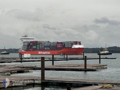
BG ORANGE
Cargo A
Current Trip
| Time Travelled | 17 h, 37 mins |
|---|---|
| Remaining Time | 1 day |
| Distance Travelled | 230.95 nm |
| Remaining Distance | 416.92 nm |
| AVG Speed | 12 Knop |
| MAX Speed | 16.1 Knop |
| AVG Wind | 21.9 knots |
| MAX Wind | 30 knots |
| MIN Temp | 5.6°C / 42.08°F |
| MAX Temp | 10.8°C / 51.44°F |
| Djupgående | 9.7 m |
| Position mottagen | 6 m sen |
Current Position
| Longitud | -5.46064° |
|---|---|
| Latitude | 49.85531° |
| Status | Under way using engine |
| Fart | 14.6 Knop |
| Kurs | 95.2° |
| Område | English Channel |
| Station | T-AIS |
| Position mottagen | 6 m sen |
Info
Information
The current position of BG ORANGE is in English Channel with coordinates 49.85531° / -5.46064° as reported on 2025-02-19 06:59 by AIS to our vessel tracker app. The vessel's current speed is 14.6 Knop and is heading at the port of ROTTERDAM. The estimated time of arrival as calculated by MyShipTracking vessel tracking app is 2025-02-20 14:22 LT
The vessel BG ORANGE (IMO: 9964637, MMSI: 255804850) is a Cargo A It's sailing under the flag of [PT] Portugal.
In this page you can find informations about the vessels current position, last detected port calls, and current voyage information. If the vessels is not in coverage by AIS you will find the latest position.
The current position of BG ORANGE is detected by our AIS receivers and we are not responsible for the reliability of the data. The last position was recorded while the vessel was in Coverage by the Ais receivers of our vessel tracking app.
The current draught of BG ORANGE as reported by AIS is 9.7 meters
Weather
| Temperature | 10.9°C / 51.62°F |
|---|---|
| Wind Speed | 9 knots |
| Direction | 278° W |
| Pressure | 1009.7 hPa |
| Humidity | 88 % |
| Cloud Coverage | 100 % |
Featured Company
Last Port Calls
| Port | Arrival | Departure | Time In Port |
|---|---|---|---|
| 2025-02-14 23:14 | 2025-02-18 13:29 | 3 d | |
| 2025-02-09 18:48 | 2025-02-12 00:35 | 2 d | |
| 2025-02-07 21:37 | 2025-02-09 18:45 | 1 d | |
| 2025-02-03 01:47 | 2025-02-05 18:21 | 2 d | |
| 2025-01-31 11:11 | 2025-02-01 14:10 | 1 d | |
| 2025-01-25 18:49 | 2025-01-29 01:17 | 3 d | |
| 2025-01-25 00:57 | 2025-01-25 18:46 | 17 h | |
| 2025-01-24 19:33 | 2025-01-25 00:48 | 5 h | |
| 2025-01-24 14:06 | 2025-01-24 18:07 | 4 h | |
| 2025-01-24 14:06 |
Most Visited Ports (Last year)
| Port | Arrivals | |
|---|---|---|
| 24 | ||
| 9 | ||
| 8 | ||
| 6 | ||
| 4 | ||
| 2 |
Last Trips
| Origin | Departure | Destination | Arrival | Distance | |
|---|---|---|---|---|---|
| 2025-02-12 01:35 | 2025-02-14 23:14 | 655.28 nm | |||
| 2025-02-09 19:45 | 2025-02-09 19:48 | 0.76 nm | |||
| 2025-02-05 18:21 | 2025-02-07 22:37 | 637.63 nm | |||
| 2025-02-01 14:10 | 2025-02-03 01:47 | 128.03 nm | |||
| 2025-01-29 02:17 | 2025-01-31 11:11 | 706.81 nm | |||
| 2025-01-25 19:46 | 2025-01-25 19:49 | 0.53 nm | |||
| 2025-01-25 01:48 | 2025-01-25 01:57 | 0.69 nm | |||
| 2025-01-24 19:07 | 2025-01-24 20:33 | 15.21 nm | |||
| 2025-01-24 12:50 | 2025-01-24 15:06 | 16.40 nm | |||
| 2025-01-24 12:50 | 2025-01-24 15:06 | 16.40 nm |
Events
| Tid | Event | Detaljer | Position / Dest | Information |
|---|---|---|---|---|
| 2025-02-19 06:47 | Upptäckt i hav | United Kingdom part of the English Channel |
49.86059 / -5.54023
English Channel
NL RTM
|
Fart: 14.7 kn Kurs: 96.8° |
| 2025-02-19 05:45 | I täckningsområde |
49.89083 / -5.93172
Celtic Sea
NL RTM
|
Fart: 14.7 kn Kurs: 98.3° |
|
| 2025-02-19 00:35 | UTANFÖR täckningsområde |
50.98202 / -6.02951
Celtic Sea
NL RTM
|
Fart: 12.5 kn Kurs: 183.4° |
|
| 2025-02-18 20:02 | Djupgående ändrat | 9.7 9.8 |
51.89932 / -5.88633
NL RTM
|
Fart: 13.1 kn Kurs: 197° |
| 2025-02-18 19:48 | Upptäckt i hav | United Kingdom part of the Celtic Sea |
51.94903 / -5.86981
Celtic Sea
NL RTM
|
Fart: 13.1 kn Kurs: 188.5° |
| 2025-02-18 19:22 | Byter havsområde | Irish part of the Celtic Sea Irish part of the Irish Sea and St. George's Channel |
52.04514 / -5.84402
Celtic Sea
NL RTM
|
Fart: 13.8 kn Kurs: 189.1° |
| 2025-02-18 19:08 | I täckningsområde |
52.09956 / -5.82940
Irish Sea and St. George's Channel
NL RTM
|
Fart: 14.1 kn Kurs: 189.9° |
|
| 2025-02-18 17:14 | UTANFÖR täckningsområde |
52.57031 / -5.79535
Irish Sea and St. George's Channel
NL RTM
|
Fart: 15.5 kn Kurs: 179.7° |
|
| 2025-02-18 13:29 | AVGÅTT HAMN |
|
53.34369 / -6.17454
NL RTM
|
Fart: 8.3 kn Kurs: 89° |
| 2025-02-18 13:19 | STARTAR förflyttning |
53.34412 / -6.20463
[IE] DUBLIN
|
Fart: 4.2 kn Kurs: 99° |