
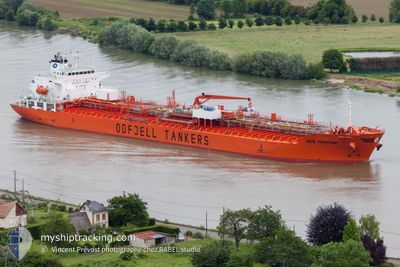
BOW HARMONY
Oil/Chemical Tanker
Current Trip
BRPNG
| Time Travelled | 7 days |
|---|---|
| Remaining Time | --- |
| Distance Travelled | 1900.28 nm |
| Remaining Distance | --- |
| AVG Speed | 13 Knop |
| MAX Speed | 14.2 Knop |
| AVG Wind | 11 knots |
| MAX Wind | 23 knots |
| MIN Temp | 21.6°C / 70.88°F |
| MAX Temp | 29.9°C / 85.82°F |
| Djupgående | 9.4 m |
| Position mottagen | 9 d sen |
Current Position
| Longitud | -48.21473° |
|---|---|
| Latitude | -25.66827° |
| Status | Under way using engine |
| Fart | 8.2 Knop |
| Kurs | 314° |
| Område | South Atlantic Ocean |
| Station | T-AIS |
| Position mottagen | 9 d sen |
Info
Information
The current position of BOW HARMONY is in South Atlantic Ocean with coordinates -25.66827° / -48.21473° as reported on 2025-01-28 20:47 by AIS to our vessel tracker app. The vessel's current speed is 8.2 Knop
The vessel BOW HARMONY (IMO: 9379909, MMSI: 257441000) is a Oil/Chemical Tanker that was built in 2008 ( 17 År gammal ). It's sailing under the flag of [NO] Norway.
In this page you can find informations about the vessels current position, last detected port calls, and current voyage information. If the vessels is not in coverage by AIS you will find the latest position.
The current position of BOW HARMONY is detected by our AIS receivers and we are not responsible for the reliability of the data. The last position was recorded while the vessel was in Coverage by the Ais receivers of our vessel tracking app.
The current draught of BOW HARMONY as reported by AIS is 9.4 meters
Weather
| Temperature | 27.3°C / 81.14°F |
|---|---|
| Wind Speed | 9 knots |
| Direction | 77° ENE |
| Pressure | 1009 hPa |
| Humidity | 78.4 % |
| Cloud Coverage | 12 % |
Featured Company
Last Port Calls
| Port | Arrival | Departure | Time In Port |
|---|---|---|---|
| 2025-01-28 22:53 | 2025-01-31 14:38 | 2 d | |
| 2025-01-24 17:14 | 2025-01-25 19:58 | 1 d | |
| 2025-01-21 08:30 | 2025-01-24 05:34 | 2 d | |
| 2025-01-17 02:10 | 2025-01-21 07:02 | 4 d | |
| 2024-12-29 02:22 | 2024-12-30 14:54 | 1 d | |
| 2024-12-16 10:20 | 2024-12-17 12:50 | 1 d | |
| 2024-12-13 19:46 | 2024-12-15 21:53 | 2 d | |
| 2024-12-05 23:39 | 2024-12-09 13:46 | 3 d | |
| 2024-12-05 15:41 |
Last Trips
| Origin | Departure | Destination | Arrival | Distance | |
|---|---|---|---|---|---|
| 2025-01-25 16:58 | 2025-01-28 19:53 | 957.91 nm | |||
| 2025-01-24 02:34 | 2025-01-24 14:14 | 122.01 nm | |||
| 2025-01-21 04:02 | 2025-01-21 05:30 | 10.50 nm | |||
| 2024-12-30 11:54 | 2025-01-16 23:10 | 2236.72 nm | |||
| 2024-12-17 13:50 | 2024-12-28 23:22 | 3588.68 nm | |||
| 2024-12-15 22:53 | 2024-12-16 11:20 | 144.44 nm | |||
| 2024-12-09 14:46 | 2024-12-13 20:46 | 1418.10 nm | |||
| 2024-12-05 16:41 | 2024-12-06 00:39 | 73.69 nm |
Events
| Tid | Event | Detaljer | Position / Dest | Information |
|---|---|---|---|---|
| 2025-02-01 20:21 | STARTAR förflyttning | 1.94 nm, East of PARANAGUA |
-25.49057 / -48.48360
BRPNG
|
Fart: 6.6 kn Kurs: 100° |
| 2025-01-31 15:24 | STOPPAR förflyttning | 1.46 nm, North East of PARANAGUA |
-25.48945 / -48.49365
BRPNG
|
Fart: 0.3 kn Kurs: 99° |
| 2025-01-31 14:46 | STARTAR förflyttning | 0.62 nm, West of PARANAGUA |
-25.49852 / -48.52885
BRPNG
|
Fart: 6.8 kn Kurs: 94° |
| 2025-01-31 14:38 | AVGÅTT HAMN |
|
-25.49663 / -48.53773
BRPNG
|
Fart: 1.5 kn Kurs: 259° |
| 2025-01-28 23:05 | STOPPAR förflyttning |
-25.50037 / -48.53686
[BR] PARANAGUA
|
Fart: Kurs: 287° |
|
| 2025-01-28 22:53 | ANLÄNDER HAMN |
|
-25.49895 / -48.53438
[BR] PARANAGUA
|
Fart: 4.9 kn Kurs: 267° |
| 2025-01-28 20:49 | Status ändrad | Default Under way using engine |
-25.66438 / -48.21919
BRPNG
|
Fart: 8.2 kn Kurs: 314° |
| 2025-01-28 20:47 | UTANFÖR täckningsområde |
-25.66827 / -48.21473
South Atlantic Ocean
BRPNG
|
Fart: 8.2 kn Kurs: 314° |
|
| 2025-01-28 20:43 | Status ändrad | Under way using engine Default |
-25.67523 / -48.20673
BRPNG
|
Fart: 9.8 kn Kurs: 313° |