

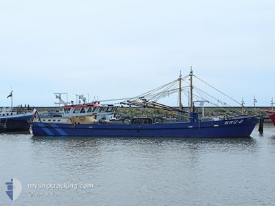
BRU-8 MARINUS
Fishing Vessel

Current Trip
| Trip Time | 2 days |
|---|---|
| Trip Distance | 119.96 nm |
| AVG Speed | 5.4 Knop |
| MAX Speed | 12.1 Knop |
| Djupgående | 1.5 m |
| AVG Wind | 15.3 knots |
| MAX Wind | 19 knots |
| MIN Temp | 9.6°C / 49.28°F |
| MAX Temp | 12.5°C / 54.5°F |
| Position mottagen | Nu |
Current Position
| Longitud | 5.41114° |
|---|---|
| Latitude | 53.17073° |
| Status | Under way using engine |
| Fart | |
| Kurs | 310° |
| Område | North Sea |
| Station | T-AIS |
| Position mottagen | Nu |
Information
The current position of BRU-8 MARINUS is in North Sea with coordinates 53.17073° / 5.41114° as reported on 2025-04-26 20:49 by AIS to our vessel tracker app. The vessel's current speed is 0 Knop and is currently inside the port of HARLINGEN.
The vessel BRU-8 MARINUS (IMO: 8911970, MMSI: 244035000) is a Fishing Vessel that was built in 1990 ( 35 År gammal ). It's sailing under the flag of [NL] Netherlands.
In this page you can find informations about the vessels current position, last detected port calls, and current voyage information. If the vessels is not in coverage by AIS you will find the latest position.
The current position of BRU-8 MARINUS is detected by our AIS receivers and we are not responsible for the reliability of the data. The last position was recorded while the vessel was in Coverage by the Ais receivers of our vessel tracking app.
The current draught of BRU-8 MARINUS as reported by AIS is 1.5 meters
Weather
| Temperature | 10.4°C / 50.72°F |
|---|---|
| Wind Speed | 9 knots |
| Direction | 70° ENE |
| Pressure | 1024.6 hPa |
| Humidity | 84.2 % |
| Cloud Coverage | 8 % |


Featured Company
Last Port Calls
| Port | Arrival | Departure | Time In Port |
|---|---|---|---|
| 2025-04-24 15:21 | |||
| 2025-04-17 14:48 | 2025-04-22 06:10 | 4 d | |
| 2025-04-16 15:11 | 2025-04-16 21:26 | 6 h | |
| 2025-04-15 13:33 | 2025-04-15 14:29 | 56 m | |
| 2025-04-10 19:26 | 2025-04-14 06:10 | 3 d | |
| 2025-04-09 10:18 | 2025-04-09 10:59 | 40 m | |
| 2025-04-07 16:30 | 2025-04-07 16:50 | 19 m | |
| 2025-04-03 13:56 | 2025-04-07 06:02 | 3 d | |
| 2025-04-01 19:00 | 2025-04-01 19:17 | 16 m | |
| 2025-03-31 17:28 | 2025-03-31 19:00 | 1 h |
Most Visited Ports (Last year)
| Port | Arrivals | |
|---|---|---|
| 79 | ||
| 9 | ||
| 7 | ||
| 6 | ||
| 6 | ||
| 2 |
Last Trips
| Origin | Departure | Destination | Arrival | Distance | |
|---|---|---|---|---|---|
| 2025-04-22 06:10 | 2025-04-24 15:21 | 119.96 nm | |||
| 2025-04-16 21:26 | 2025-04-17 14:48 | 67.21 nm | |||
| 2025-04-15 14:29 | 2025-04-16 15:11 | 31.43 nm | |||
| 2025-04-14 06:10 | 2025-04-15 13:33 | 66.89 nm | |||
| 2025-04-09 10:59 | 2025-04-10 19:26 | 36.77 nm | |||
| 2025-04-07 16:50 | 2025-04-09 10:18 | 24.96 nm | |||
| 2025-04-07 06:02 | 2025-04-07 16:30 | 25.33 nm | |||
| 2025-04-01 19:17 | 2025-04-03 13:56 | 94.95 nm | |||
| 2025-03-31 19:00 | 2025-04-01 19:00 | 50.61 nm | |||
| 2025-03-31 06:15 | 2025-03-31 17:28 | 40.96 nm |
Events
| Tid | Event | Detaljer | Position / Dest | Information |
|---|---|---|---|---|
| 2025-04-24 13:46 | STOPPAR förflyttning |
53.17079 / 5.41113
[NL] HARLINGEN
|
Fart: 0.2 kn Kurs: 305° |
|
| 2025-04-24 13:40 | STARTAR förflyttning |
53.17812 / 5.41275
[NL] HARLINGEN
|
Fart: 7.3 kn Kurs: 213° |
|
| 2025-04-24 13:22 | STOPPAR förflyttning |
53.17962 / 5.41452
[NL] HARLINGEN
|
Fart: 0.3 kn Kurs: 157° |
|
| 2025-04-24 13:21 | ANLÄNDER HAMN |
|
53.17963 / 5.41451
[NL] HARLINGEN
|
Fart: 1.1 kn Kurs: 152° |
| 2025-04-24 09:40 | STARTAR förflyttning | 5.49 nm, East of TERSCHELLING |
53.33153 / 5.36555
WERP
|
Fart: 3.8 kn Kurs: 154° |
| 2025-04-24 09:36 | STOPPAR förflyttning | 5.45 nm, East of TERSCHELLING |
53.33379 / 5.36529
WERP
|
Fart: 0.2 kn Kurs: 270° |
| 2025-04-24 09:02 | STARTAR förflyttning | 5.44 nm, East of TERSCHELLING |
53.33295 / 5.36476
WERP
|
Fart: 3.6 kn Kurs: 161° |
| 2025-04-24 08:59 | STOPPAR förflyttning | 5.48 nm, East of TERSCHELLING |
53.33452 / 5.36645
WERP
|
Fart: 0.1 kn Kurs: 111° |
| 2025-04-24 08:04 | STARTAR förflyttning | 5.48 nm, East of TERSCHELLING |
53.33194 / 5.36518
WERP
|
Fart: 3.6 kn Kurs: 7° |
| 2025-04-24 07:49 | STOPPAR förflyttning | 5.57 nm, East of TERSCHELLING |
53.33027 / 5.36700
WERP
|
Fart: 0.2 kn Kurs: 171° |