

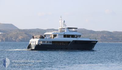
CAPE COD II
Pleasure Craft

Current Trip
| Trip Time | 5 mins |
|---|---|
| Trip Distance | 0.81 nm |
| AVG Speed | --- |
| MAX Speed | --- |
| Djupgående | 3 m |
| AVG Wind | 9.3 knots |
| MAX Wind | 9.7 knots |
| MIN Temp | 29.6°C / 85.28°F |
| MAX Temp | 29.7°C / 85.46°F |
| Position mottagen | 2 d sen |
Current Position
| Longitud | 33.03853° |
|---|---|
| Latitude | 34.66892° |
| Status | Moored |
| Fart | |
| Kurs | --- |
| Område | Mediterranean Sea - Eastern Basin |
| Station | T-AIS |
| Position mottagen | 2 d sen |
Information
The current position of CAPE COD II is in Mediterranean Sea - Eastern Basin with coordinates 34.66892° / 33.03853° as reported on 2025-05-22 13:21 by AIS to our vessel tracker app. The vessel's current speed is 0 Knop and is currently inside the port of LIMASSOL.
The vessel CAPE COD II (MMSI: 215388000) is a Pleasure Craft It's sailing under the flag of [MT] Malta.
In this page you can find informations about the vessels current position, last detected port calls, and current voyage information. If the vessels is not in coverage by AIS you will find the latest position.
The current position of CAPE COD II is detected by our AIS receivers and we are not responsible for the reliability of the data. The last position was recorded while the vessel was in Coverage by the Ais receivers of our vessel tracking app.
The current draught of CAPE COD II as reported by AIS is 3 meters
Weather
| Temperature | 29.5°C / 85.1°F |
|---|---|
| Wind Speed | 11 knots |
| Direction | 220° SW |
| Pressure | 1010.9 hPa |
| Humidity | 25.3 % |
| Cloud Coverage | 100 % |


Featured Company
Last Port Calls
| Port | Arrival | Departure | Time In Port |
|---|---|---|---|
| 2025-05-22 12:38 | |||
| 2025-05-04 12:37 | 2025-05-22 12:33 | 17 d | |
| 2025-04-24 13:06 | 2025-05-02 12:40 | 7 d | |
| 2025-04-19 14:22 | 2025-04-24 02:57 | 4 d | |
| 2025-04-04 14:44 | 2025-04-17 07:41 | 12 d | |
| 2025-03-26 13:39 | 2025-04-04 06:15 | 8 d | |
| 2025-03-12 13:11 | 2025-03-26 13:23 | 14 d | |
| 2025-03-12 12:59 |
Most Visited Ports (Last year)
| Port | Arrivals | |
|---|---|---|
| 15 | ||
| 2 | ||
| 1 | ||
| 1 | ||
| 1 | ||
| 1 |
Last Trips
| Origin | Departure | Destination | Arrival | Distance | |
|---|---|---|---|---|---|
| 2025-05-22 15:33 | 2025-05-22 15:38 | 0.81 nm | |||
| 2025-05-02 15:40 | 2025-05-04 15:37 | 47.46 nm | |||
| 2025-04-24 05:57 | 2025-04-24 16:06 | 13.54 nm | |||
| 2025-04-17 10:41 | 2025-04-19 17:22 | 131.14 nm | |||
| 2025-04-04 09:15 | 2025-04-04 17:44 | 27.95 nm | |||
| 2025-03-26 15:23 | 2025-03-26 15:39 | 2.69 nm | |||
| 2025-03-12 14:59 | 2025-03-12 15:11 | 1.74 nm |
Events
| Tid | Event | Detaljer | Position / Dest | Information |
|---|---|---|---|---|
| 2025-05-22 13:21 | UTANFÖR täckningsområde |
34.66892 / 33.03853
Mediterranean Sea - Eastern Basin
[CY] LIMASSOL
|
Fart: Kurs: 294.8° |
|
| 2025-05-22 12:45 | STOPPAR förflyttning |
34.66886 / 33.03852
[CY] LIMASSOL
|
Fart: 0.1 kn Kurs: 511° |
|
| 2025-05-22 12:38 | ANLÄNDER HAMN |
|
34.67545 / 33.04078
[CY] LIMASSOL
|
Fart: 102.2 kn Kurs: 134.5° |
| 2025-05-22 12:38 | STARTAR förflyttning | 1.42 nm, North East of LIMASSOL |
34.67596 / 33.04055
LIMASSOL MARINA
|
Fart: 58.9 kn Kurs: 137.1° |
| 2025-05-22 12:33 | AVGÅTT HAMN |
|
34.68283 / 33.03998
LIMASSOL MARINA
|
Fart: 3.2 kn Kurs: 43.6° |
| 2025-05-22 12:24 | STOPPAR förflyttning |
34.67018 / 33.03866
[CY] LIMASSOL
|
Fart: 0.2 kn Kurs: 511° |
|
| 2025-05-22 12:23 | STARTAR förflyttning |
34.67137 / 33.03496
[CY] LIMASSOL
|
Fart: 25.6 kn Kurs: 196° |
|
| 2025-05-22 10:17 | ETA ändrat | 2025/05/22 13:40 2025/05/19 13:40 |
34.66887 / 33.03856
[CY] LIMASSOL
|
Fart: Kurs: 57° |
| 2025-05-22 07:59 | I täckningsområde |
34.66890 / 33.03849
Mediterranean Sea - Eastern Basin
[CY] LIMASSOL
|
Fart: Kurs: 325.9° |
|
| 2025-05-20 15:11 | UTANFÖR täckningsområde |
34.66893 / 33.03850
Mediterranean Sea - Eastern Basin
[CY] LIMASSOL
|
Fart: Kurs: 233.9° |