

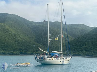
CAPRICIOUS
Sailing

Current Trip
CAPRICIOUS is out of coverage. Learn how you can join the community and extend the coverage to your area by clicking here!
Unknown
Destination Port
ETA*
---
| Time Travelled | 7 days |
|---|---|
| Remaining Time | --- |
| Distance Travelled | 104.64 nm |
| Remaining Distance | --- |
| AVG Speed | 6.8 Knop |
| MAX Speed | 9.1 Knop |
| AVG Wind | 17.7 knots |
| MAX Wind | 19.3 knots |
| MIN Temp | 22.8°C / 73.04°F |
| MAX Temp | 26.1°C / 78.98°F |
| Djupgående | --- |
| Position mottagen | 3 d sen |
Current Position
| Longitud | -66.29170° |
|---|---|
| Latitude | 17.94758° |
| Status | Default |
| Fart | |
| Kurs | --- |
| Område | Caribbean Sea |
| Station | T-AIS |
| Position mottagen | 3 d sen |
Information
The current position of CAPRICIOUS is in Caribbean Sea with coordinates 17.94758° / -66.29170° as reported on 2025-04-09 09:26 by AIS to our vessel tracker app. The vessel's current speed is 0 Knop
The vessel CAPRICIOUS (MMSI: 368261130) is a Sailing It's sailing under the flag of [US] USA.
In this page you can find informations about the vessels current position, last detected port calls, and current voyage information. If the vessels is not in coverage by AIS you will find the latest position.
The current position of CAPRICIOUS is detected by our AIS receivers and we are not responsible for the reliability of the data. The last position was recorded while the vessel was in Coverage by the Ais receivers of our vessel tracking app.
Weather
| Temperature | 22.6°C / 72.68°F |
|---|---|
| Wind Speed | 6 knots |
| Direction | 62° ENE |
| Pressure | 1015.5 hPa |
| Humidity | 87.7 % |
| Cloud Coverage | 14 % |


Featured Company
Limited time offer - Install a base station receiver to your area and list your company on MyShipTracking Free forever!
Last Port Calls
| Port | Arrival | Departure | Time In Port |
|---|---|---|---|
| 2025-03-29 13:07 | 2025-04-05 09:46 | 6 d | |
| 2025-03-17 15:08 | 2025-03-29 09:20 | 11 d | |
| 2025-03-14 09:59 | |||
| 2025-03-10 12:57 | 2025-03-10 15:24 | 2 h | |
| 2025-03-03 09:05 | 2025-03-10 09:10 | 7 d | |
| 2025-02-27 11:43 | 2025-02-27 13:37 | 1 h | |
| 2025-02-05 14:24 | 2025-02-05 14:42 | 17 m |
Most Visited Ports (Last year)
| Port | Arrivals | |
|---|---|---|
| 13 | ||
| 1 | ||
| 1 | ||
| 1 | ||
| 1 | ||
| 1 |
Last Trips
| Origin | Departure | Destination | Arrival | Distance | |
|---|---|---|---|---|---|
| 2025-03-29 09:20 | 2025-03-29 13:07 | 9.38 nm | |||
| 2025-03-14 09:59 | 2025-03-17 15:08 | 70.47 nm | |||
| 2025-03-10 09:10 | 2025-03-10 12:57 | 22.22 nm | |||
| 2025-02-27 13:37 | 2025-03-03 09:05 | 66.42 nm | |||
| 2025-02-05 14:42 | 2025-02-27 11:43 | 231.29 nm |
Events
| Tid | Event | Detaljer | Position / Dest | Information |
|---|---|---|---|---|
| 2025-04-09 09:26 | UTANFÖR täckningsområde |
17.94758 / -66.29170
Caribbean Sea
|
Fart: Kurs: 511° |
|
| 2025-04-09 03:50 | I täckningsområde |
17.94767 / -66.29181
Caribbean Sea
|
Fart: Kurs: 511° |
|
| 2025-04-06 18:16 | UTANFÖR täckningsområde |
18.10363 / -65.30240
Caribbean Sea
|
Fart: 6.3 kn Kurs: 240.9° |
|
| 2025-04-06 16:01 | I täckningsområde |
18.29144 / -65.27481
Caribbean Sea
|
Fart: 6 kn Kurs: 157.9° |
|
| 2025-04-05 18:58 | UTANFÖR täckningsområde |
18.28279 / -65.25895
Caribbean Sea
|
Fart: 6.8 kn Kurs: 290.2° |
|
| 2025-04-05 14:25 | STARTAR förflyttning | 1.2 nm, South East of ST THOMAS |
18.31039 / -64.83439
|
Fart: 6.1 kn Kurs: 227.6° |
| 2025-04-05 14:10 | STOPPAR förflyttning | 1.25 nm, South East of ST THOMAS |
18.31144 / -64.83191
|
Fart: 0.2 kn Kurs: 511° |
| 2025-04-05 13:46 | AVGÅTT HAMN |
|
18.33412 / -64.84480
|
Fart: 4.5 kn Kurs: 76.6° |
| 2025-04-05 13:45 | STARTAR förflyttning |
18.33365 / -64.84671
[VI] ST JOHN BAY
|
Fart: 4.2 kn Kurs: 66.3° |
|
| 2025-04-05 11:00 | I täckningsområde |
18.33290 / -64.84852
Caribbean Sea
[VI] ST JOHN BAY
|
Fart: Kurs: 511° |