
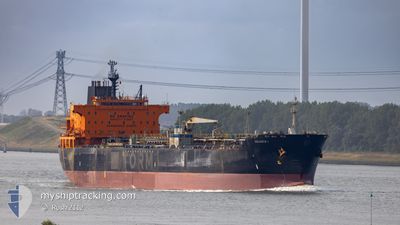
CELESTE I
Oil/Chemical Tanker
Current Trip
| Time Travelled | 2 days |
|---|---|
| Remaining Time | 4 h, 3 mins |
| Distance Travelled | 527.61 nm |
| Remaining Distance | 71.52 nm |
| AVG Speed | 13.1 Knop |
| MAX Speed | 14.5 Knop |
| AVG Wind | 17.4 knots |
| MAX Wind | 28.7 knots |
| MIN Temp | 9.4°C / 48.92°F |
| MAX Temp | 21.3°C / 70.34°F |
| Djupgående | 8 m |
| Position mottagen | 1 d sen |
Current Position
| Longitud | 32.55157° |
|---|---|
| Latitude | 29.86950° |
| Status | Under way using engine |
| Fart | 7.8 Knop |
| Kurs | 173.7° |
| Område | Gulf of Suez |
| Station | T-AIS |
| Position mottagen | 1 d sen |
Info
Information
The current position of CELESTE I is in Gulf of Suez with coordinates 29.86950° / 32.55157° as reported on 2025-02-06 09:46 by AIS to our vessel tracker app. The vessel's current speed is 7.8 Knop and is heading at the port of JEDDAH. The estimated time of arrival as calculated by MyShipTracking vessel tracking app is 2025-02-08 12:47 LT
The vessel CELESTE I (IMO: 9250488, MMSI: 352003334) is a Oil/Chemical Tanker that was built in 2003 ( 22 År gammal ). It's sailing under the flag of [PA] Panama.
In this page you can find informations about the vessels current position, last detected port calls, and current voyage information. If the vessels is not in coverage by AIS you will find the latest position.
The current position of CELESTE I is detected by our AIS receivers and we are not responsible for the reliability of the data. The last position was recorded while the vessel was in Coverage by the Ais receivers of our vessel tracking app.
The current draught of CELESTE I as reported by AIS is 8 meters
Weather
| Temperature | 21.9°C / 71.42°F |
|---|---|
| Wind Speed | 18 knots |
| Direction | 337° NNW |
| Pressure | 1015.7 hPa |
| Humidity | 63.9 % |
| Cloud Coverage | --- |
Featured Company
Last Port Calls
| Port | Arrival | Departure | Time In Port |
|---|---|---|---|
| 2025-02-03 13:35 | 2025-02-06 04:25 | 2 d | |
| 2025-01-27 07:25 | 2025-02-01 10:22 | 5 d | |
| 2025-01-23 22:08 | 2025-01-24 23:23 | 1 d | |
| 2025-01-06 15:54 | 2025-01-08 14:12 | 1 d | |
| 2024-12-23 15:15 | 2024-12-25 03:43 | 1 d | |
| 2024-12-13 17:04 | 2024-12-14 16:56 | 23 h | |
| 2024-12-11 07:23 | 2024-12-12 15:57 | 1 d | |
| 2024-12-08 02:44 | 2024-12-10 14:56 | 2 d | |
| 2024-12-06 02:08 | 2024-12-06 11:17 | 9 h | |
| 2024-12-02 19:39 | 2024-12-02 20:58 | 1 h |
Most Visited Ports (Last year)
| Port | Arrivals | |
|---|---|---|
| 6 | ||
| 4 | ||
| 3 | ||
| 2 | ||
| 1 | ||
| 1 |
Last Trips
| Origin | Departure | Destination | Arrival | Distance | |
|---|---|---|---|---|---|
| 2025-02-01 10:22 | 2025-02-03 13:35 | 633.95 nm | |||
| 2025-01-24 23:23 | 2025-01-27 07:25 | 699.70 nm | |||
| 2025-01-08 14:12 | 2025-01-23 22:08 | 4020.82 nm | |||
| 2024-12-25 03:43 | 2025-01-06 15:54 | 2924.79 nm | |||
| 2024-12-14 16:56 | 2024-12-23 15:15 | 2380.29 nm | |||
| 2024-12-12 15:57 | 2024-12-13 17:04 | 8.36 nm | |||
| 2024-12-10 14:56 | 2024-12-11 07:23 | 211.55 nm | |||
| 2024-12-02 20:58 | 2024-12-08 02:44 | 1409.00 nm | |||
| 2024-12-02 20:58 | 2024-12-06 02:08 | 828.20 nm | |||
| 2024-12-01 00:52 | 2024-12-02 19:39 | 466.82 nm |
Events
| Tid | Event | Detaljer | Position / Dest | Information |
|---|---|---|---|---|
| 2025-02-06 09:53 | Status ändrad | Default Under way using engine |
29.84721 / 32.55415
SA JED
|
Fart: 7.8 kn Kurs: 173.7° |
| 2025-02-06 09:46 | UTANFÖR täckningsområde |
29.86950 / 32.55157
Gulf of Suez
SA JED
|
Fart: 7.8 kn Kurs: 173.7° |
|
| 2025-02-06 09:37 | Status ändrad | Under way using engine Default |
29.89123 / 32.54404
SA JED
|
Fart: 0.6 kn Kurs: 293° |
| 2025-02-06 09:37 | STARTAR förflyttning | 3.44 nm, South of SUEZ PORT |
29.89123 / 32.54404
SA JED
|
Fart: 12 kn Kurs: 118.4° |
| 2025-02-06 09:20 | I täckningsområde |
29.88966 / 32.54623
Gulf of Suez
SA JED
|
Fart: 11.9 kn Kurs: 135.1° |
|
| 2025-02-06 08:32 | Status ändrad | Default At anchor |
29.88853 / 32.51064
SA JED
|
Fart: 0.2 kn Kurs: 1° |
| 2025-02-06 08:26 | UTANFÖR täckningsområde |
29.88805 / 32.50976
Gulf of Suez
SA JED
|
Fart: 0.2 kn Kurs: 2.9° |
|
| 2025-02-06 02:53 | Status ändrad | At anchor Under way using engine |
29.88903 / 32.50854
SA JED
|
Fart: 0.2 kn Kurs: 37° |
| 2025-02-06 02:49 | STOPPAR förflyttning | 1.6 nm, East of AL ADABIYAH |
29.88930 / 32.50839
SA JED
|
Fart: Kurs: 33° |
| 2025-02-06 02:25 | AVGÅTT HAMN |
|
29.88205 / 32.48392
SA JED
|
Fart: 5.9 kn Kurs: 92° |