
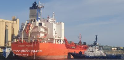
CHEM BARIUM
Tanker
Current Trip
| Time Travelled | 11 days |
|---|---|
| Remaining Time | --- |
| Distance Travelled | 2436.05 nm |
| Remaining Distance | --- |
| AVG Speed | 13 Knop |
| MAX Speed | 15 Knop |
| AVG Wind | 12.1 knots |
| MAX Wind | 21.2 knots |
| MIN Temp | 23.9°C / 75.02°F |
| MAX Temp | 28.4°C / 83.12°F |
| Djupgående | 10 m |
| Position mottagen | 3 d sen |
Current Position
| Longitud | 111.62178° |
|---|---|
| Latitude | -16.65875° |
| Status | Under way using engine |
| Fart | 3 Knop |
| Kurs | 128° |
| Område | Indian Ocean |
| Station | T-AIS |
| Position mottagen | 3 d sen |
Info
Information
The current position of CHEM BARIUM is in Indian Ocean with coordinates -16.65875° / 111.62178° as reported on 2025-02-09 08:08 by AIS to our vessel tracker app. The vessel's current speed is 3 Knop and is heading at the port of DAMPIER. The estimated time of arrival as calculated by MyShipTracking vessel tracking app is 2025-02-20 07:00 LT
The vessel CHEM BARIUM (IMO: 9838670, MMSI: 538008470) is a Tanker It's sailing under the flag of [MH] Marshall Is.
In this page you can find informations about the vessels current position, last detected port calls, and current voyage information. If the vessels is not in coverage by AIS you will find the latest position.
The current position of CHEM BARIUM is detected by our AIS receivers and we are not responsible for the reliability of the data. The last position was recorded while the vessel was in Coverage by the Ais receivers of our vessel tracking app.
The current draught of CHEM BARIUM as reported by AIS is 10 meters
Weather
| Temperature | 27.1°C / 80.78°F |
|---|---|
| Wind Speed | 17 knots |
| Direction | 221° SW |
| Pressure | 1004.4 hPa |
| Humidity | 86.6 % |
| Cloud Coverage | 99 % |
Featured Company
Last Port Calls
| Port | Arrival | Departure | Time In Port |
|---|---|---|---|
| 2025-01-31 02:47 | 2025-01-31 17:46 | 14 h | |
| 2025-01-24 05:57 | 2025-01-26 13:09 | 2 d | |
| 2025-01-03 15:21 | 2025-01-04 16:19 | 1 d | |
| 2024-12-15 13:07 | 2024-12-23 19:39 | 8 d |
Most Visited Ports (Last year)
| Port | Arrivals | |
|---|---|---|
| 7 | ||
| 6 | ||
| 5 | ||
| 4 | ||
| 3 | ||
| 3 |
Last Trips
| Origin | Departure | Destination | Arrival | Distance | |
|---|---|---|---|---|---|
| 2025-01-26 21:09 | 2025-01-31 10:47 | 270.23 nm | |||
| 2025-01-04 18:19 | 2025-01-24 13:57 | 5643.33 nm | |||
| 2024-12-23 20:39 | 2025-01-03 17:21 | 3030.97 nm | |||
| 2024-11-24 03:53 | 2024-12-15 14:07 | 4473.45 nm |
Events
| Tid | Event | Detaljer | Position / Dest | Information |
|---|---|---|---|---|
| 2025-02-12 02:55 | Djupgående ändrat | 10 9.8 |
-16.65875 / 111.62178
PORT LOUIS
|
Fart: 3 kn Kurs: 128° |
| 2025-02-12 02:55 | Destination ändrad | PORT LOUIS DAMPIER |
-16.65875 / 111.62178
PORT LOUIS
|
Fart: 3 kn Kurs: 128° |
| 2025-02-12 02:55 | ETA ändrat | 2025/02/12 05:00 2025/02/20 07:00 |
-16.65875 / 111.62178
PORT LOUIS
|
Fart: 3 kn Kurs: 128° |
| 2025-02-09 08:08 | UTANFÖR täckningsområde |
-16.65875 / 111.62178
Indian Ocean
DAMPIER
|
Fart: 3 kn Kurs: 128.4° |
|
| 2025-02-09 08:00 | Status ändrad | Under way using engine Default |
-16.65462 / 111.61637
DAMPIER
|
Fart: 3 kn Kurs: 128° |
| 2025-02-09 07:55 | Status ändrad | Default Under way using engine |
-16.65220 / 111.61320
DAMPIER
|
Fart: 3 kn Kurs: 128° |
| 2025-02-09 07:31 | Status ändrad | Under way using engine Default |
-16.63946 / 111.59655
DAMPIER
|
Fart: 3 kn Kurs: 128° |
| 2025-02-09 07:26 | Status ändrad | Default Under way using engine |
-16.63687 / 111.59316
DAMPIER
|
Fart: 3 kn Kurs: 128° |
| 2025-02-09 05:52 | Status ändrad | Under way using engine Default |
-16.56907 / 111.50423
DAMPIER
|
Fart: 14.1 kn Kurs: 128° |
| 2025-02-09 05:46 | Status ändrad | Default Under way using engine |
-16.55353 / 111.48380
DAMPIER
|
Fart: 14.1 kn Kurs: 128.4° |