
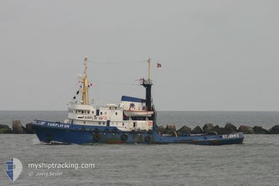
CHRISTOS XXIV
Tug
Current Trip
| Trip Time | 4 days |
|---|---|
| Trip Distance | 597.22 nm |
| AVG Speed | 6.2 Knop |
| MAX Speed | 10.8 Knop |
| Djupgående | 6 m |
| AVG Wind | 14.8 knots |
| MAX Wind | 25.8 knots |
| MIN Temp | 12.6°C / 54.68°F |
| MAX Temp | 24.6°C / 76.28°F |
| Position mottagen | 9 d sen |
Current Position
| Longitud | 36.02078° |
|---|---|
| Latitude | 26.18375° |
| Status | Restricted manoeuverability |
| Fart | 6.3 Knop |
| Kurs | 151.2° |
| Område | Red Sea |
| Station | T-AIS |
| Position mottagen | 9 d sen |
Info
Information
The current position of CHRISTOS XXIV is in Red Sea with coordinates 26.18375° / 36.02078° as reported on 2025-01-30 23:56 by AIS to our vessel tracker app. The vessel's current speed is 6.3 Knop and is currently inside the port of YANBU.
The vessel CHRISTOS XXIV (IMO: 7041625, MMSI: 370901000) is a Tug that was built in 1971 ( 54 År gammal ). It's sailing under the flag of [PA] Panama.
In this page you can find informations about the vessels current position, last detected port calls, and current voyage information. If the vessels is not in coverage by AIS you will find the latest position.
The current position of CHRISTOS XXIV is detected by our AIS receivers and we are not responsible for the reliability of the data. The last position was recorded while the vessel was in Coverage by the Ais receivers of our vessel tracking app.
The current draught of CHRISTOS XXIV as reported by AIS is 6 meters
Weather
| Temperature | 21.1°C / 69.98°F |
|---|---|
| Wind Speed | 20 knots |
| Direction | 304° NW |
| Pressure | 1014.6 hPa |
| Humidity | 64.7 % |
| Cloud Coverage | 4 % |
Featured Company
Last Port Calls
| Port | Arrival | Departure | Time In Port |
|---|---|---|---|
| 2025-02-01 14:32 | |||
| 2025-01-27 21:17 | 2025-01-28 19:10 | 21 h | |
| 2025-01-27 13:25 | 2025-01-27 21:05 | 7 h | |
| 2025-01-25 07:34 | 2025-01-25 11:06 | 3 h | |
| 2024-12-08 03:31 | 2024-12-08 21:03 | 17 h | |
| 2024-12-05 12:18 |
Most Visited Ports (Last year)
| Port | Arrivals | |
|---|---|---|
| 4 | ||
| 3 | ||
| 3 | ||
| 2 | ||
| 2 | ||
| 1 |
Last Trips
| Origin | Departure | Destination | Arrival | Distance | |
|---|---|---|---|---|---|
| 2025-01-27 21:05 | 2025-02-01 14:32 | 597.22 nm | |||
| 2025-01-27 21:05 | 2025-01-27 21:17 | --- | |||
| 2025-01-25 11:06 | 2025-01-27 13:25 | 233.13 nm | |||
| 2024-12-05 12:18 | 2025-01-25 07:34 | 1733.82 nm | |||
| 2024-12-05 12:18 | 2024-12-08 03:31 | 487.15 nm |
Events
| Tid | Event | Detaljer | Position / Dest | Information |
|---|---|---|---|---|
| 2025-02-01 11:57 | STOPPAR förflyttning |
24.07960 / 38.06960
[SA] YANBU
|
Fart: 0.3 kn Kurs: 349° |
|
| 2025-02-01 11:32 | ANLÄNDER HAMN |
|
24.06830 / 38.05127
[SA] YANBU
|
Fart: 5 kn Kurs: 47° |
| 2025-01-31 00:02 | Status ändrad | Default Restricted manoeuverability |
26.17428 / 36.02659
SA-YNB_>>
|
Fart: 6.3 kn Kurs: 151.2° |
| 2025-01-30 23:56 | UTANFÖR täckningsområde |
26.18375 / 36.02078
Red Sea
SA-YNB_>>
|
Fart: 6.3 kn Kurs: 151.2° |
|
| 2025-01-30 23:44 | Byter havsområde | Saudi Arabian part of the Red Sea Egyptian part of the Gulf of Suez |
26.20302 / 36.00893
Red Sea
SA-YNB_>>
|
Fart: 6.3 kn Kurs: 151.4° |
| 2025-01-30 23:42 | Status ändrad | Restricted manoeuverability Default |
26.20609 / 36.00708
SA-YNB_>>
|
Fart: 6.3 kn Kurs: 152° |
| 2025-01-30 23:42 | I täckningsområde |
26.20302 / 36.00893
Red Sea
SA-YNB_>>
|
Fart: 6.3 kn Kurs: 151.4° |