
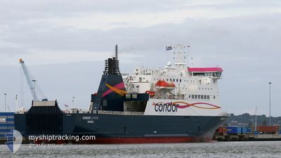
CONDOR ISLANDER
Ro-Ro/Passenger Ship
Current Trip
| Time Travelled | 1 h, 34 mins |
|---|---|
| Remaining Time | 3 mins |
| Distance Travelled | 22.64 nm |
| Remaining Distance | 4.25 nm |
| AVG Speed | 16.9 Knop |
| MAX Speed | 19 Knop |
| AVG Wind | 12.5 knots |
| MAX Wind | 13 knots |
| MIN Temp | 6.6°C / 43.88°F |
| MAX Temp | 7.1°C / 44.78°F |
| Djupgående | 5.2 m |
| Position mottagen | 1 m sen |
Current Position
| Longitud | -2.48641° |
|---|---|
| Latitude | 49.42484° |
| Status | Under way using engine |
| Fart | 12.2 Knop |
| Kurs | 339.5° |
| Område | English Channel |
| Station | T-AIS |
| Position mottagen | 1 m sen |
Info
Information
The current position of CONDOR ISLANDER is in English Channel with coordinates 49.42484° / -2.48641° as reported on 2025-02-10 20:40 by AIS to our vessel tracker app. The vessel's current speed is 12.2 Knop and is heading at the port of GUERNSEY. The estimated time of arrival as calculated by MyShipTracking vessel tracking app is 2025-02-10 20:44 LT
The vessel CONDOR ISLANDER (IMO: 9323704, MMSI: 311001287) is a Ro-Ro/Passenger Ship that was built in 2005 ( 20 År gammal ). It's sailing under the flag of [BS] Bahamas.
In this page you can find informations about the vessels current position, last detected port calls, and current voyage information. If the vessels is not in coverage by AIS you will find the latest position.
The current position of CONDOR ISLANDER is detected by our AIS receivers and we are not responsible for the reliability of the data. The last position was recorded while the vessel was in Coverage by the Ais receivers of our vessel tracking app.
The current draught of CONDOR ISLANDER as reported by AIS is 5.2 meters
Weather
| Temperature | 6.8°C / 44.24°F |
|---|---|
| Wind Speed | 13 knots |
| Direction | 27° NNE |
| Pressure | 1020.3 hPa |
| Humidity | 74.8 % |
| Cloud Coverage | 100 % |
Featured Company
Last Port Calls
| Port | Arrival | Departure | Time In Port |
|---|---|---|---|
| 2025-02-10 16:46 | 2025-02-10 19:07 | 2 h | |
| 2025-02-09 05:40 | 2025-02-10 09:07 | 1 d | |
| 2025-02-08 20:52 | 2025-02-08 22:01 | 1 h | |
| 2025-02-08 16:51 | 2025-02-08 19:07 | 2 h | |
| 2025-02-08 05:39 | 2025-02-08 09:08 | 3 h | |
| 2025-02-07 19:16 | 2025-02-07 21:36 | 2 h | |
| 2025-02-07 15:53 | 2025-02-07 17:35 | 1 h | |
| 2025-02-07 06:05 | 2025-02-07 09:01 | 2 h | |
| 2025-02-06 20:07 | 2025-02-06 22:42 | 2 h | |
| 2025-02-06 16:46 | 2025-02-06 18:18 | 1 h |
Most Visited Ports (Last year)
| Port | Arrivals | |
|---|---|---|
| 318 | ||
| 299 | ||
| 282 |
Last Trips
| Origin | Departure | Destination | Arrival | Distance | |
|---|---|---|---|---|---|
| 2025-02-10 09:07 | 2025-02-10 16:46 | 121.81 nm | |||
| 2025-02-08 22:01 | 2025-02-09 05:40 | 102.56 nm | |||
| 2025-02-08 19:07 | 2025-02-08 20:52 | 27.39 nm | |||
| 2025-02-08 09:08 | 2025-02-08 16:51 | 122.12 nm | |||
| 2025-02-07 21:36 | 2025-02-08 05:39 | 121.32 nm | |||
| 2025-02-07 17:35 | 2025-02-07 19:16 | 27.36 nm | |||
| 2025-02-07 09:01 | 2025-02-07 15:53 | 102.67 nm | |||
| 2025-02-06 22:42 | 2025-02-07 06:05 | 121.72 nm | |||
| 2025-02-06 18:18 | 2025-02-06 20:07 | 27.64 nm | |||
| 2025-02-06 09:13 | 2025-02-06 16:46 | 104.08 nm |
Events
| Tid | Event | Detaljer | Position / Dest | Information |
|---|---|---|---|---|
| 2025-02-10 20:09 | Destination ändrad | GUERNSEY JERSEY |
49.32021 / -2.42783
GUERNSEY
|
Fart: 14.6 kn Kurs: 337.7° |
| 2025-02-10 20:09 | ETA ändrat | 2025/02/10 21:00 2025/02/10 17:00 |
49.32021 / -2.42783
GUERNSEY
|
Fart: 14.6 kn Kurs: 337.7° |
| 2025-02-10 20:05 | Byter havsområde | Guernsey part of the English Channel Jersey part of the English Channel |
49.30367 / -2.41746
English Channel
JERSEY
|
Fart: 14.8 kn Kurs: 337.4° |
| 2025-02-10 19:53 | Status ändrad | Under way using engine Default |
49.25658 / -2.38841
JERSEY
|
Fart: 16.3 kn Kurs: 335° |
| 2025-02-10 19:47 | Status ändrad | Default Under way using engine |
49.23440 / -2.37236
JERSEY
|
Fart: 18.5 kn Kurs: 325.6° |
| 2025-02-10 19:36 | Status ändrad | Under way using engine Default |
49.18996 / -2.32979
JERSEY
|
Fart: 18.8 kn Kurs: 298° |
| 2025-02-10 19:31 | Status ändrad | Default Under way using engine |
49.17470 / -2.29746
JERSEY
|
Fart: 18.7 kn Kurs: 290.1° |
| 2025-02-10 19:31 | Status ändrad | Under way using engine Default |
49.17308 / -2.29176
JERSEY
|
Fart: 19 kn Kurs: 282° |
| 2025-02-10 19:15 | Status ändrad | Default Under way using engine |
49.16127 / -2.16906
JERSEY
|
Fart: 15 kn Kurs: 259.9° |
| 2025-02-10 19:09 | Status ändrad | Under way using engine Default |
49.16533 / -2.12804
JERSEY
|
Fart: 12 kn Kurs: 198° |