
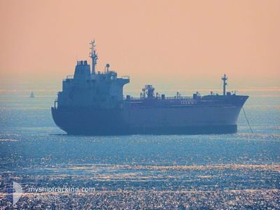
CONTI BENGUELA
Oil/Chemical Tanker
Current Trip
| Time Travelled | 1 day |
|---|---|
| Remaining Time | 16 h, 59 mins |
| Distance Travelled | 279.71 nm |
| Remaining Distance | 225.64 nm |
| AVG Speed | 11 Knop |
| MAX Speed | 13.8 Knop |
| AVG Wind | 10.3 knots |
| MAX Wind | 22 knots |
| MIN Temp | 8.1°C / 46.58°F |
| MAX Temp | 14.8°C / 58.64°F |
| Djupgående | 7.4 m |
| Position mottagen | Nu |
Current Position
| Longitud | -0.42961° |
|---|---|
| Latitude | 37.65088° |
| Status | Under way using engine |
| Fart | 13.5 Knop |
| Kurs | 34.9° |
| Område | Mediterranean Sea - Western Basin |
| Station | T-AIS |
| Position mottagen | Nu |
Info
Information
The current position of CONTI BENGUELA is in Mediterranean Sea - Western Basin with coordinates 37.65088° / -0.42961° as reported on 2025-02-04 21:07 by AIS to our vessel tracker app. The vessel's current speed is 13.5 Knop and is heading at the port of TARRAGONA. The estimated time of arrival as calculated by MyShipTracking vessel tracking app is 2025-02-05 14:07 LT
The vessel CONTI BENGUELA (IMO: 9391373, MMSI: 636091569) is a Oil/Chemical Tanker that was built in 2008 ( 17 År gammal ). It's sailing under the flag of [LR] Liberia.
In this page you can find informations about the vessels current position, last detected port calls, and current voyage information. If the vessels is not in coverage by AIS you will find the latest position.
The current position of CONTI BENGUELA is detected by our AIS receivers and we are not responsible for the reliability of the data. The last position was recorded while the vessel was in Coverage by the Ais receivers of our vessel tracking app.
The current draught of CONTI BENGUELA as reported by AIS is 7.4 meters
Weather
| Temperature | 14.1°C / 57.38°F |
|---|---|
| Wind Speed | 3 knots |
| Direction | 71° ENE |
| Pressure | 1030 hPa |
| Humidity | 60.6 % |
| Cloud Coverage | 4 % |
Featured Company
Last Port Calls
| Port | Arrival | Departure | Time In Port |
|---|---|---|---|
| 2025-02-01 19:46 | 2025-02-02 23:48 | 1 d | |
| 2025-01-29 00:00 | 2025-01-30 11:54 | 1 d | |
| 2025-01-21 05:09 | 2025-01-22 19:40 | 1 d | |
| 2025-01-09 22:09 | 2025-01-10 16:37 | 18 h | |
| 2025-01-03 14:21 | 2025-01-04 15:55 | 1 d | |
| 2024-12-24 05:04 | 2024-12-24 14:10 | 9 h | |
| 2024-12-16 05:44 | 2024-12-20 13:21 | 4 d | |
| 2024-12-11 08:32 | 2024-12-13 21:38 | 2 d | |
| 2024-12-01 09:28 |
Most Visited Ports (Last year)
| Port | Arrivals | |
|---|---|---|
| 5 | ||
| 4 | ||
| 3 | ||
| 3 | ||
| 3 | ||
| 3 |
Last Trips
| Origin | Departure | Destination | Arrival | Distance | |
|---|---|---|---|---|---|
| 2025-01-30 12:54 | 2025-02-01 20:46 | 609.90 nm | |||
| 2025-01-22 22:40 | 2025-01-29 01:00 | 1569.59 nm | |||
| 2025-01-04 18:55 | 2025-01-21 08:09 | 1829.74 nm | |||
| 2025-01-04 18:55 | 2025-01-10 00:09 | 657.51 nm | |||
| 2024-12-20 15:21 | 2025-01-03 17:21 | 971.73 nm | |||
| 2024-12-20 15:21 | 2024-12-24 07:04 | 172.46 nm | |||
| 2024-12-13 23:38 | 2024-12-16 07:44 | 533.28 nm | |||
| 2024-12-01 10:28 | 2024-12-11 10:32 | 2990.20 nm |
Events
| Tid | Event | Detaljer | Position / Dest | Information |
|---|---|---|---|---|
| 2025-02-04 18:47 | Status ändrad | Under way using engine Default |
37.28972 / -.88596
ES ALG>ES TAR
|
Fart: 13 kn Kurs: 50° |
| 2025-02-04 18:43 | Status ändrad | Default Under way using engine |
37.28020 / -.89978
ES ALG>ES TAR
|
Fart: 13 kn Kurs: 50.8° |
| 2025-02-04 18:28 | Status ändrad | Under way using engine Default |
37.24436 / -.95247
ES ALG>ES TAR
|
Fart: 12.9 kn Kurs: 48° |
| 2025-02-04 18:19 | Status ändrad | Default Under way using engine |
37.22261 / -.98469
ES ALG>ES TAR
|
Fart: 12.8 kn Kurs: 48.6° |
| 2025-02-04 18:13 | ETA ändrat | 2025/02/05 18:00 2025/02/05 19:00 |
37.20948 / -1.00396
ES ALG>ES TAR
|
Fart: 12.7 kn Kurs: 49.6° |
| 2025-02-04 17:45 | Status ändrad | Under way using engine Default |
37.14617 / -1.09607
ES ALG>ES TAR
|
Fart: 12.3 kn Kurs: 49° |
| 2025-02-04 17:43 | Status ändrad | Default Under way using engine |
37.14044 / -1.10396
ES ALG>ES TAR
|
Fart: 12.3 kn Kurs: 47.8° |
| 2025-02-04 17:28 | Upptäckt i hav | Spanish part of the Mediterranean Sea - Western Basin |
37.10715 / -1.15128
Mediterranean Sea - Western Basin
ES ALG>ES TAR
|
Fart: 12.2 kn Kurs: 47.8° |
| 2025-02-04 17:25 | Status ändrad | Under way using engine Default |
37.10046 / -1.16091
ES ALG>ES TAR
|
Fart: 12.2 kn Kurs: 49° |
| 2025-02-04 17:19 | I täckningsområde |
37.10715 / -1.15128
Mediterranean Sea - Western Basin
ES ALG>ES TAR
|
Fart: 12.2 kn Kurs: 47.8° |