
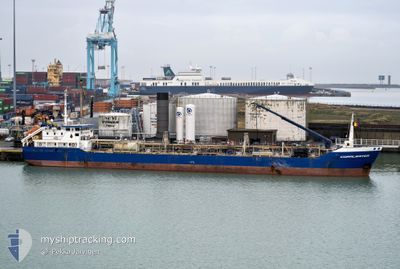
CORALWATER
Chemical Tanker
Current Trip
| Trip Time | 17 h, 23 mins |
|---|---|
| Trip Distance | 90.13 nm |
| AVG Speed | 5.7 Knop |
| MAX Speed | 8.5 Knop |
| Djupgående | 4.7 m |
| AVG Wind | 24.4 knots |
| MAX Wind | 27.9 knots |
| MIN Temp | 4.6°C / 40.28°F |
| MAX Temp | 7.3°C / 45.14°F |
| Position mottagen | 8 h, 21 m sen |
Current Position
| Longitud | -6.06255° |
|---|---|
| Latitude | 54.01606° |
| Status | Under way using engine |
| Fart | 7.1 Knop |
| Kurs | 310.5° |
| Område | Irish Sea and St. George's Channel |
| Station | T-AIS |
| Position mottagen | 8 h, 21 m sen |
Info
Information
The current position of CORALWATER is in Irish Sea and St. George's Channel with coordinates 54.01606° / -6.06255° as reported on 2025-02-18 16:31 by AIS to our vessel tracker app. The vessel's current speed is 7.1 Knop and is currently inside the port of WARRENPOINT.
The vessel CORALWATER (IMO: 9004164, MMSI: 245675000) is a Chemical Tanker that was built in 1998 ( 27 År gammal ). It's sailing under the flag of [NL] Netherlands.
In this page you can find informations about the vessels current position, last detected port calls, and current voyage information. If the vessels is not in coverage by AIS you will find the latest position.
The current position of CORALWATER is detected by our AIS receivers and we are not responsible for the reliability of the data. The last position was recorded while the vessel was in Coverage by the Ais receivers of our vessel tracking app.
The current draught of CORALWATER as reported by AIS is 4.7 meters
Weather
| Temperature | 6.7°C / 44.06°F |
|---|---|
| Wind Speed | 17 knots |
| Direction | 136° SE |
| Pressure | 1011.7 hPa |
| Humidity | 75.1 % |
| Cloud Coverage | 100 % |
Featured Company
Last Port Calls
| Port | Arrival | Departure | Time In Port |
|---|---|---|---|
| 2025-02-18 18:07 | |||
| 2025-02-17 20:02 | 2025-02-18 00:44 | 4 h | |
| 2025-02-16 00:30 | 2025-02-16 18:10 | 17 h | |
| 2025-02-10 05:09 | 2025-02-10 19:13 | 14 h | |
| 2025-02-09 06:38 | 2025-02-09 12:20 | 5 h | |
| 2025-02-08 10:45 | 2025-02-08 15:00 | 4 h | |
| 2025-02-07 11:44 | 2025-02-07 16:27 | 4 h | |
| 2025-02-03 19:24 | 2025-02-04 07:59 | 12 h | |
| 2025-02-01 10:21 | 2025-02-01 21:41 | 11 h | |
| 2025-01-31 06:15 | 2025-01-31 19:59 | 13 h |
Last Trips
| Origin | Departure | Destination | Arrival | Distance | |
|---|---|---|---|---|---|
| 2025-02-18 00:44 | 2025-02-18 18:07 | 90.13 nm | |||
| 2025-02-16 18:10 | 2025-02-17 20:02 | 146.51 nm | |||
| 2025-02-10 19:13 | 2025-02-16 00:30 | 401.41 nm | |||
| 2025-02-09 12:20 | 2025-02-10 05:09 | 143.80 nm | |||
| 2025-02-08 15:00 | 2025-02-09 06:38 | 110.56 nm | |||
| 2025-02-07 16:27 | 2025-02-08 10:45 | 118.89 nm | |||
| 2025-02-04 07:59 | 2025-02-07 11:44 | 337.27 nm | |||
| 2025-02-01 21:41 | 2025-02-03 19:24 | 313.24 nm | |||
| 2025-01-31 19:59 | 2025-02-01 10:21 | 122.96 nm | |||
| 2025-01-30 12:23 | 2025-01-31 06:15 | 85.89 nm |
Events
| Tid | Event | Detaljer | Position / Dest | Information |
|---|---|---|---|---|
| 2025-02-18 18:07 | STOPPAR förflyttning |
54.10168 / -6.26497
[GB] WARRENPOINT
|
Fart: 0.3 kn Kurs: 129° |
|
| 2025-02-18 18:07 | ANLÄNDER HAMN |
|
54.10168 / -6.26497
[GB] WARRENPOINT
|
Fart: 2.2 kn Kurs: 132° |
| 2025-02-18 16:36 | Status ändrad | Default Under way using engine |
54.02208 / -6.07493
WARENPOINT
|
Fart: 7.1 kn Kurs: 310.5° |
| 2025-02-18 16:31 | UTANFÖR täckningsområde |
54.01606 / -6.06255
Irish Sea and St. George's Channel
WARENPOINT
|
Fart: 7.1 kn Kurs: 310.5° |
|
| 2025-02-18 16:20 | Status ändrad | Under way using engine Default |
54.00020 / -6.03329
WARENPOINT
|
Fart: 1.5 kn Kurs: 140° |
| 2025-02-18 16:20 | STARTAR förflyttning | 3.32 nm, South East of GREENCASTLE |
54.00020 / -6.03329
WARENPOINT
|
Fart: 7.4 kn Kurs: 327.3° |
| 2025-02-18 16:20 | I täckningsområde |
54.00071 / -6.03400
Irish Sea and St. George's Channel
WARENPOINT
|
Fart: 7.2 kn Kurs: 317.4° |
|
| 2025-02-18 12:45 | UTANFÖR täckningsområde |
53.97397 / -6.04341
Irish Sea and St. George's Channel
WARENPOINT
|
Fart: 0.8 kn Kurs: 323.8° |
|
| 2025-02-18 12:44 | Status ändrad | Under way using engine Default |
53.97378 / -6.04315
WARENPOINT
|
Fart: 1.9 kn Kurs: 202° |
| 2025-02-18 12:23 | Status ändrad | Default Under way using engine |
53.98989 / -5.99881
WARENPOINT
|
Fart: 7.4 kn Kurs: 238.3° |