
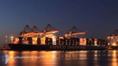
COSCO SHIPPING LIBRA
Cargo A
Current Trip
| Time Travelled | 29 days |
|---|---|
| Remaining Time | --- |
| Distance Travelled | 12663.79 nm |
| Remaining Distance | 1988.88 nm |
| AVG Speed | 17.7 Knop |
| MAX Speed | 21.5 Knop |
| AVG Wind | 16.1 knots |
| MAX Wind | 39 knots |
| MIN Temp | 7.4°C / 45.32°F |
| MAX Temp | 28.4°C / 83.12°F |
| Djupgående | 11.8 m |
| Position mottagen | 1 d sen |
Current Position
| Longitud | 104.33178° |
|---|---|
| Latitude | 1.29589° |
| Status | Under way using engine |
| Fart | 20.3 Knop |
| Kurs | 58.4° |
| Område | Singapore Strait |
| Station | T-AIS |
| Position mottagen | 1 d sen |
Info
Information
The current position of COSCO SHIPPING LIBRA is in Singapore Strait with coordinates 1.29589° / 104.33178° as reported on 2026-01-02 04:16 by AIS to our vessel tracker app. The vessel's current speed is 20.3 Knop and is heading at the port of TIANJIN. The estimated time of arrival as calculated by MyShipTracking vessel tracking app is 2026-01-09 17:00 LT
The vessel COSCO SHIPPING LIBRA (IMO: 9783538, MMSI: 477172700) is a Cargo A It's sailing under the flag of [HK] Hong Kong.
In this page you can find informations about the vessels current position, last detected port calls, and current voyage information. If the vessels is not in coverage by AIS you will find the latest position.
The current position of COSCO SHIPPING LIBRA is detected by our AIS receivers and we are not responsible for the reliability of the data. The last position was recorded while the vessel was in Coverage by the Ais receivers of our vessel tracking app.
The current draught of COSCO SHIPPING LIBRA as reported by AIS is 11.8 meters
Weather
| Temperature | 24.8°C / 76.64°F |
|---|---|
| Wind Speed | 24 knots |
| Direction | 36° NE |
| Pressure | 1013.3 hPa |
| Humidity | 88.3 % |
| Cloud Coverage | 100 % |
Featured Company
Last Port Calls
| Port | Arrival | Departure | Time In Port |
|---|---|---|---|
| 2025-12-03 08:44 | 2025-12-05 14:43 | 2 d | |
| 2025-11-28 21:30 | 2025-12-01 23:08 | 3 d | |
| 2025-11-21 00:06 | 2025-11-25 07:47 | 4 d |
Most Visited Ports (Last year)
| Port | Arrivals | |
|---|---|---|
| 3 | ||
| 3 | ||
| 2 | ||
| 2 | ||
| 2 | ||
| 1 |
Last Trips
| Origin | Departure | Destination | Arrival | Distance | |
|---|---|---|---|---|---|
| 2025-12-01 23:08 | 2025-12-03 08:44 | 387.21 nm | |||
| 2025-11-25 07:47 | 2025-11-28 21:30 | 443.36 nm | |||
| 2025-10-06 22:13 | 2025-11-21 00:06 | 11961.04 nm |
Events
| Tid | Event | Detaljer | Position / Dest | Information |
|---|---|---|---|---|
| 2026-01-02 04:25 | Status ändrad | Default Under way using engine |
1.32701 / 104.36787
TIANJIN
|
Fart: 20.3 kn Kurs: 58.4° |
| 2026-01-02 04:16 | UTANFÖR täckningsområde |
1.29589 / 104.33178
Singapore Strait
TIANJIN
|
Fart: 20.3 kn Kurs: 58.4° |
|
| 2026-01-02 04:16 | Status ändrad | Under way using engine Default |
1.29471 / 104.32983
TIANJIN
|
Fart: 20.4 kn Kurs: 72° |
| 2026-01-02 04:12 | Status ändrad | Default Under way using engine |
1.28597 / 104.30838
TIANJIN
|
Fart: 20.1 kn Kurs: 71.9° |
| 2026-01-02 03:41 | Byter havsområde | Malaysian part of the Singapore Strait Indonesian part of the Singapore Strait |
1.26735 / 104.13988
Singapore Strait
TIANJIN
|
Fart: 19.2 kn Kurs: 81.6° |
| 2026-01-02 00:52 | Byter havsområde | Indonesian part of the Singapore Strait Indonesian part of the Malacca Strait |
1.16688 / 103.46074
Singapore Strait
TIANJIN
|
Fart: 15.7 kn Kurs: 122.5° |
| 2026-01-02 00:50 | Status ändrad | Under way using engine Default |
1.17160 / 103.45336
TIANJIN
|
Fart: 15.6 kn Kurs: 124° |
| 2026-01-02 00:45 | Status ändrad | Default Under way using engine |
1.18526 / 103.43493
TIANJIN
|
Fart: 14.1 kn Kurs: 120.2° |
| 2026-01-02 00:38 | Status ändrad | Under way using engine Default |
1.20241 / 103.41232
TIANJIN
|
Fart: 13.9 kn Kurs: 111° |
| 2026-01-02 00:37 | Status ändrad | Default Under way using engine |
1.20448 / 103.40830
TIANJIN
|
Fart: 13 kn Kurs: 112.1° |