
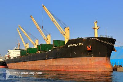
DATO SUCCESS
Bulk Carrier
Current Trip
| Time Travelled | 20 days |
|---|---|
| Remaining Time | 14 days |
| Distance Travelled | 4348.40 nm |
| Remaining Distance | 3312.30 nm |
| AVG Speed | 9.2 Knop |
| MAX Speed | 11.3 Knop |
| AVG Wind | 13.2 knots |
| MAX Wind | 32 knots |
| MIN Temp | 16.2°C / 61.16°F |
| MAX Temp | 34.2°C / 93.56°F |
| Djupgående | 11.7 m |
| Position mottagen | 8 d sen |
Current Position
| Longitud | 18.44451° |
|---|---|
| Latitude | -34.53338° |
| Status | Under way using engine |
| Fart | 9 Knop |
| Kurs | 122.5° |
| Område | South Atlantic Ocean |
| Station | T-AIS |
| Position mottagen | 8 d sen |
Info
Information
The current position of DATO SUCCESS is in South Atlantic Ocean with coordinates -34.53338° / 18.44451° as reported on 2025-03-02 04:51 by AIS to our vessel tracker app. The vessel's current speed is 9 Knop and is heading at the port of KAKINADA. The estimated time of arrival as calculated by MyShipTracking vessel tracking app is 2025-03-25 16:09 LT
The vessel DATO SUCCESS (IMO: 9610494, MMSI: 477462100) is a Bulk Carrier that was built in 2012 ( 13 År gammal ). It's sailing under the flag of [HK] Hong Kong.
In this page you can find informations about the vessels current position, last detected port calls, and current voyage information. If the vessels is not in coverage by AIS you will find the latest position.
The current position of DATO SUCCESS is detected by our AIS receivers and we are not responsible for the reliability of the data. The last position was recorded while the vessel was in Coverage by the Ais receivers of our vessel tracking app.
The current draught of DATO SUCCESS as reported by AIS is 11.7 meters
Weather
| Temperature | 27.2°C / 80.96°F |
|---|---|
| Wind Speed | 16 knots |
| Direction | 103° ESE |
| Pressure | 1015.4 hPa |
| Humidity | 72.5 % |
| Cloud Coverage | 57 % |
Featured Company
Most Visited Ports (Last year)
| Port | Arrivals | |
|---|---|---|
| 2 | ||
| 2 | ||
| 1 | ||
| 1 | ||
| 1 | ||
| 1 |
Events
| Tid | Event | Detaljer | Position / Dest | Information |
|---|---|---|---|---|
| 2025-03-02 04:55 | Status ändrad | Default Under way using engine |
-34.53917 / 18.45519
NAWVB>INKAK
|
Fart: 9 kn Kurs: 122.5° |
| 2025-03-02 04:51 | UTANFÖR täckningsområde |
-34.53338 / 18.44451
South Atlantic Ocean
NAWVB>INKAK
|
Fart: 9 kn Kurs: 122.5° |
|
| 2025-03-02 04:49 | Status ändrad | Under way using engine Default |
-34.53081 / 18.43980
NAWVB>INKAK
|
Fart: 9.1 kn Kurs: 124° |
| 2025-03-02 04:46 | Status ändrad | Default Under way using engine |
-34.52680 / 18.43253
NAWVB>INKAK
|
Fart: 9 kn Kurs: 123.6° |
| 2025-03-02 03:29 | Status ändrad | Under way using engine Default |
-34.40674 / 18.25224
NAWVB>INKAK
|
Fart: 8.6 kn Kurs: 142° |
| 2025-03-02 03:17 | Status ändrad | Default Under way using engine |
-34.38333 / 18.23030
NAWVB>INKAK
|
Fart: 8.9 kn Kurs: 143° |
| 2025-03-02 02:21 | Djupgående ändrat | 11.7 12 |
-34.27007 / 18.12423
NAWVB>INKAK
|
Fart: 9.3 kn Kurs: 138.9° |
| 2025-03-02 02:21 | Destination ändrad | NAWVB>INKAK AOLAD. |
-34.27007 / 18.12423
NAWVB>INKAK
|
Fart: 9.3 kn Kurs: 138.9° |
| 2025-03-02 02:21 | ETA ändrat | 2025/03/21 01:30 2024/12/25 16:00 |
-34.27007 / 18.12423
NAWVB>INKAK
|
Fart: 9.3 kn Kurs: 138.9° |
| 2025-03-02 01:38 | Status ändrad | Under way using engine Default |
-34.18599 / 18.03792
AOLAD.
|
Fart: 9 kn Kurs: 140° |