
DESTINY
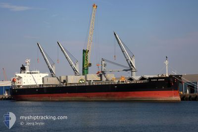
General Cargo
Current Trip
| Time Travelled | 1 day |
|---|---|
| Remaining Time | --- |
| Distance Travelled | 343.30 nm |
| Remaining Distance | --- |
| AVG Speed | 11.6 Knop |
| MAX Speed | 12.9 Knop |
| AVG Wind | 12.2 knots |
| MAX Wind | 17.1 knots |
| MIN Temp | 23.4°C / 74.12°F |
| MAX Temp | 25.9°C / 78.62°F |
| Djupgående | 9.4 m |
| Position mottagen | 3 h, 26 m sen |
Current Position
| Longitud | 40.62003° |
|---|---|
| Latitude | 16.87142° |
| Status | Under way using engine |
| Fart | 11.5 Knop |
| Kurs | 150° |
| Område | Red Sea |
| Station | T-AIS |
| Position mottagen | 3 h, 26 m sen |
Info
Information
The current position of DESTINY is in Red Sea with coordinates 16.87142° / 40.62003° as reported on 2025-02-11 17:41 by AIS to our vessel tracker app. The vessel's current speed is 11.5 Knop
The vessel DESTINY (IMO: 9385491, MMSI: 370662000) is a General Cargo that was built in 2009 ( 16 År gammal ). It's sailing under the flag of [PA] Panama.
In this page you can find informations about the vessels current position, last detected port calls, and current voyage information. If the vessels is not in coverage by AIS you will find the latest position.
The current position of DESTINY is detected by our AIS receivers and we are not responsible for the reliability of the data. The last position was recorded while the vessel was in Coverage by the Ais receivers of our vessel tracking app.
The current draught of DESTINY as reported by AIS is 9.4 meters
Weather
| Temperature | 25.7°C / 78.26°F |
|---|---|
| Wind Speed | 14 knots |
| Direction | 108° ESE |
| Pressure | 1011.6 hPa |
| Humidity | 83.8 % |
| Cloud Coverage | 12 % |
Featured Company
Most Visited Ports (Last year)
| Port | Arrivals | |
|---|---|---|
| 3 | ||
| 2 | ||
| 2 | ||
| 2 | ||
| 2 | ||
| 2 |
Events
| Tid | Event | Detaljer | Position / Dest | Information |
|---|---|---|---|---|
| 2025-02-11 17:48 | Status ändrad | Default Under way using engine |
16.85030 / 40.63270
SA JED
|
Fart: 11.5 kn Kurs: 150° |
| 2025-02-11 17:41 | UTANFÖR täckningsområde |
16.87142 / 40.62003
Red Sea
|
Fart: 11.5 kn Kurs: 150° |
|
| 2025-02-11 17:37 | Byter havsområde | Eritrean part of the Red Sea Saudi Arabian part of the Red Sea |
16.88218 / 40.61368
Red Sea
|
Fart: 11.6 kn Kurs: 150° |
| 2025-02-11 17:37 | Status ändrad | Under way using engine Default |
16.88218 / 40.61368
SA JED
|
Fart: 11.6 kn Kurs: 148° |
| 2025-02-11 17:32 | I täckningsområde |
16.88218 / 40.61368
Red Sea
|
Fart: 11.6 kn Kurs: 150° |
|
| 2025-02-10 15:58 | STARTAR förflyttning | 4.59 nm, South West of JEDDAH |
21.41920 / 39.07948
SA JED
|
Fart: 5.4 kn Kurs: 263° |
| 2025-02-10 07:31 | STOPPAR förflyttning | 4.08 nm, South West of JEDDAH |
21.42065 / 39.08963
SA JED
|
Fart: 0.3 kn Kurs: 352° |
| 2025-02-10 06:34 | AVGÅTT HAMN |
|
21.45993 / 39.10813
SA JED
|
Fart: 8.2 kn Kurs: 260° |
| 2025-02-10 06:28 | Status ändrad | Default Moored |
21.46383 / 39.12018
[SA] JEDDAH
|
Fart: 9.2 kn Kurs: 267° |
| 2025-02-10 06:23 | UTANFÖR täckningsområde |
21.46575 / 39.13458
Red Sea
|
Fart: 9.2 kn Kurs: 267° |