
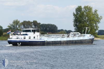
ESLABON
Tanker
Current Trip
VAN A NAAR B
| Time Travelled | 23 days |
|---|---|
| Remaining Time | --- |
| Distance Travelled | 38.69 nm |
| Remaining Distance | --- |
| AVG Speed | 5.9 Knop |
| MAX Speed | 8 Knop |
| AVG Wind | 10.7 knots |
| MAX Wind | 19 knots |
| MIN Temp | -6.9°C / 19.58°F |
| MAX Temp | 11.8°C / 53.24°F |
| Djupgående | 2.5 m |
| Position mottagen | 16 m sen |
Current Position
| Longitud | 5.69854° |
|---|---|
| Latitude | 52.91521° |
| Status | Under way using engine |
| Fart | |
| Kurs | --- |
| Område | North Sea |
| Station | T-AIS |
| Position mottagen | 16 m sen |
Info
Information
The current position of ESLABON is in North Sea with coordinates 52.91521° / 5.69854° as reported on 2026-01-06 13:49 by AIS to our vessel tracker app. The vessel's current speed is 0 Knop
The vessel ESLABON (MMSI: 244780231) is a Tanker It's sailing under the flag of [NL] Netherlands.
In this page you can find informations about the vessels current position, last detected port calls, and current voyage information. If the vessels is not in coverage by AIS you will find the latest position.
The current position of ESLABON is detected by our AIS receivers and we are not responsible for the reliability of the data. The last position was recorded while the vessel was in Coverage by the Ais receivers of our vessel tracking app.
The current draught of ESLABON as reported by AIS is 2.5 meters
Weather
| Temperature | 1.4°C / 34.52°F |
|---|---|
| Wind Speed | 4 knots |
| Direction | 221° SW |
| Pressure | 1012.9 hPa |
| Humidity | 93.9 % |
| Cloud Coverage | 100 % |
Featured Company
Last Port Calls
| Port | Arrival | Departure | Time In Port |
|---|---|---|---|
| 2025-12-13 20:58 | 2025-12-14 09:33 | 12 h | |
| 2025-12-13 14:51 | 2025-12-13 14:58 | 6 m | |
| 2025-12-07 18:24 | 2025-12-13 08:25 | 5 d | |
| 2025-12-06 20:00 | 2025-12-07 06:54 | 10 h | |
| 2025-12-06 10:52 | 2025-12-06 11:58 | 1 h | |
| 2025-12-05 17:45 | |||
| 2025-11-14 00:30 | 2025-11-15 07:52 | 1 d | |
| 2025-11-11 19:28 | 2025-11-13 16:52 | 1 d | |
| 2025-11-11 02:24 | 2025-11-11 08:25 | 6 h | |
| 2025-11-08 21:22 | 2025-11-09 09:12 | 11 h |
Last Trips
| Origin | Departure | Destination | Arrival | Distance | |
|---|---|---|---|---|---|
| 2025-12-13 14:58 | 2025-12-13 20:58 | 42.93 nm | |||
| 2025-12-13 08:25 | 2025-12-13 14:51 | 58.15 nm | |||
| 2025-12-07 06:54 | 2025-12-07 18:24 | 59.84 nm | |||
| 2025-12-06 11:58 | 2025-12-06 20:00 | 42.34 nm | |||
| 2025-12-05 17:45 | 2025-12-06 10:52 | 43.06 nm | |||
| 2025-11-13 16:52 | 2025-11-14 00:30 | 40.60 nm | |||
| 2025-11-11 08:25 | 2025-11-11 19:28 | 60.67 nm | |||
| 2025-11-09 09:12 | 2025-11-11 02:24 | 86.22 nm | |||
| 2025-11-08 07:21 | 2025-11-08 21:22 | 100.02 nm | |||
| 2025-11-06 13:11 | 2025-11-07 03:37 | 77.79 nm |
Events
| Tid | Event | Detaljer | Position / Dest | Information |
|---|---|---|---|---|
| 2026-01-06 12:48 | Status ändrad | Under way using engine Default |
52.91513 / 5.69834
VAN A NAAR B
|
Fart: Kurs: -1° |
| 2026-01-06 12:23 | Status ändrad | Default Under way using engine |
52.91514 / 5.69857
VAN A NAAR B
|
Fart: Kurs: 511° |
| 2026-01-06 10:43 | I täckningsområde |
52.91507 / 5.69854
North Sea
|
Fart: Kurs: 326.9° |
|
| 2026-01-06 09:27 | UTANFÖR täckningsområde |
52.91515 / 5.69862
North Sea
|
Fart: Kurs: 282.4° |
|
| 2026-01-06 09:22 | Status ändrad | Under way using engine Default |
52.91513 / 5.69852
VAN A NAAR B
|
Fart: Kurs: -1° |
| 2026-01-06 09:15 | Status ändrad | Default Under way using engine |
52.91512 / 5.69852
VAN A NAAR B
|
Fart: Kurs: 511° |
| 2026-01-06 09:02 | Status ändrad | Under way using engine Default |
52.91509 / 5.69843
VAN A NAAR B
|
Fart: Kurs: -1° |
| 2026-01-06 08:54 | Status ändrad | Default Under way using engine |
52.91494 / 5.69832
VAN A NAAR B
|
Fart: Kurs: 511° |
| 2026-01-06 08:50 | Status ändrad | Under way using engine Default |
52.91514 / 5.69853
VAN A NAAR B
|
Fart: Kurs: -1° |
| 2026-01-06 08:44 | Status ändrad | Default Under way using engine |
52.91515 / 5.69850
VAN A NAAR B
|
Fart: Kurs: 511° |