
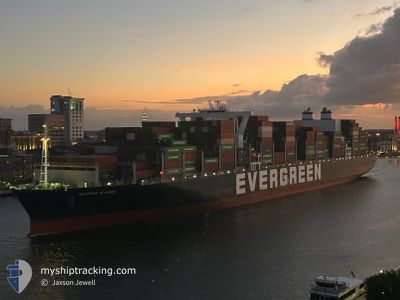
EVER FAIR
Cargo
Current Trip
| Time Travelled | 1 day |
|---|---|
| Remaining Time | --- |
| Distance Travelled | 363.42 nm |
| Remaining Distance | 23.90 nm |
| AVG Speed | 10.7 Knop |
| MAX Speed | 13.9 Knop |
| AVG Wind | 9.6 knots |
| MAX Wind | 19 knots |
| MIN Temp | -0.1°C / 31.82°F |
| MAX Temp | 4.6°C / 40.28°F |
| Djupgående | 11.6 m |
| Position mottagen | 2 m sen |
Current Position
| Longitud | -73.58777° |
|---|---|
| Latitude | 40.48776° |
| Status | At anchor |
| Fart | 0.4 Knop |
| Kurs | 110° |
| Område | North Atlantic Ocean |
| Station | T-AIS |
| Position mottagen | 2 m sen |
Info
Information
The current position of EVER FAIR is in North Atlantic Ocean with coordinates 40.48776° / -73.58777° as reported on 2025-02-24 06:29 by AIS to our vessel tracker app. The vessel's current speed is 0.4 Knop and is heading at the port of NEW YORK. The estimated time of arrival as calculated by MyShipTracking vessel tracking app is 2025-02-24 00:00 LT
The vessel EVER FAIR (IMO: 9850886, MMSI: 636020536) is a Cargo It's sailing under the flag of [LR] Liberia.
In this page you can find informations about the vessels current position, last detected port calls, and current voyage information. If the vessels is not in coverage by AIS you will find the latest position.
The current position of EVER FAIR is detected by our AIS receivers and we are not responsible for the reliability of the data. The last position was recorded while the vessel was in Coverage by the Ais receivers of our vessel tracking app.
The current draught of EVER FAIR as reported by AIS is 11.6 meters
Weather
| Temperature | 3.8°C / 38.84°F |
|---|---|
| Wind Speed | 8 knots |
| Direction | 32° NNE |
| Pressure | 1019.3 hPa |
| Humidity | 72.3 % |
| Cloud Coverage | 100 % |
Featured Company
Last Port Calls
| Port | Arrival | Departure | Time In Port |
|---|---|---|---|
| 2025-02-20 22:58 | 2025-02-22 20:19 | 1 d | |
| 2025-02-16 14:33 | 2025-02-17 11:36 | 21 h | |
| 2025-02-10 22:06 | 2025-02-13 02:55 | 2 d | |
| 2025-01-31 09:15 | 2025-02-01 15:46 | 1 d | |
| 2025-01-02 13:41 | 2025-01-03 07:51 | 18 h | |
| 2024-12-29 04:24 | 2024-12-30 04:31 | 1 d | |
| 2024-12-22 01:37 | 2024-12-23 02:51 | 1 d |
Last Trips
| Origin | Departure | Destination | Arrival | Distance | |
|---|---|---|---|---|---|
| 2025-02-17 06:36 | 2025-02-20 17:58 | 914.87 nm | |||
| 2025-02-12 21:55 | 2025-02-16 09:33 | 146.95 nm | |||
| 2025-02-01 10:46 | 2025-02-10 17:06 | 1595.71 nm | |||
| 2025-01-03 16:51 | 2025-01-31 04:15 | 8696.66 nm | |||
| 2024-12-30 12:31 | 2025-01-02 22:41 | 664.35 nm | |||
| 2024-12-23 10:51 | 2024-12-29 12:24 | 669.85 nm | |||
| 2024-11-24 13:50 | 2024-12-22 09:37 | 9189.32 nm |
Events
| Tid | Event | Detaljer | Position / Dest | Information |
|---|---|---|---|---|
| 2025-02-24 05:17 | Status ändrad | At anchor Default |
40.48851 / -73.58434
USNYC
|
Fart: 0.1 kn Kurs: 211° |
| 2025-02-24 05:14 | Status ändrad | Default At anchor |
40.48857 / -73.58433
USNYC
|
Fart: 0.1 kn Kurs: 212° |
| 2025-02-24 02:17 | Status ändrad | At anchor Under way using engine |
40.48707 / -73.58437
USNYC
|
Fart: 0.1 kn Kurs: 250° |
| 2025-02-24 02:15 | STOPPAR förflyttning | 18.94 nm, East of TWIN LIGHTS |
40.48705 / -73.58441
USNYC
|
Fart: 0.3 kn Kurs: 244° |
| 2025-02-23 22:28 | Status ändrad | Under way using engine Default |
40.50290 / -72.83273
USNYC
|
Fart: 13.3 kn Kurs: 270° |
| 2025-02-23 22:10 | I täckningsområde |
40.50290 / -72.83273
North Atlantic Ocean
USNYC
|
Fart: 12.4 kn Kurs: 266.8° |
|
| 2025-02-23 00:27 | Status ändrad | Default Under way using engine |
42.23914 / -70.00549
USNYC
|
Fart: 11.3 kn Kurs: 156.9° |
| 2025-02-23 00:21 | Status ändrad | Under way using engine Default |
42.25512 / -70.01496
USNYC
|
Fart: 11.3 kn Kurs: 158° |
| 2025-02-23 00:21 | UTANFÖR täckningsområde |
42.25512 / -70.01496
North Atlantic Ocean
USNYC
|
Fart: 11.3 kn Kurs: 156.9° |
|
| 2025-02-22 23:43 | Status ändrad | Default Under way using engine |
42.29329 / -70.16674
USNYC
|
Fart: 12.4 kn Kurs: 94.7° |