
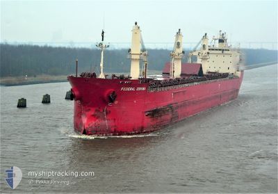
FEDERAL OSHIMA
Bulk Carrier
Current Trip
| Time Travelled | 3 days |
|---|---|
| Remaining Time | --- |
| Distance Travelled | 608.47 nm |
| Remaining Distance | --- |
| AVG Speed | 8.2 Knop |
| MAX Speed | 14.1 Knop |
| AVG Wind | 18.4 knots |
| MAX Wind | 26.1 knots |
| MIN Temp | 8.1°C / 46.58°F |
| MAX Temp | 14.6°C / 58.28°F |
| Djupgående | 5.8 m |
| Position mottagen | Nu |
Current Position
| Longitud | 24.26904° |
|---|---|
| Latitude | 37.42841° |
| Status | Under way using engine |
| Fart | 8.1 Knop |
| Kurs | 55.6° |
| Område | Aegean Sea |
| Station | T-AIS |
| Position mottagen | Nu |
Info
Information
The current position of FEDERAL OSHIMA is in Aegean Sea with coordinates 37.42841° / 24.26904° as reported on 2025-02-21 04:28 by AIS to our vessel tracker app. The vessel's current speed is 8.1 Knop and is heading at the port of HEREKE. The estimated time of arrival as calculated by MyShipTracking vessel tracking app is 2025-02-23 06:00 LT
The vessel FEDERAL OSHIMA (IMO: 9200330, MMSI: 538006783) is a Bulk Carrier that was built in 1999 ( 26 År gammal ). It's sailing under the flag of [MH] Marshall Is.
In this page you can find informations about the vessels current position, last detected port calls, and current voyage information. If the vessels is not in coverage by AIS you will find the latest position.
The current position of FEDERAL OSHIMA is detected by our AIS receivers and we are not responsible for the reliability of the data. The last position was recorded while the vessel was in Coverage by the Ais receivers of our vessel tracking app.
The current draught of FEDERAL OSHIMA as reported by AIS is 5.8 meters
Weather
| Temperature | 8.2°C / 46.76°F |
|---|---|
| Wind Speed | 19 knots |
| Direction | 13° NNE |
| Pressure | 1028.5 hPa |
| Humidity | 58.8 % |
| Cloud Coverage | 98 % |
Featured Company
Last Port Calls
| Port | Arrival | Departure | Time In Port |
|---|---|---|---|
| 2025-02-11 05:25 | 2025-02-17 23:27 | 6 d | |
| 2025-01-06 13:30 | 2025-01-09 19:10 | 3 d | |
| 2024-12-28 21:32 | 2024-12-28 23:45 | 2 h | |
| 2024-12-28 18:07 | 2024-12-28 19:34 | 1 h | |
| 2024-12-26 20:25 | 2024-12-26 21:07 | 42 m | |
| 2024-12-24 12:46 | 2024-12-24 13:51 | 1 h | |
| 2024-12-21 12:43 | 2024-12-23 10:36 | 1 d | |
| 2024-12-14 17:35 | 2024-12-21 11:18 | 6 d | |
| 2024-12-13 20:41 | 2024-12-13 22:45 | 2 h | |
| 2024-12-08 11:40 | 2024-12-11 18:41 | 3 d |
Most Visited Ports (Last year)
| Port | Arrivals | |
|---|---|---|
| 7 | ||
| 4 | ||
| 4 | ||
| 3 | ||
| 3 | ||
| 1 |
Last Trips
| Origin | Departure | Destination | Arrival | Distance | |
|---|---|---|---|---|---|
| 2025-01-09 14:10 | 2025-02-11 06:25 | 4885.78 nm | |||
| 2024-12-28 18:45 | 2025-01-06 08:30 | 55.59 nm | |||
| 2024-12-28 14:34 | 2024-12-28 16:32 | 6.41 nm | |||
| 2024-12-26 16:07 | 2024-12-28 13:07 | 292.87 nm | |||
| 2024-12-24 08:51 | 2024-12-26 15:25 | 525.35 nm | |||
| 2024-12-23 05:36 | 2024-12-24 07:46 | 236.93 nm | |||
| 2024-12-21 06:18 | 2024-12-21 07:43 | 7.91 nm | |||
| 2024-12-13 17:45 | 2024-12-14 12:35 | 236.74 nm | |||
| 2024-12-11 13:41 | 2024-12-13 15:41 | 287.85 nm | |||
| 2024-12-07 23:30 | 2024-12-08 06:40 | 88.24 nm |
Events
| Tid | Event | Detaljer | Position / Dest | Information |
|---|---|---|---|---|
| 2025-02-21 04:26 | Status ändrad | Under way using engine Default |
37.42637 / 24.26653
HEREKE TURKEY
|
Fart: 8.6 kn Kurs: 18° |
| 2025-02-21 04:04 | Status ändrad | Default Under way using engine |
37.37520 / 24.24485
HEREKE TURKEY
|
Fart: 8.2 kn Kurs: 18.8° |
| 2025-02-20 21:42 | ETA ändrat | 2025/02/23 06:00 2025/02/22 22:00 |
36.57614 / 23.87048
HEREKE TURKEY
|
Fart: 7.7 kn Kurs: 47.9° |
| 2025-02-20 21:21 | Byter havsområde | Greek part of the Aegean Sea Greek part of the Ionian Sea |
36.54505 / 23.83158
Aegean Sea
HEREKE TURKEY
|
Fart: 7.3 kn Kurs: 42.4° |
| 2025-02-20 21:21 | Status ändrad | Under way using engine Default |
36.54505 / 23.83158
HEREKE TURKEY
|
Fart: 7.5 kn Kurs: 42° |
| 2025-02-20 21:06 | I täckningsområde |
36.54505 / 23.83158
Aegean Sea
HEREKE TURKEY
|
Fart: 7.3 kn Kurs: 42.4° |
|
| 2025-02-19 15:52 | Status ändrad | Default Under way using engine |
36.70402 / 20.30653
HEREKE TURKEY
|
Fart: 7.5 kn Kurs: 155.9° |
| 2025-02-19 15:38 | UTANFÖR täckningsområde |
36.73233 / 20.29230
Ionian Sea
HEREKE TURKEY
|
Fart: 7.5 kn Kurs: 155.9° |
|
| 2025-02-19 15:30 | Status ändrad | Under way using engine Default |
36.74762 / 20.28406
HEREKE TURKEY
|
Fart: 7.6 kn Kurs: 157° |
| 2025-02-19 15:30 | I täckningsområde |
36.74762 / 20.28406
Ionian Sea
HEREKE TURKEY
|
Fart: 7.4 kn Kurs: 156.8° |