
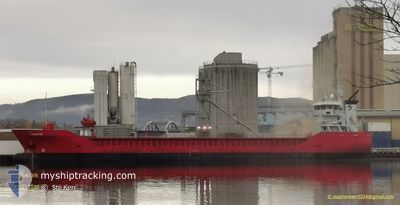
FRAKT VIK
General Cargo
Current Trip
| Time Travelled | 1 day |
|---|---|
| Remaining Time | 2 days |
| Distance Travelled | 416.25 nm |
| Remaining Distance | 741.63 nm |
| AVG Speed | 11 Knop |
| MAX Speed | 12.9 Knop |
| AVG Wind | 16.9 knots |
| MAX Wind | 25.9 knots |
| MIN Temp | --- |
| MAX Temp | 4.7°C / 40.46°F |
| Djupgående | 6.6 m |
| Position mottagen | 4 h, 53 m sen |
Current Position
| Longitud | 4.13042° |
|---|---|
| Latitude | 53.04017° |
| Status | Under way using engine |
| Fart | 10.2 Knop |
| Kurs | 234.2° |
| Område | North Sea |
| Station | T-AIS |
| Position mottagen | 4 h, 53 m sen |
Info
Information
The current position of FRAKT VIK is in North Sea with coordinates 53.04017° / 4.13042° as reported on 2025-02-10 02:22 by AIS to our vessel tracker app. The vessel's current speed is 10.2 Knop and is heading at the port of SANTANDER. The estimated time of arrival as calculated by MyShipTracking vessel tracking app is 2025-02-13 04:17 LT
The vessel FRAKT VIK (IMO: 9356579, MMSI: 212979000) is a General Cargo that was built in 2010 ( 15 År gammal ). It's sailing under the flag of [CY] Cyprus.
In this page you can find informations about the vessels current position, last detected port calls, and current voyage information. If the vessels is not in coverage by AIS you will find the latest position.
The current position of FRAKT VIK is detected by our AIS receivers and we are not responsible for the reliability of the data. The last position was recorded while the vessel was in Coverage by the Ais receivers of our vessel tracking app.
The current draught of FRAKT VIK as reported by AIS is 6.6 meters
Weather
| Temperature | 4.1°C / 39.38°F |
|---|---|
| Wind Speed | 24 knots |
| Direction | 78° ENE |
| Pressure | 1027.7 hPa |
| Humidity | 79.2 % |
| Cloud Coverage | 97 % |
Featured Company
Last Port Calls
| Port | Arrival | Departure | Time In Port |
|---|---|---|---|
| 2025-02-04 20:31 | 2025-02-08 12:44 | 3 d | |
| 2025-01-31 19:28 | 2025-02-01 13:03 | 17 h | |
| 2025-01-28 06:04 | 2025-01-30 09:10 | 2 d | |
| 2025-01-26 04:45 | 2025-01-27 21:10 | 1 d | |
| 2025-01-22 08:35 | 2025-01-23 12:52 | 1 d | |
| 2025-01-13 16:43 | 2025-01-14 12:55 | 20 h | |
| 2025-01-06 20:20 | 2025-01-11 04:58 | 4 d | |
| 2024-12-31 00:43 | 2025-01-04 18:38 | 4 d | |
| 2024-12-30 20:07 | 2024-12-30 23:45 | 3 h | |
| 2024-12-21 09:20 | 2024-12-22 21:48 | 1 d |
Last Trips
| Origin | Departure | Destination | Arrival | Distance | |
|---|---|---|---|---|---|
| 2025-02-01 14:03 | 2025-02-04 21:31 | 814.38 nm | |||
| 2025-01-30 10:10 | 2025-01-31 20:28 | 12.64 nm | |||
| 2025-01-27 22:10 | 2025-01-28 07:04 | 93.29 nm | |||
| 2025-01-23 13:52 | 2025-01-26 05:45 | 774.20 nm | |||
| 2025-01-14 13:55 | 2025-01-22 09:35 | 1542.56 nm | |||
| 2025-01-11 05:58 | 2025-01-13 17:43 | 447.08 nm | |||
| 2025-01-04 19:38 | 2025-01-06 21:20 | 356.68 nm | |||
| 2024-12-31 00:45 | 2024-12-31 01:43 | 8.06 nm | |||
| 2024-12-22 22:48 | 2024-12-30 21:07 | 823.75 nm | |||
| 2024-12-20 09:32 | 2024-12-21 10:20 | 264.36 nm |
Events
| Tid | Event | Detaljer | Position / Dest | Information |
|---|---|---|---|---|
| 2025-02-10 02:24 | Status ändrad | Default Under way using engine |
53.03605 / 4.12195
SANTANDER
|
Fart: 10.2 kn Kurs: 234.2° |
| 2025-02-10 02:22 | Status ändrad | Under way using engine Default |
53.04017 / 4.13042
SANTANDER
|
Fart: 10 kn Kurs: 224° |
| 2025-02-10 02:22 | UTANFÖR täckningsområde |
53.04017 / 4.13042
North Sea
SANTANDER
|
Fart: 10.2 kn Kurs: 234.2° |
|
| 2025-02-10 01:33 | Status ändrad | Default Under way using engine |
53.12991 / 4.30159
SANTANDER
|
Fart: 10.4 kn Kurs: 230.3° |
| 2025-02-10 00:20 | Upptäckt i hav | Dutch part of the North Sea |
53.30842 / 4.47954
North Sea
SANTANDER
|
Fart: 10.6 kn Kurs: 202.7° |
| 2025-02-10 00:20 | Status ändrad | Under way using engine Default |
53.30842 / 4.47954
SANTANDER
|
Fart: 11.1 kn Kurs: 198° |
| 2025-02-10 00:08 | I täckningsområde |
53.30842 / 4.47954
North Sea
SANTANDER
|
Fart: 10.6 kn Kurs: 202.7° |
|
| 2025-02-09 04:36 | Status ändrad | Default Under way using engine |
56.53721 / 7.30452
SANTANDER
|
Fart: 11.1 kn Kurs: 211° |
| 2025-02-09 04:27 | UTANFÖR täckningsområde |
56.55973 / 7.33093
North Sea
SANTANDER
|
Fart: 11.1 kn Kurs: 211° |
|
| 2025-02-09 04:16 | Status ändrad | Under way using engine Default |
56.58983 / 7.36509
SANTANDER
|
Fart: 11.1 kn Kurs: 210° |