
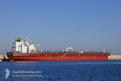
FREEDOM GLORY
Tanker
Current Trip
| Time Travelled | 4 days |
|---|---|
| Remaining Time | --- |
| Distance Travelled | 657.50 nm |
| Remaining Distance | --- |
| AVG Speed | 7.4 Knop |
| MAX Speed | 14.5 Knop |
| AVG Wind | 18 knots |
| MAX Wind | 34 knots |
| MIN Temp | 5.8°C / 42.44°F |
| MAX Temp | 14.6°C / 58.28°F |
| Djupgående | 8.5 m |
| Position mottagen | 4 d sen |
Current Position
| Longitud | 139.61458° |
|---|---|
| Latitude | 35.02770° |
| Status | Under way using engine |
| Fart | 5.9 Knop |
| Kurs | 237.5° |
| Område | North Pacific Ocean |
| Station | T-AIS |
| Position mottagen | 4 d sen |
Info
Information
The current position of FREEDOM GLORY is in North Pacific Ocean with coordinates 35.02770° / 139.61458° as reported on 2025-12-30 16:07 by AIS to our vessel tracker app. The vessel's current speed is 5.9 Knop and is heading at the port of ZHOUSHAN. The estimated time of arrival as calculated by MyShipTracking vessel tracking app is 2026-01-06 12:00 LT
The vessel FREEDOM GLORY (IMO: 9863417, MMSI: 538009036) is a Tanker It's sailing under the flag of [MH] Marshall Is.
In this page you can find informations about the vessels current position, last detected port calls, and current voyage information. If the vessels is not in coverage by AIS you will find the latest position.
The current position of FREEDOM GLORY is detected by our AIS receivers and we are not responsible for the reliability of the data. The last position was recorded while the vessel was in Coverage by the Ais receivers of our vessel tracking app.
The current draught of FREEDOM GLORY as reported by AIS is 8.5 meters
Weather
| Temperature | 13.7°C / 56.66°F |
|---|---|
| Wind Speed | 12 knots |
| Direction | 312° NW |
| Pressure | 1025.5 hPa |
| Humidity | 61.5 % |
| Cloud Coverage | 100 % |
Featured Company
Last Port Calls
| Port | Arrival | Departure | Time In Port |
|---|---|---|---|
| 2025-12-29 10:13 | 2025-12-30 20:25 | 1 d | |
| 2025-11-25 10:45 | 2025-11-26 15:12 | 1 d | |
| 2025-11-04 08:36 | 2025-11-05 15:59 | 1 d |
Last Trips
| Origin | Departure | Destination | Arrival | Distance | |
|---|---|---|---|---|---|
| 2025-11-26 15:12 | 2025-12-29 10:13 | 5981.32 nm | |||
| 2025-11-05 15:59 | 2025-11-25 10:45 | 4860.51 nm | |||
| 2025-09-16 16:22 | 2025-11-04 08:36 | 9739.04 nm |
Events
| Tid | Event | Detaljer | Position / Dest | Information |
|---|---|---|---|---|
| 2025-12-30 16:13 | Status ändrad | Default Under way using engine |
35.02267 / 139.60498
CNZOS
|
Fart: 5.9 kn Kurs: 237.5° |
| 2025-12-30 16:07 | UTANFÖR täckningsområde |
35.02770 / 139.61458
North Pacific Ocean
CNZOS
|
Fart: 5.9 kn Kurs: 237.5° |
|
| 2025-12-30 16:06 | Status ändrad | Under way using engine Default |
35.02875 / 139.61657
CNZOS
|
Fart: 5.9 kn Kurs: 237° |
| 2025-12-30 15:57 | Status ändrad | Default Under way using engine |
35.03699 / 139.63217
CNZOS
|
Fart: 5.8 kn Kurs: 237.4° |
| 2025-12-30 15:56 | Status ändrad | Under way using engine Default |
35.03713 / 139.63245
CNZOS
|
Fart: 5.8 kn Kurs: 236° |
| 2025-12-30 15:41 | Status ändrad | Default Under way using engine |
35.05301 / 139.65736
CNZOS
|
Fart: 5.8 kn Kurs: 228.8° |
| 2025-12-30 15:34 | Status ändrad | Under way using engine Default |
35.06007 / 139.66701
CNZOS
|
Fart: 5.8 kn Kurs: 229° |
| 2025-12-30 15:32 | Status ändrad | Default Under way using engine |
35.06167 / 139.66922
CNZOS
|
Fart: 5.8 kn Kurs: 231.3° |
| 2025-12-30 14:49 | Status ändrad | Under way using engine Default |
35.10561 / 139.73622
CNZOS
|
Fart: 5.9 kn Kurs: 192° |
| 2025-12-30 14:20 | Status ändrad | Default Under way using engine |
35.15314 / 139.75269
CNZOS
|
Fart: 6.3 kn Kurs: 192.7° |