
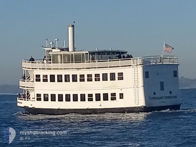
FUME BLANC COMMODORE
Passenger
Current Trip
| Trip Time | 25 mins |
|---|---|
| Trip Distance | 3.27 nm |
| AVG Speed | 7.1 Knop |
| MAX Speed | 7.7 Knop |
| Djupgående | 1.5 m |
| AVG Wind | 4.7 knots |
| MAX Wind | 10.2 knots |
| MIN Temp | 9.3°C / 48.74°F |
| MAX Temp | 10°C / 50°F |
| Position mottagen | 7 d sen |
Current Position
| Longitud | -122.27701° |
|---|---|
| Latitude | 37.79198° |
| Status | Under way using engine |
| Fart | |
| Kurs | --- |
| Område | North Pacific Ocean |
| Station | T-AIS |
| Position mottagen | 7 d sen |
Info
Information
The current position of FUME BLANC COMMODORE is in North Pacific Ocean with coordinates 37.79198° / -122.27701° as reported on 2026-01-01 09:53 by AIS to our vessel tracker app. The vessel's current speed is 0 Knop and is currently inside the port of OAKLAND.
The vessel FUME BLANC COMMODORE (IMO: 30, MMSI: 367155780) is a Passenger It's sailing under the flag of [US] USA.
In this page you can find informations about the vessels current position, last detected port calls, and current voyage information. If the vessels is not in coverage by AIS you will find the latest position.
The current position of FUME BLANC COMMODORE is detected by our AIS receivers and we are not responsible for the reliability of the data. The last position was recorded while the vessel was in Coverage by the Ais receivers of our vessel tracking app.
The current draught of FUME BLANC COMMODORE as reported by AIS is 1.5 meters
Weather
| Temperature | 9.3°C / 48.74°F |
|---|---|
| Wind Speed | 4 knots |
| Direction | 62° ENE |
| Pressure | 1011.8 hPa |
| Humidity | 93.5 % |
| Cloud Coverage | 100 % |
Featured Company
Last Port Calls
| Port | Arrival | Departure | Time In Port |
|---|---|---|---|
| 2026-01-01 01:29 | |||
| 2026-01-01 00:31 | 2026-01-01 01:04 | 32 m | |
| 2025-12-31 20:59 | 2025-12-31 22:25 | 1 h | |
| 2025-12-14 19:33 | 2025-12-31 20:36 | 17 d | |
| 2025-12-13 20:18 | 2025-12-14 17:11 | 20 h | |
| 2025-12-12 21:37 | 2025-12-13 17:48 | 20 h | |
| 2025-12-12 20:25 | 2025-12-12 20:32 | 6 m | |
| 2025-12-10 20:27 | 2025-12-12 18:30 | 1 d | |
| 2025-12-10 19:28 | 2025-12-10 19:42 | 14 m | |
| 2025-12-08 20:08 | 2025-12-10 19:06 | 1 d |
Most Visited Ports (Last year)
| Port | Arrivals | |
|---|---|---|
| 47 | ||
| 46 | ||
| 5 | ||
| 1 |
Last Trips
| Origin | Departure | Destination | Arrival | Distance | |
|---|---|---|---|---|---|
| 2026-01-01 01:04 | 2026-01-01 01:29 | 3.27 nm | |||
| 2025-12-31 22:25 | 2026-01-01 00:31 | 10.07 nm | |||
| 2025-12-31 20:36 | 2025-12-31 20:59 | 2.36 nm | |||
| 2025-12-14 17:11 | 2025-12-14 19:33 | 15.20 nm | |||
| 2025-12-13 17:48 | 2025-12-13 20:18 | 14.48 nm | |||
| 2025-12-12 20:32 | 2025-12-12 21:37 | 4.00 nm | |||
| 2025-12-12 18:30 | 2025-12-12 20:25 | 7.53 nm | |||
| 2025-12-10 19:42 | 2025-12-10 20:27 | 4.61 nm | |||
| 2025-12-10 19:06 | 2025-12-10 19:28 | 2.26 nm | |||
| 2025-12-08 19:28 | 2025-12-08 20:08 | 4.61 nm |
Events
| Tid | Event | Detaljer | Position / Dest | Information |
|---|---|---|---|---|
| 2026-01-01 09:55 | Status ändrad | Default Under way using engine |
37.79198 / -122.27701
[US] OAKLAND
|
Fart: Kurs: 511° |
| 2026-01-01 09:53 | UTANFÖR täckningsområde |
37.79198 / -122.27701
North Pacific Ocean
[US] OAKLAND
|
Fart: Kurs: 0° |
|
| 2026-01-01 09:48 | STOPPAR förflyttning |
37.79198 / -122.27701
[US] OAKLAND
|
Fart: Kurs: 511° |
|
| 2026-01-01 09:29 | ANLÄNDER HAMN |
|
37.79634 / -122.32345
[US] OAKLAND
|
Fart: 7.4 kn Kurs: 108.6° |
| 2026-01-01 09:04 | AVGÅTT HAMN |
|
37.78412 / -122.38032
ALAMEDA 7
|
Fart: 7.3 kn Kurs: 60° |
| 2026-01-01 09:02 | STARTAR förflyttning |
37.78281 / -122.38372
[US] SAN FRANCISCO
|
Fart: 6.6 kn Kurs: 59.6° |
|
| 2026-01-01 08:31 | STOPPAR förflyttning |
37.78140 / -122.38545
[US] SAN FRANCISCO
|
Fart: Kurs: 511° |
|
| 2026-01-01 08:31 | ANLÄNDER HAMN |
|
37.78140 / -122.38545
[US] SAN FRANCISCO
|
Fart: 1 kn Kurs: 511° |
| 2026-01-01 08:17 | STARTAR förflyttning | 1.34 nm, South West of TREASURE ISLAND |
37.79981 / -122.38456
ALAMEDA 7
|
Fart: 4.2 kn Kurs: 134.8° |
| 2026-01-01 08:07 | STOPPAR förflyttning | 1.36 nm, South West of TREASURE ISLAND |
37.80080 / -122.38646
ALAMEDA 7
|
Fart: Kurs: 511° |