

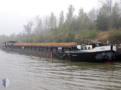
GINA
Cargo

Current Trip
GINA is out of coverage. Learn how you can join the community and extend the coverage to your area by clicking here!
Unknown
Destination Port
ETA*
---
| Time Travelled | 14 days |
|---|---|
| Remaining Time | --- |
| Distance Travelled | 351.70 nm |
| Remaining Distance | --- |
| AVG Speed | 6 Knop |
| MAX Speed | 7.3 Knop |
| AVG Wind | 7.1 knots |
| MAX Wind | 13 knots |
| MIN Temp | 8.3°C / 46.94°F |
| MAX Temp | 26.3°C / 79.34°F |
| Djupgående | 0 m |
| Position mottagen | 6 h, 3 m sen |
Current Position
| Longitud | 10.48284° |
|---|---|
| Latitude | 52.31669° |
| Status | Default |
| Fart | 6.3 Knop |
| Kurs | 50.7° |
| Område | North Sea |
| Station | T-AIS |
| Position mottagen | 6 h, 3 m sen |
Information
The current position of GINA is in North Sea with coordinates 52.31669° / 10.48284° as reported on 2025-05-15 10:44 by AIS to our vessel tracker app. The vessel's current speed is 6.3 Knop
The vessel GINA (MMSI: 211566610) is a Cargo It's sailing under the flag of [DE] Germany.
In this page you can find informations about the vessels current position, last detected port calls, and current voyage information. If the vessels is not in coverage by AIS you will find the latest position.
The current position of GINA is detected by our AIS receivers and we are not responsible for the reliability of the data. The last position was recorded while the vessel was in Coverage by the Ais receivers of our vessel tracking app.
Weather
| Temperature | 13.8°C / 56.84°F |
|---|---|
| Wind Speed | 11 knots |
| Direction | 4° N |
| Pressure | 1017.4 hPa |
| Humidity | 42.7 % |
| Cloud Coverage | 4 % |


Featured Company
Limited time offer - Install a base station receiver to your area and list your company on MyShipTracking Free forever!
Last Port Calls
| Port | Arrival | Departure | Time In Port |
|---|---|---|---|
| 2025-05-01 15:19 | 2025-05-01 16:10 | 51 m | |
| 2025-04-30 16:40 | 2025-05-01 09:40 | 16 h | |
| 2025-04-30 15:56 | |||
| 2025-04-30 00:19 | |||
| 2025-04-30 00:19 | |||
| 2025-04-29 17:03 | |||
| 2025-04-28 19:13 | 2025-04-29 10:54 | 15 h | |
| 2025-04-23 13:39 | 2025-04-23 13:53 | 14 m | |
| 2025-04-14 13:36 | 2025-04-15 12:14 | 22 h | |
| 2025-04-03 19:48 | 2025-04-04 07:36 | 11 h |
Last Trips
| Origin | Departure | Destination | Arrival | Distance | |
|---|---|---|---|---|---|
| 2025-05-01 09:40 | 2025-05-01 15:19 | 27.71 nm | |||
| 2025-04-30 15:56 | 2025-04-30 16:40 | 0.85 nm | |||
| 2025-04-30 00:19 | 2025-04-30 00:19 | --- | |||
| 2025-04-29 10:54 | 2025-04-29 17:03 | 1.35 nm | |||
| 2025-04-23 13:53 | 2025-04-28 19:13 | 129.03 nm | |||
| 2025-04-15 12:14 | 2025-04-23 13:39 | 157.01 nm | |||
| 2025-04-04 07:36 | 2025-04-14 13:36 | 462.00 nm | |||
| 2025-04-03 08:43 | 2025-04-03 19:48 | 69.56 nm | |||
| 2025-03-31 11:31 | 2025-04-03 08:21 | 26.55 nm | |||
| 2025-03-12 13:54 | 2025-03-31 09:55 | 469.29 nm |
Events
| Tid | Event | Detaljer | Position / Dest | Information |
|---|---|---|---|---|
| 2025-05-15 10:44 | UTANFÖR täckningsområde |
52.31669 / 10.48284
North Sea
|
Fart: 6.3 kn Kurs: 50.7° |
|
| 2025-05-15 10:38 | I täckningsområde |
52.31263 / 10.46919
North Sea
|
Fart: 6.3 kn Kurs: 75.3° |
|
| 2025-05-14 15:12 | UTANFÖR täckningsområde |
52.40590 / 9.74613
North Sea
|
Fart: 6 kn Kurs: 109.5° |
|
| 2025-05-14 14:57 | I täckningsområde |
52.41841 / 9.70886
North Sea
|
Fart: 6.6 kn Kurs: 120.4° |
|
| 2025-05-14 13:31 | UTANFÖR täckningsområde |
52.40094 / 9.46563
North Sea
|
Fart: 6.5 kn Kurs: 67.8° |
|
| 2025-05-14 13:14 | I täckningsområde |
52.39384 / 9.43065
North Sea
|
Fart: 7 kn Kurs: 79.3° |
|
| 2025-05-14 10:56 | UTANFÖR täckningsområde |
52.30069 / 9.02995
North Sea
|
Fart: 6.7 kn Kurs: 53.1° |
|
| 2025-05-14 10:11 | I täckningsområde |
52.30167 / 8.90051
North Sea
|
Fart: 5.4 kn Kurs: 92.3° |
|
| 2025-05-14 06:08 | UTANFÖR täckningsområde |
52.38114 / 8.21178
North Sea
|
Fart: 6.9 kn Kurs: 127.7° |
|
| 2025-05-14 05:31 | STARTAR förflyttning | 4.49 nm, East of BRAMSCHE |
52.41282 / 8.11647
|
Fart: 5.5 kn Kurs: 93.2° |