
GIORGIA 1
Pleasure Craft
Current Trip
| Trip Time | 1 h, 51 mins |
|---|---|
| Trip Distance | 15.27 nm |
| AVG Speed | 11.7 Knop |
| MAX Speed | 15.3 Knop |
| Djupgående | --- |
| AVG Wind | 4.8 knots |
| MAX Wind | 12 knots |
| MIN Temp | 12.2°C / 53.96°F |
| MAX Temp | 13.3°C / 55.94°F |
| Position mottagen | 1 h, 4 m sen |
Current Position
| Longitud | 8.56820° |
|---|---|
| Latitude | 44.35534° |
| Status | Default |
| Fart | |
| Kurs | 144° |
| Område | Ligurian Sea |
| Station | T-AIS |
| Position mottagen | 1 h, 4 m sen |
Info
Information
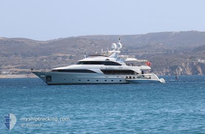
The current position of GIORGIA 1 is in Ligurian Sea with coordinates 44.35534° / 8.56820° as reported on 2025-03-01 03:20 by AIS to our vessel tracker app. The vessel's current speed is 0 Knop and is currently inside the port of VARAZZE.
The vessel GIORGIA 1 (MMSI: 256003908) is a Pleasure Craft It's sailing under the flag of [MT] Malta.
In this page you can find informations about the vessels current position, last detected port calls, and current voyage information. If the vessels is not in coverage by AIS you will find the latest position.
The current position of GIORGIA 1 is detected by our AIS receivers and we are not responsible for the reliability of the data. The last position was recorded while the vessel was in Coverage by the Ais receivers of our vessel tracking app.
Weather
| Temperature | 8.8°C / 47.84°F |
|---|---|
| Wind Speed | 9 knots |
| Direction | 338° NNW |
| Pressure | 1018 hPa |
| Humidity | 76.2 % |
| Cloud Coverage | 91 % |
Featured Company
Events
| Tid | Event | Detaljer | Position / Dest | Information |
|---|---|---|---|---|
| 2025-03-01 03:20 | UTANFÖR täckningsområde |
44.35534 / 8.56820
Ligurian Sea
[IT] VARAZZE
|
Fart: Kurs: 144° |
|
| 2025-03-01 01:56 | I täckningsområde |
44.35536 / 8.56815
Ligurian Sea
[IT] VARAZZE
|
Fart: Kurs: 144° |
|
| 2025-03-01 00:56 | UTANFÖR täckningsområde |
44.35534 / 8.56817
Ligurian Sea
[IT] VARAZZE
|
Fart: Kurs: 144° |
|
| 2025-03-01 00:56 | I täckningsområde |
44.35534 / 8.56817
Ligurian Sea
[IT] VARAZZE
|
Fart: Kurs: 144° |
|
| 2025-02-28 23:56 | UTANFÖR täckningsområde |
44.35534 / 8.56817
Ligurian Sea
[IT] VARAZZE
|
Fart: Kurs: 144° |
|
| 2025-02-28 22:20 | I täckningsområde |
44.35534 / 8.56817
Ligurian Sea
[IT] VARAZZE
|
Fart: Kurs: 144° |
|
| 2025-02-28 20:02 | UTANFÖR täckningsområde |
44.35531 / 8.56813
Ligurian Sea
[IT] VARAZZE
|
Fart: Kurs: 144° |
|
| 2025-02-28 19:44 | I täckningsområde |
44.35534 / 8.56815
Ligurian Sea
[IT] VARAZZE
|
Fart: Kurs: 144° |
|
| 2025-02-28 18:26 | UTANFÖR täckningsområde |
44.35533 / 8.56817
Ligurian Sea
[IT] VARAZZE
|
Fart: Kurs: 144° |
|
| 2025-02-28 16:56 | UTANFÖR täckningsområde |
44.35535 / 8.56818
Ligurian Sea
[IT] VARAZZE
|
Fart: Kurs: 144° |