

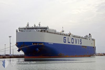
GLOVIS SUNLIGHT
Cargo
Current Trip
| Time Travelled | 4 days |
|---|---|
| Remaining Time | --- |
| Distance Travelled | 2039.49 nm |
| Remaining Distance | --- |
| AVG Speed | 17.9 Knop |
| MAX Speed | 20.6 Knop |
| AVG Wind | 11 knots |
| MAX Wind | 24 knots |
| MIN Temp | 5.7°C / 42.26°F |
| MAX Temp | 21.4°C / 70.52°F |
| Djupgående | 9.5 m |
| Position mottagen | 2 d sen |
Current Position
| Longitud | 141.74187° |
|---|---|
| Latitude | 41.65539° |
| Status | Under way using engine |
| Fart | 18.5 Knop |
| Kurs | 93.2° |
| Område | North Pacific Ocean |
| Station | T-AIS |
| Position mottagen | 2 d sen |
Information
The current position of GLOVIS SUNLIGHT is in North Pacific Ocean with coordinates 41.65539° / 141.74187° as reported on 2025-06-03 00:19 by AIS to our vessel tracker app. The vessel's current speed is 18.5 Knop and is heading at the port of SAN DIEGO. The estimated time of arrival as calculated by MyShipTracking vessel tracking app is 2025-06-13 17:01 LT
The vessel GLOVIS SUNLIGHT (IMO: 9798416, MMSI: 538007440) is a Cargo It's sailing under the flag of [MH] Marshall Is.
In this page you can find informations about the vessels current position, last detected port calls, and current voyage information. If the vessels is not in coverage by AIS you will find the latest position.
The current position of GLOVIS SUNLIGHT is detected by our AIS receivers and we are not responsible for the reliability of the data. The last position was recorded while the vessel was in Coverage by the Ais receivers of our vessel tracking app.
The current draught of GLOVIS SUNLIGHT as reported by AIS is 9.5 meters
Weather
| Temperature | 6°C / 42.8°F |
|---|---|
| Wind Speed | 17 knots |
| Direction | 141° SE |
| Pressure | 1020.1 hPa |
| Humidity | 92.7 % |
| Cloud Coverage | 100 % |
Featured Company
Last Port Calls
| Port | Arrival | Departure | Time In Port |
|---|---|---|---|
| 2025-05-31 19:30 | 2025-06-01 12:30 | 17 h | |
| 2025-05-28 15:19 | 2025-05-30 21:39 | 2 d | |
| 2025-05-27 08:14 | 2025-05-27 16:55 | 8 h | |
| 2025-05-25 01:47 | 2025-05-26 12:09 | 1 d | |
| 2025-05-24 08:26 | 2025-05-24 16:37 | 8 h | |
| 2025-05-17 15:30 | 2025-05-18 15:47 | 1 d | |
| 2025-05-14 08:17 | 2025-05-14 18:46 | 10 h | |
| 2025-04-30 03:24 | 2025-04-30 19:25 | 16 h | |
| 2025-04-26 12:17 | 2025-04-27 15:07 | 1 d |
Most Visited Ports (Last year)
| Port | Arrivals | |
|---|---|---|
| 7 | ||
| 4 | ||
| 4 | ||
| 4 | ||
| 4 | ||
| 3 |
Last Trips
| Origin | Departure | Destination | Arrival | Distance | |
|---|---|---|---|---|---|
| 2025-05-30 21:39 | 2025-05-31 19:30 | 369.51 nm | |||
| 2025-05-27 16:55 | 2025-05-28 15:19 | 378.57 nm | |||
| 2025-05-26 12:09 | 2025-05-27 08:14 | 317.52 nm | |||
| 2025-05-24 16:37 | 2025-05-25 01:47 | 139.55 nm | |||
| 2025-05-18 15:47 | 2025-05-24 08:26 | 547.53 nm | |||
| 2025-05-14 18:46 | 2025-05-17 15:30 | 427.25 nm | |||
| 2025-04-30 19:25 | 2025-05-14 08:17 | 5503.91 nm | |||
| 2025-04-27 15:07 | 2025-04-30 03:24 | 799.67 nm | |||
| 2025-03-28 20:02 | 2025-04-26 12:17 | 8576.58 nm |
Events
| Tid | Event | Detaljer | Position / Dest | Information |
|---|---|---|---|---|
| 2025-06-03 00:25 | Status ändrad | Default Under way using engine |
41.65330 / 141.78453
USSAN
|
Fart: 18.5 kn Kurs: 93.2° |
| 2025-06-03 00:19 | UTANFÖR täckningsområde |
41.65539 / 141.74187
North Pacific Ocean
USSAN
|
Fart: 18.5 kn Kurs: 93.2° |
|
| 2025-06-02 23:13 | Byter havsområde | Japanese part of the North Pacific Ocean Japanese part of the Japan Sea |
41.63429 / 141.29205
North Pacific Ocean
USSAN
|
Fart: 17.8 kn Kurs: 89.3° |
| 2025-06-02 22:03 | Status ändrad | Under way using engine Default |
41.60173 / 140.83085
USSAN
|
Fart: 18.7 kn Kurs: 52° |
| 2025-06-02 21:59 | Status ändrad | Default Under way using engine |
41.58879 / 140.80844
USSAN
|
Fart: 18.8 kn Kurs: 50.3° |
| 2025-06-02 20:25 | Status ändrad | Under way using engine Default |
41.30526 / 140.24004
USSAN
|
Fart: 19.1 kn Kurs: 53° |
| 2025-06-02 20:12 | Status ändrad | Default Under way using engine |
41.26505 / 140.16672
USSAN
|
Fart: 19.2 kn Kurs: 55.3° |
| 2025-06-02 17:46 | Status ändrad | Under way using engine Default |
40.81746 / 139.37653
USSAN
|
Fart: 18.6 kn Kurs: 53° |
| 2025-06-02 17:20 | Status ändrad | Default Under way using engine |
40.73891 / 139.23206
USSAN
|
Fart: 19.1 kn Kurs: 55.2° |
| 2025-06-02 17:17 | Status ändrad | Under way using engine Default |
40.72892 / 139.21311
USSAN
|
Fart: 19 kn Kurs: 55° |