
GOLDEN FREEZE
Cargo
Current Trip
GNKMR
| Time Travelled | 7 days |
|---|---|
| Remaining Time | --- |
| Distance Travelled | 787.42 nm |
| Remaining Distance | --- |
| AVG Speed | 7.9 Knop |
| MAX Speed | 16.5 Knop |
| AVG Wind | 16.3 knots |
| MAX Wind | 28 knots |
| MIN Temp | -19°C / -2.2°F |
| MAX Temp | -3.6°C / 25.52°F |
| Djupgående | 7.5 m |
| Position mottagen | 6 d sen |
Current Position
| Longitud | -68.65134° |
|---|---|
| Latitude | 48.59385° |
| Status | Under way using engine |
| Fart | 13 Knop |
| Kurs | 57.2° |
| Område | Gulf of St-Lawrence |
| Station | T-AIS |
| Position mottagen | 6 d sen |
Info
Information
The current position of GOLDEN FREEZE is in Gulf of St-Lawrence with coordinates 48.59385° / -68.65134° as reported on 2025-02-04 05:07 by AIS to our vessel tracker app. The vessel's current speed is 13 Knop
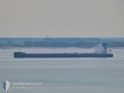
The vessel GOLDEN FREEZE (IMO: 984990400, MMSI: 538009115) is a Cargo It's sailing under the flag of [MH] Marshall Is.
In this page you can find informations about the vessels current position, last detected port calls, and current voyage information. If the vessels is not in coverage by AIS you will find the latest position.
The current position of GOLDEN FREEZE is detected by our AIS receivers and we are not responsible for the reliability of the data. The last position was recorded while the vessel was in Coverage by the Ais receivers of our vessel tracking app.
The current draught of GOLDEN FREEZE as reported by AIS is 7.5 meters
Weather
| Temperature | -10.4°C / 13.28°F |
|---|---|
| Wind Speed | 13 knots |
| Direction | 298° WNW |
| Pressure | 1020.8 hPa |
| Humidity | 66.4 % |
| Cloud Coverage | 100 % |
Featured Company
Last Port Calls
| Port | Arrival | Departure | Time In Port |
|---|---|---|---|
| 2025-01-31 17:14 | 2025-02-03 20:22 | 3 d | |
| 2025-01-30 17:06 | 2025-01-30 23:42 | 6 h | |
| 2025-01-03 10:10 | 2025-01-04 22:54 | 1 d | |
| 2024-12-18 16:05 | 2024-12-21 12:10 | 2 d |
Most Visited Ports (Last year)
| Port | Arrivals | |
|---|---|---|
| 3 | ||
| 3 | ||
| 3 | ||
| 2 | ||
| 2 | ||
| 1 |
Last Trips
| Origin | Departure | Destination | Arrival | Distance | |
|---|---|---|---|---|---|
| 2025-01-30 18:42 | 2025-01-31 12:14 | 0.48 nm | |||
| 2025-01-04 22:54 | 2025-01-30 12:06 | 4139.87 nm | |||
| 2024-12-21 13:10 | 2025-01-03 10:10 | 3294.70 nm | |||
| 2024-11-24 04:36 | 2024-12-18 17:05 | 3943.92 nm |
Events
| Tid | Event | Detaljer | Position / Dest | Information |
|---|---|---|---|---|
| 2025-02-10 09:25 | STOPPAR förflyttning | 20.16 nm, South East of PORT CARTIER |
49.77882 / -66.43571
GNKMR
|
Fart: 0.3 kn Kurs: 323° |
| 2025-02-04 05:14 | Status ändrad | Default Under way using engine |
48.60701 / -68.62049
GNKMR
|
Fart: 13 kn Kurs: 57.2° |
| 2025-02-04 05:07 | UTANFÖR täckningsområde |
48.59385 / -68.65134
Gulf of St-Lawrence
|
Fart: 13 kn Kurs: 57.2° |
|
| 2025-02-04 05:06 | Status ändrad | Under way using engine Default |
48.59195 / -68.65575
GNKMR
|
Fart: 12.8 kn Kurs: 57° |
| 2025-02-04 04:49 | Status ändrad | Default Under way using engine |
48.55894 / -68.73357
GNKMR
|
Fart: 13.4 kn Kurs: 55.9° |
| 2025-02-04 04:43 | Upptäckt i hav | Canadian part of the Gulf of St-Lawrence |
48.54537 / -68.76420
Gulf of St-Lawrence
|
Fart: 13.4 kn Kurs: 55.9° |
| 2025-02-04 04:43 | Status ändrad | Under way using engine Default |
48.54537 / -68.76420
GNKMR
|
Fart: 13.7 kn Kurs: 56° |
| 2025-02-04 04:43 | I täckningsområde |
48.54537 / -68.76420
Gulf of St-Lawrence
|
Fart: 13.4 kn Kurs: 55.9° |
|
| 2025-02-03 20:22 | STARTAR förflyttning | 0.35 nm, South East of PORT-ALFRED |
48.33514 / -70.86223
GNKMR
|
Fart: 3.2 kn Kurs: 76° |
| 2025-02-03 20:22 | AVGÅTT HAMN |
|
48.33514 / -70.86223
GNKMR
|
Fart: 1.7 kn Kurs: 70° |