
GUIDE
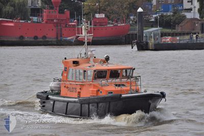
Pilot Vessel
Current Position
| Longitud | 0.37435° |
|---|---|
| Latitude | 51.44561° |
| Status | Under way using engine |
| Fart | 0.2 Knop |
| Kurs | --- |
| Område | North Sea |
| Station | T-AIS |
| Position mottagen | Nu |
Info
Information
The current position of GUIDE is in North Sea with coordinates 51.44561° / 0.37435° as reported on 2026-01-11 06:50 by AIS to our vessel tracker app. The vessel's current speed is 0.2 Knop and is currently inside the port of GRAVESEND.
The vessel GUIDE (MMSI: 235004469) is a Pilot Vessel It's sailing under the flag of [GB] United Kingdom.
In this page you can find informations about the vessels current position, last detected port calls, and current voyage information. If the vessels is not in coverage by AIS you will find the latest position.
The current position of GUIDE is detected by our AIS receivers and we are not responsible for the reliability of the data. The last position was recorded while the vessel was in Coverage by the Ais receivers of our vessel tracking app.
Weather
| Temperature | 1.4°C / 34.52°F |
|---|---|
| Wind Speed | 6 knots |
| Direction | 155° SSE |
| Pressure | 1019.8 hPa |
| Humidity | 78.8 % |
| Cloud Coverage | 100 % |
Featured Company
Last Port Calls
| Port | Arrival | Departure | Time In Port |
|---|---|---|---|
| 2026-01-06 12:00 | |||
| 2026-01-06 11:55 | 2026-01-06 11:59 | 3 m | |
| 2026-01-06 10:43 | 2026-01-06 11:53 | 1 h | |
| 2026-01-06 10:38 | 2026-01-06 10:41 | 3 m | |
| 2026-01-06 08:15 | 2026-01-06 10:34 | 2 h | |
| 2026-01-06 08:10 | 2026-01-06 08:12 | 1 m | |
| 2026-01-06 08:05 | 2026-01-06 08:08 | 3 m | |
| 2026-01-06 07:58 | 2026-01-06 08:01 | 3 m | |
| 2026-01-06 06:34 | 2026-01-06 07:50 | 1 h | |
| 2026-01-06 06:26 | 2026-01-06 06:30 | 3 m |
Most Visited Ports (Last year)
| Port | Arrivals | |
|---|---|---|
| 2043 | ||
| 1565 | ||
| 69 | ||
| 34 | ||
| 2 |
Last Trips
| Origin | Departure | Destination | Arrival | Distance | |
|---|---|---|---|---|---|
| 2026-01-06 11:59 | 2026-01-06 12:00 | 0.35 nm | |||
| 2026-01-06 11:53 | 2026-01-06 11:55 | 0.17 nm | |||
| 2026-01-06 10:41 | 2026-01-06 10:43 | 0.26 nm | |||
| 2026-01-06 10:34 | 2026-01-06 10:38 | 0.58 nm | |||
| 2026-01-06 08:12 | 2026-01-06 08:15 | 0.24 nm | |||
| 2026-01-06 08:08 | 2026-01-06 08:10 | 0.42 nm | |||
| 2026-01-06 08:01 | 2026-01-06 08:05 | 0.25 nm | |||
| 2026-01-06 07:50 | 2026-01-06 07:58 | 1.19 nm | |||
| 2026-01-06 06:30 | 2026-01-06 06:34 | 0.23 nm | |||
| 2026-01-06 06:24 | 2026-01-06 06:26 | 0.14 nm |
Events
| Tid | Event | Detaljer | Position / Dest | Information |
|---|---|---|---|---|
| 2026-01-10 09:45 | I täckningsområde |
51.44561 / .37436
North Sea
[GB] GRAVESEND
|
Fart: Kurs: 511° |
|
| 2026-01-09 21:35 | UTANFÖR täckningsområde |
51.44560 / .37436
North Sea
[GB] GRAVESEND
|
Fart: Kurs: 511° |
|
| 2026-01-09 05:43 | I täckningsområde |
51.44561 / .37434
North Sea
[GB] GRAVESEND
|
Fart: Kurs: 511° |
|
| 2026-01-09 03:47 | UTANFÖR täckningsområde |
51.44559 / .37432
North Sea
[GB] GRAVESEND
|
Fart: 0.1 kn Kurs: 511° |
|
| 2026-01-08 17:20 | I täckningsområde |
51.44561 / .37435
North Sea
[GB] GRAVESEND
|
Fart: Kurs: 511° |
|
| 2026-01-08 16:04 | UTANFÖR täckningsområde |
51.44559 / .37433
North Sea
[GB] GRAVESEND
|
Fart: 0.2 kn Kurs: 511° |
|
| 2026-01-08 13:15 | STOPPAR förflyttning |
51.44560 / .37433
[GB] GRAVESEND
|
Fart: Kurs: 511° |
|
| 2026-01-08 13:08 | STARTAR förflyttning |
51.44650 / .39066
[GB] GRAVESEND
|
Fart: 10 kn Kurs: 299.3° |
|
| 2026-01-08 12:34 | I täckningsområde |
51.44465 / .39315
North Sea
[GB] GRAVESEND
|
Fart: Kurs: 511° |
|
| 2026-01-07 13:57 | UTANFÖR täckningsområde |
51.44465 / .39317
North Sea
[GB] GRAVESEND
|
Fart: 0.1 kn Kurs: 511° |