
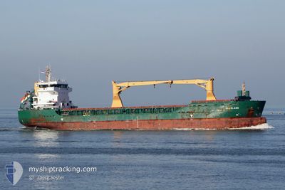
HADELAND
General Cargo
Current Trip
| Time Travelled | 3 days |
|---|---|
| Remaining Time | 19 h, 8 mins |
| Distance Travelled | 834.53 nm |
| Remaining Distance | 206.01 nm |
| AVG Speed | 10.4 Knop |
| MAX Speed | 12.4 Knop |
| AVG Wind | 6.8 knots |
| MAX Wind | 24.3 knots |
| MIN Temp | 13.7°C / 56.66°F |
| MAX Temp | 16.8°C / 62.24°F |
| Djupgående | 8.1 m |
| Position mottagen | 3 d sen |
Current Position
| Longitud | -4.49600° |
|---|---|
| Latitude | 36.09233° |
| Status | Under way using engine |
| Fart | 10 Knop |
| Kurs | 77.7° |
| Område | Alboran Sea |
| Station | T-AIS |
| Position mottagen | 3 d sen |
Info
Information
The current position of HADELAND is in Alboran Sea with coordinates 36.09233° / -4.49600° as reported on 2026-01-03 08:38 by AIS to our vessel tracker app. The vessel's current speed is 10 Knop and is heading at the port of SFAX. The estimated time of arrival as calculated by MyShipTracking vessel tracking app is 2026-01-07 07:38 LT
The vessel HADELAND (IMO: 9505601, MMSI: 305715000) is a General Cargo that was built in 2011 ( 15 År gammal ). It's sailing under the flag of [AG] Antigua Barbuda.
In this page you can find informations about the vessels current position, last detected port calls, and current voyage information. If the vessels is not in coverage by AIS you will find the latest position.
The current position of HADELAND is detected by our AIS receivers and we are not responsible for the reliability of the data. The last position was recorded while the vessel was in Coverage by the Ais receivers of our vessel tracking app.
The current draught of HADELAND as reported by AIS is 8.1 meters
Weather
| Temperature | 15.7°C / 60.26°F |
|---|---|
| Wind Speed | 23 knots |
| Direction | 294° WNW |
| Pressure | 1004.6 hPa |
| Humidity | 74.6 % |
| Cloud Coverage | --- |
Featured Company
Last Port Calls
| Port | Arrival | Departure | Time In Port |
|---|---|---|---|
| 2026-01-03 02:18 | 2026-01-03 05:38 | 3 h | |
| 2025-12-19 10:37 | 2025-12-19 22:38 | 12 h | |
| 2025-12-16 21:31 | 2025-12-18 00:16 | 1 d | |
| 2025-12-02 14:59 | 2025-12-03 22:36 | 1 d | |
| 2025-11-27 19:21 | 2025-12-01 07:16 | 3 d | |
| 2025-11-19 03:18 | 2025-11-19 04:33 | 1 h | |
| 2025-11-16 08:51 | 2025-11-17 05:23 | 20 h | |
| 2025-11-13 01:48 | 2025-11-14 18:40 | 1 d | |
| 2025-11-11 18:04 | 2025-11-12 23:32 | 1 d |
Most Visited Ports (Last year)
| Port | Arrivals | |
|---|---|---|
| 5 | ||
| 4 | ||
| 3 | ||
| 3 | ||
| 3 | ||
| 2 |
Last Trips
| Origin | Departure | Destination | Arrival | Distance | |
|---|---|---|---|---|---|
| 2025-12-19 22:38 | 2026-01-03 02:18 | 2680.09 nm | |||
| 2025-12-18 00:16 | 2025-12-19 10:37 | 394.38 nm | |||
| 2025-12-03 22:36 | 2025-12-16 21:31 | 2807.51 nm | |||
| 2025-12-01 07:16 | 2025-12-02 14:59 | 350.91 nm | |||
| 2025-11-19 04:33 | 2025-11-27 19:21 | 2183.50 nm | |||
| 2025-11-17 05:23 | 2025-11-19 03:18 | 426.17 nm | |||
| 2025-11-14 18:40 | 2025-11-16 08:51 | 403.88 nm | |||
| 2025-11-12 23:32 | 2025-11-13 01:48 | 18.92 nm | |||
| 2025-10-30 12:20 | 2025-11-11 18:04 | 2931.80 nm |
Events
| Tid | Event | Detaljer | Position / Dest | Information |
|---|---|---|---|---|
| 2026-01-03 08:41 | Status ändrad | Default Under way using engine |
36.09379 / -4.48528
TNSFA
|
Fart: 10 kn Kurs: 77.7° |
| 2026-01-03 08:38 | UTANFÖR täckningsområde |
36.09233 / -4.49600
Alboran Sea
TNSFA
|
Fart: 10 kn Kurs: 77.7° |
|
| 2026-01-03 08:08 | Status ändrad | Under way using engine Moored |
36.07567 / -4.59667
TNSFA
|
Fart: 10 kn Kurs: 77.9° |
| 2026-01-03 07:57 | Destination ändrad | TNSFA TNSFA VIA NOK |
36.06883 / -4.63800
TNSFA
|
Fart: 10.3 kn Kurs: 79.4° |
| 2026-01-03 07:33 | I täckningsområde |
36.05617 / -4.71650
Alboran Sea
TNSFA VIA NOK
|
Fart: 10.4 kn Kurs: 77.6° |
|
| 2026-01-03 07:30 | Status ändrad | Moored Default |
36.05367 / -4.73117
TNSFA VIA NOK
|
Fart: 10.5 kn Kurs: 77° |
| 2026-01-03 06:10 | Status ändrad | Default Moored |
35.99917 / -5.01167
TNSFA VIA NOK
|
Fart: 10.7 kn Kurs: 61.6° |
| 2026-01-03 06:07 | UTANFÖR täckningsområde |
35.99637 / -5.02581
Alboran Sea
TNSFA VIA NOK
|
Fart: 10.7 kn Kurs: 61.6° |
|
| 2026-01-03 05:38 | Status ändrad | Moored Default |
35.96067 / -5.11967
TNSFA VIA NOK
|
Fart: 11.3 kn Kurs: 70° |
| 2026-01-03 05:25 | Status ändrad | Default Moored |
35.94867 / -5.16550
TNSFA VIA NOK
|
Fart: 11.8 kn Kurs: 74.5° |