
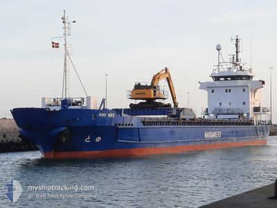
HAV NES
General Cargo
Current Trip
VOPNAFJORDUR
| Time Travelled | 9 h, 5 mins |
|---|---|
| Remaining Time | --- |
| Distance Travelled | 88.01 nm |
| Remaining Distance | --- |
| AVG Speed | 9.9 Knop |
| MAX Speed | 10.7 Knop |
| AVG Wind | 16.1 knots |
| MAX Wind | 21.1 knots |
| MIN Temp | 3.1°C / 37.58°F |
| MAX Temp | 4.5°C / 40.1°F |
| Djupgående | 4.6 m |
| Position mottagen | 3 d sen |
Current Position
| Longitud | -6.56035° |
|---|---|
| Latitude | 62.10934° |
| Status | Under way using engine |
| Fart | 9.1 Knop |
| Kurs | 43.7° |
| Område | North Atlantic Ocean |
| Station | T-AIS |
| Position mottagen | 3 d sen |
Info
Information
The current position of HAV NES is in North Atlantic Ocean with coordinates 62.10934° / -6.56035° as reported on 2025-02-08 00:17 by AIS to our vessel tracker app. The vessel's current speed is 9.1 Knop
The vessel HAV NES (IMO: 8719097, MMSI: 231099000) is a General Cargo that was built in 1991 ( 34 År gammal ). It's sailing under the flag of [FO] Faroe Is.
In this page you can find informations about the vessels current position, last detected port calls, and current voyage information. If the vessels is not in coverage by AIS you will find the latest position.
The current position of HAV NES is detected by our AIS receivers and we are not responsible for the reliability of the data. The last position was recorded while the vessel was in Coverage by the Ais receivers of our vessel tracking app.
The current draught of HAV NES as reported by AIS is 4.6 meters
Weather
| Temperature | 3.5°C / 38.3°F |
|---|---|
| Wind Speed | 15 knots |
| Direction | 203° SSW |
| Pressure | 1032.1 hPa |
| Humidity | 85.3 % |
| Cloud Coverage | 53 % |
Featured Company
Last Port Calls
| Port | Arrival | Departure | Time In Port |
|---|---|---|---|
| 2025-02-09 10:30 | 2025-02-10 22:35 | 1 d | |
| 2025-02-03 01:09 | 2025-02-07 23:09 | 4 d | |
| 2025-02-01 09:29 | 2025-02-02 22:06 | 1 d | |
| 2025-01-27 21:16 | 2025-01-28 16:46 | 19 h | |
| 2025-01-21 21:57 | 2025-01-22 22:01 | 1 d | |
| 2025-01-14 18:25 | 2025-01-16 19:40 | 2 d | |
| 2025-01-12 07:04 | 2025-01-12 12:25 | 5 h | |
| 2025-01-08 14:21 | 2025-01-09 13:39 | 23 h | |
| 2024-12-30 21:02 | 2025-01-01 08:07 | 1 d | |
| 2024-12-25 10:39 | 2024-12-29 09:14 | 3 d |
Most Visited Ports (Last year)
| Port | Arrivals | |
|---|---|---|
| 7 | ||
| 6 | ||
| 6 | ||
| 5 | ||
| 5 | ||
| 4 |
Last Trips
| Origin | Departure | Destination | Arrival | Distance | |
|---|---|---|---|---|---|
| 2025-02-07 23:09 | 2025-02-09 10:30 | 343.87 nm | |||
| 2025-02-02 22:06 | 2025-02-03 01:09 | 19.04 nm | |||
| 2025-01-28 17:46 | 2025-02-01 09:29 | 786.72 nm | |||
| 2025-01-22 22:01 | 2025-01-27 22:16 | 853.30 nm | |||
| 2025-01-16 20:40 | 2025-01-21 21:57 | 892.63 nm | |||
| 2025-01-12 13:25 | 2025-01-14 19:25 | 564.93 nm | |||
| 2025-01-09 14:39 | 2025-01-12 08:04 | 595.79 nm | |||
| 2025-01-01 08:07 | 2025-01-08 15:21 | 1205.80 nm | |||
| 2024-12-29 09:14 | 2024-12-30 21:02 | 262.03 nm | |||
| 2024-12-22 22:26 | 2024-12-25 10:39 | 503.99 nm |
Events
| Tid | Event | Detaljer | Position / Dest | Information |
|---|---|---|---|---|
| 2025-02-10 22:35 | AVGÅTT HAMN |
|
65.74558 / -14.81677
VOPNAFJORDUR
|
Fart: 5.7 kn Kurs: 188° |
| 2025-02-10 22:31 | STARTAR förflyttning |
65.74913 / -14.82562
[IS] VOPNAFJORDUR
|
Fart: 5.7 kn Kurs: 188° |
|
| 2025-02-09 10:30 | ANLÄNDER HAMN |
|
65.75571 / -14.82165
[IS] VOPNAFJORDUR
|
Fart: 9.2 kn Kurs: 237° |
| 2025-02-08 00:18 | Status ändrad | Default Under way using engine |
62.11153 / -6.55712
VOPNAFJORDUR
|
Fart: 9.1 kn Kurs: 43.7° |
| 2025-02-08 00:17 | UTANFÖR täckningsområde |
62.10934 / -6.56035
North Atlantic Ocean
VOPNAFJORDUR
|
Fart: 9.1 kn Kurs: 43.7° |
|
| 2025-02-08 00:02 | Destination ändrad | VOPNAFJORDUR FUGLAFJORDUR |
62.08022 / -6.62404
VOPNAFJORDUR
|
Fart: 8.9 kn Kurs: 46.8° |
| 2025-02-08 00:02 | ETA ändrat | 2025/02/09 10:00 2025/02/01 09:00 |
62.08022 / -6.62404
VOPNAFJORDUR
|
Fart: 8.9 kn Kurs: 46.8° |
| 2025-02-07 23:42 | Byter havsområde | Faeroe Islands part of the North Atlantic Ocean United Kingdom part of the North Sea |
62.04894 / -6.68953
North Atlantic Ocean
|
Fart: 7.8 kn Kurs: 90.2° |
| 2025-02-07 23:42 | Status ändrad | Under way using engine Default |
62.04894 / -6.68953
FUGLAFJORDUR
|
Fart: 8.6 kn Kurs: 151° |
| 2025-02-07 23:42 | I täckningsområde |
62.04894 / -6.68953
North Atlantic Ocean
|
Fart: 7.8 kn Kurs: 90.2° |