
HELENA G
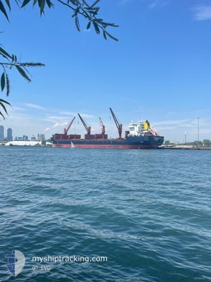
Bulk Carrier
Current Trip
| Trip Time | 1 day |
|---|---|
| Trip Distance | 463.60 nm |
| AVG Speed | 11.5 Knop |
| MAX Speed | 14.2 Knop |
| Djupgående | 5.6 m |
| AVG Wind | 4.3 knots |
| MAX Wind | 9 knots |
| MIN Temp | 11°C / 51.8°F |
| MAX Temp | 22.3°C / 72.14°F |
| Position mottagen | 8 d sen |
Current Position
| Longitud | 31.38074° |
|---|---|
| Latitude | 41.26051° |
| Status | At anchor |
| Fart | 0.1 Knop |
| Kurs | 78° |
| Område | Black Sea |
| Station | T-AIS |
| Position mottagen | 8 d sen |
Info
Information
The current position of HELENA G is in Black Sea with coordinates 41.26051° / 31.38074° as reported on 2025-03-08 02:25 by AIS to our vessel tracker app. The vessel's current speed is 0.1 Knop and is currently inside the port of RIZE.
The vessel HELENA G (IMO: 9358383, MMSI: 255806030) is a Bulk Carrier that was built in 2007 ( 18 År gammal ). It's sailing under the flag of [PT] Portugal.
In this page you can find informations about the vessels current position, last detected port calls, and current voyage information. If the vessels is not in coverage by AIS you will find the latest position.
The current position of HELENA G is detected by our AIS receivers and we are not responsible for the reliability of the data. The last position was recorded while the vessel was in Coverage by the Ais receivers of our vessel tracking app.
The current draught of HELENA G as reported by AIS is 5.6 meters
Weather
| Temperature | 22.4°C / 72.32°F |
|---|---|
| Wind Speed | 3 knots |
| Direction | --- N |
| Pressure | 1016.5 hPa |
| Humidity | 31.8 % |
| Cloud Coverage | 71 % |
Featured Company
Last Port Calls
| Port | Arrival | Departure | Time In Port |
|---|---|---|---|
| 2025-03-14 10:46 | |||
| 2025-03-08 10:49 | 2025-03-12 20:52 | 4 d | |
| 2025-03-01 14:23 | 2025-03-05 20:41 | 4 d | |
| 2025-02-26 10:42 | 2025-02-27 15:34 | 1 d | |
| 2025-02-19 10:20 | 2025-02-22 11:22 | 3 d | |
| 2025-01-23 09:28 | 2025-01-28 07:43 | 4 d | |
| 2025-01-05 16:05 | 2025-01-10 23:07 | 5 d |
Most Visited Ports (Last year)
| Port | Arrivals | |
|---|---|---|
| 5 | ||
| 4 | ||
| 2 | ||
| 2 | ||
| 2 | ||
| 2 |
Last Trips
| Origin | Departure | Destination | Arrival | Distance | |
|---|---|---|---|---|---|
| 2025-03-12 20:52 | 2025-03-14 10:46 | 463.60 nm | |||
| 2025-03-05 20:41 | 2025-03-08 10:49 | 199.25 nm | |||
| 2025-02-27 15:34 | 2025-03-01 14:23 | 396.14 nm | |||
| 2025-02-22 11:22 | 2025-02-26 10:42 | 1022.59 nm | |||
| 2025-01-28 07:43 | 2025-02-19 10:20 | 5206.30 nm | |||
| 2025-01-10 23:07 | 2025-01-23 09:28 | 71.30 nm | |||
| 2024-12-15 00:00 | 2025-01-05 16:05 | 5153.35 nm |
Events
| Tid | Event | Detaljer | Position / Dest | Information |
|---|---|---|---|---|
| 2025-03-14 07:46 | ANLÄNDER HAMN |
|
41.03667 / 40.52450
[TR] RIZE
|
Fart: 2.4 kn Kurs: 243° |
| 2025-03-12 17:52 | AVGÅTT HAMN |
|
41.27633 / 31.37633
TR ERE
|
Fart: 5.2 kn Kurs: 266° |
| 2025-03-12 17:32 | STARTAR förflyttning |
41.26783 / 31.40933
[TR] EREGLI
|
Fart: 3.5 kn Kurs: 348° |
|
| 2025-03-08 08:22 | STOPPAR förflyttning |
41.26450 / 31.40850
[TR] EREGLI
|
Fart: Kurs: 69° |
|
| 2025-03-08 07:49 | ANLÄNDER HAMN |
|
41.27667 / 31.40167
[TR] EREGLI
|
Fart: 5.3 kn Kurs: 31° |
| 2025-03-08 07:35 | STARTAR förflyttning | 1.28 nm, South West of EREGLI |
41.26333 / 31.38567
TR ERE
|
Fart: 3.1 kn Kurs: 35° |
| 2025-03-08 02:32 | Status ändrad | Default At anchor |
41.26067 / 31.38083
TR ERE
|
Fart: 0.1 kn Kurs: 78° |
| 2025-03-08 02:25 | UTANFÖR täckningsområde |
41.26051 / 31.38074
Black Sea
|
Fart: 0.1 kn Kurs: 1.3° |
|
| 2025-03-08 02:13 | Status ändrad | At anchor Default |
41.26017 / 31.38067
TR ERE
|
Fart: Kurs: 65° |
| 2025-03-08 02:13 | I täckningsområde |
41.26017 / 31.38067
Black Sea
|
Fart: Kurs: 15° |