

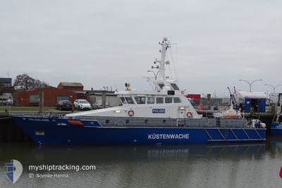
HELGOLAND
Law Enforcement

Current Trip
Current Position
| Longitud | 8.71438° |
|---|---|
| Latitude | 53.86334° |
| Status | Under way using engine |
| Fart | |
| Kurs | 203° |
| Område | North Sea |
| Station | T-AIS |
| Position mottagen | Nu |
Information
The current position of HELGOLAND is in North Sea with coordinates 53.86334° / 8.71438° as reported on 2025-05-21 19:38 by AIS to our vessel tracker app. The vessel's current speed is 0 Knop and is currently inside the port of CUXHAVEN.
The vessel HELGOLAND (MMSI: 211634540) is a Law Enforcement It's sailing under the flag of [DE] Germany.
In this page you can find informations about the vessels current position, last detected port calls, and current voyage information. If the vessels is not in coverage by AIS you will find the latest position.
The current position of HELGOLAND is detected by our AIS receivers and we are not responsible for the reliability of the data. The last position was recorded while the vessel was in Coverage by the Ais receivers of our vessel tracking app.
Weather
| Temperature | 11.9°C / 53.42°F |
|---|---|
| Wind Speed | 15 knots |
| Direction | 320° NW |
| Pressure | 1009.2 hPa |
| Humidity | 65.2 % |
| Cloud Coverage | 100 % |


Featured Company
Last Trips
| Origin | Departure | Destination | Arrival | Distance | |
|---|---|---|---|---|---|
| 2025-05-20 08:57 | 2025-05-20 11:25 | 28.86 nm | |||
| 2025-04-28 06:56 | 2025-04-28 09:11 | 35.14 nm | |||
| 2025-04-27 10:08 | 2025-04-27 11:43 | 34.36 nm | |||
| 2025-04-26 09:05 | 2025-04-26 16:04 | 50.11 nm | |||
| 2025-03-24 15:19 | 2025-03-24 16:54 | 22.46 nm |
Events
| Tid | Event | Detaljer | Position / Dest | Information |
|---|---|---|---|---|
| 2025-05-20 09:32 | STOPPAR förflyttning |
53.86330 / 8.71445
[DE] CUXHAVEN
|
Fart: 0.2 kn Kurs: 208° |
|
| 2025-05-20 09:25 | ANLÄNDER HAMN |
|
53.86670 / 8.71884
[DE] CUXHAVEN
|
Fart: 6.9 kn Kurs: 154° |
| 2025-05-20 06:57 | AVGÅTT HAMN |
|
54.11887 / 8.85543
BUESUM
|
Fart: 5.8 kn Kurs: 247° |
| 2025-05-20 06:56 | Status ändrad | Under way using engine Moored |
54.11868 / 8.85865
[DE] BUESUM
|
Fart: Kurs: 233° |
| 2025-05-20 06:56 | STARTAR förflyttning |
54.11868 / 8.85865
[DE] BUESUM
|
Fart: 5.8 kn Kurs: 247° |
|
| 2025-05-19 17:39 | I täckningsområde |
54.12447 / 8.86050
North Sea
[DE] BUESUM
|
Fart: Kurs: 3° |
|
| 2025-05-19 07:30 | UTANFÖR täckningsområde |
54.12447 / 8.86050
North Sea
[DE] BUESUM
|
Fart: Kurs: 333° |
|
| 2025-05-19 05:33 | I täckningsområde |
54.12445 / 8.86048
North Sea
[DE] BUESUM
|
Fart: 0.1 kn Kurs: 355° |
|
| 2025-05-19 03:18 | UTANFÖR täckningsområde |
54.12445 / 8.86050
North Sea
[DE] BUESUM
|
Fart: Kurs: 1° |
|
| 2025-05-19 01:18 | I täckningsområde |
54.12446 / 8.86049
North Sea
[DE] BUESUM
|
Fart: Kurs: 340° |