
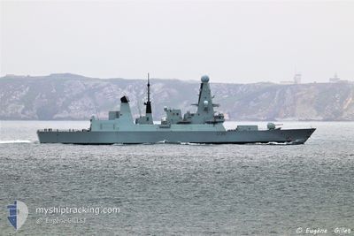
HMS SUTHERLAND
Combat Vessel
Current Trip
Unknown
| Time Travelled | 3 days |
|---|---|
| Remaining Time | --- |
| Distance Travelled | 1371.65 nm |
| Remaining Distance | --- |
| AVG Speed | 13.3 Knop |
| MAX Speed | 13.3 Knop |
| AVG Wind | 13.6 knots |
| MAX Wind | 17 knots |
| MIN Temp | 1.7°C / 35.06°F |
| MAX Temp | 9.8°C / 49.64°F |
| Djupgående | 6.5 m |
| Position mottagen | 1 m sen |
Current Position
| Longitud | -4.55113° |
|---|---|
| Latitude | 50.22613° |
| Status | Under way using engine |
| Fart | 6.7 Knop |
| Kurs | 210.5° |
| Område | English Channel |
| Station | T-AIS |
| Position mottagen | 1 m sen |
Info
Information
The current position of HMS SUTHERLAND is in English Channel with coordinates 50.22613° / -4.55113° as reported on 2025-02-16 00:17 by AIS to our vessel tracker app. The vessel's current speed is 6.7 Knop
The vessel HMS SUTHERLAND (IMO: 8949707, MMSI: 232002833) is a Combat Vessel that was built in 1997 ( 28 År gammal ). It's sailing under the flag of [GB] United Kingdom.
In this page you can find informations about the vessels current position, last detected port calls, and current voyage information. If the vessels is not in coverage by AIS you will find the latest position.
The current position of HMS SUTHERLAND is detected by our AIS receivers and we are not responsible for the reliability of the data. The last position was recorded while the vessel was in Coverage by the Ais receivers of our vessel tracking app.
The current draught of HMS SUTHERLAND as reported by AIS is 6.5 meters
Weather
| Temperature | 8.7°C / 47.66°F |
|---|---|
| Wind Speed | 15 knots |
| Direction | 102° ESE |
| Pressure | 1014.7 hPa |
| Humidity | 78.4 % |
| Cloud Coverage | 81 % |
Featured Company
Last Port Calls
| Port | Arrival | Departure | Time In Port |
|---|---|---|---|
| 2025-02-12 09:59 | 2025-02-12 16:31 | 6 h | |
| 2025-02-11 08:19 | 2025-02-11 11:05 | 2 h | |
| 2025-01-23 19:16 | |||
| 2025-01-23 10:14 | |||
| 2025-01-23 09:53 | 2025-01-23 10:05 | 12 m | |
| 2025-01-23 08:41 | 2025-01-23 09:49 | 1 h | |
| 2025-01-23 08:18 | 2025-01-23 08:31 | 12 m | |
| 2025-01-16 15:10 | 2025-01-16 16:24 | 1 h | |
| 2025-01-14 16:33 | 2025-01-14 18:22 | 1 h | |
| 2025-01-13 18:33 | 2025-01-14 07:40 | 13 h |
Most Visited Ports (Last year)
| Port | Arrivals | |
|---|---|---|
| 17 | ||
| 17 | ||
| 12 | ||
| 10 | ||
| 10 | ||
| 3 |
Last Trips
| Origin | Departure | Destination | Arrival | Distance | |
|---|---|---|---|---|---|
| 2025-02-11 11:05 | 2025-02-12 09:59 | 382.16 nm | |||
| 2025-01-23 10:05 | 2025-01-23 19:16 | 681.64 nm | |||
| 2025-01-23 10:05 | 2025-01-23 10:14 | 0.22 nm | |||
| 2025-01-23 09:49 | 2025-01-23 09:53 | 0.25 nm | |||
| 2025-01-23 08:31 | 2025-01-23 08:41 | 0.25 nm | |||
| 2025-01-16 16:24 | 2025-01-23 08:18 | 1028.06 nm | |||
| 2025-01-14 18:22 | 2025-01-16 15:10 | 255.35 nm | |||
| 2025-01-10 08:27 | 2025-01-14 16:33 | 289.80 nm | |||
| 2025-01-10 08:27 | 2025-01-13 18:33 | 234.07 nm | |||
| 2025-01-10 08:27 | 2025-01-10 18:15 | 85.33 nm |
Events
| Tid | Event | Detaljer | Position / Dest | Information |
|---|---|---|---|---|
| 2025-02-15 12:36 | STARTAR förflyttning | 9.2 nm, South of FOWEY |
50.18731 / -4.56462
|
Fart: 7 kn Kurs: 161.7° |
| 2025-02-15 12:32 | STOPPAR förflyttning | 9.12 nm, South of FOWEY |
50.18900 / -4.56343
|
Fart: 0.2 kn Kurs: 139° |
| 2025-02-15 09:50 | STARTAR förflyttning | 1.08 nm, South East of PLYMOUTH |
50.34830 / -4.13821
|
Fart: 3.1 kn Kurs: 172° |
| 2025-02-15 09:43 | Status ändrad | Under way using engine At anchor |
50.34885 / -4.14173
|
Fart: 0.4 kn Kurs: 21° |
| 2025-02-15 08:30 | Djupgående ändrat | 6.5 3.2 |
50.34893 / -4.14246
|
Fart: 0.3 kn Kurs: 79° |
| 2025-02-15 08:17 | Status ändrad | At anchor Under way using engine |
50.34875 / -4.14182
|
Fart: 0.1 kn Kurs: 32° |
| 2025-02-15 08:17 | Upptäckt i hav | United Kingdom part of the English Channel |
50.34874 / -4.14178
English Channel
|
Fart: 0.4 kn Kurs: 287.3° |
| 2025-02-15 08:16 | I täckningsområde |
50.34874 / -4.14178
English Channel
|
Fart: 0.4 kn Kurs: 287.3° |
|
| 2025-02-14 13:17 | Djupgående ändrat | 3.2 7.2 |
58.89421 / 5.00368
|
Fart: 11.6 kn Kurs: 54.1° |
| 2025-02-14 09:34 | UTANFÖR täckningsområde |
58.89421 / 5.00368
North Sea
|
Fart: 11.6 kn Kurs: 54.1° |