

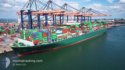
HOUSTON EXPRESS
Container Ship

Current Trip
NLRTM
| Time Travelled | 4 days |
|---|---|
| Remaining Time | --- |
| Distance Travelled | 1324.97 nm |
| Remaining Distance | --- |
| AVG Speed | 12.9 Knop |
| MAX Speed | 20.4 Knop |
| AVG Wind | 12.4 knots |
| MAX Wind | 25.8 knots |
| MIN Temp | 12.9°C / 55.22°F |
| MAX Temp | 21.4°C / 70.52°F |
| Djupgående | 13 m |
| Position mottagen | 1 m sen |
Current Position
| Longitud | 2.41930° |
|---|---|
| Latitude | 51.61835° |
| Status | Under way using engine |
| Fart | 16.3 Knop |
| Kurs | 40.8° |
| Område | North Sea |
| Station | T-AIS |
| Position mottagen | 1 m sen |
Information
The current position of HOUSTON EXPRESS is in North Sea with coordinates 51.61835° / 2.41930° as reported on 2025-06-11 06:51 by AIS to our vessel tracker app. The vessel's current speed is 16.3 Knop
The vessel HOUSTON EXPRESS (IMO: 9667150, MMSI: 636018700) is a Container Ship that was built in 2014 ( 11 År gammal ). It's sailing under the flag of [LR] Liberia.
In this page you can find informations about the vessels current position, last detected port calls, and current voyage information. If the vessels is not in coverage by AIS you will find the latest position.
The current position of HOUSTON EXPRESS is detected by our AIS receivers and we are not responsible for the reliability of the data. The last position was recorded while the vessel was in Coverage by the Ais receivers of our vessel tracking app.
The current draught of HOUSTON EXPRESS as reported by AIS is 13 meters
Weather
| Temperature | 14.2°C / 57.56°F |
|---|---|
| Wind Speed | 9 knots |
| Direction | 115° ESE |
| Pressure | 1021.7 hPa |
| Humidity | 78.5 % |
| Cloud Coverage | 49 % |


Featured Company
Last Port Calls
| Port | Arrival | Departure | Time In Port |
|---|---|---|---|
| 2025-06-06 03:58 | 2025-06-06 22:16 | 18 h | |
| 2025-05-15 22:13 | 2025-05-17 03:33 | 1 d | |
| 2025-05-11 13:05 | 2025-05-13 02:06 | 1 d | |
| 2025-05-06 16:37 | 2025-05-07 10:27 | 17 h | |
| 2025-04-30 03:34 | 2025-05-01 22:24 | 1 d | |
| 2025-04-26 21:41 | 2025-04-27 17:55 | 20 h |
Most Visited Ports (Last year)
| Port | Arrivals | |
|---|---|---|
| 4 | ||
| 2 | ||
| 2 | ||
| 2 | ||
| 2 | ||
| 2 |
Last Trips
| Origin | Departure | Destination | Arrival | Distance | |
|---|---|---|---|---|---|
| 2025-05-17 07:33 | 2025-06-06 04:58 | 9268.82 nm | |||
| 2025-05-13 07:36 | 2025-05-16 02:13 | 1104.37 nm | |||
| 2025-05-07 14:27 | 2025-05-11 18:35 | 1109.68 nm | |||
| 2025-05-02 02:24 | 2025-05-06 20:37 | 1973.58 nm | |||
| 2025-04-27 21:55 | 2025-04-30 07:34 | 1016.98 nm | |||
| 2025-03-29 22:35 | 2025-04-27 01:41 | 10857.47 nm |
Events
| Tid | Event | Detaljer | Position / Dest | Information |
|---|---|---|---|---|
| 2025-06-11 06:20 | Byter havsområde | Belgian part of the North Sea French part of the North Sea |
51.51277 / 2.27771
North Sea
|
Fart: 15.8 kn Kurs: 36.1° |
| 2025-06-11 03:59 | Byter havsområde | French part of the North Sea United Kingdom part of the North Sea |
51.13035 / 1.77742
North Sea
|
Fart: 13.9 kn Kurs: 52.1° |
| 2025-06-11 03:47 | Byter havsområde | United Kingdom part of the North Sea French part of the North Sea |
51.09994 / 1.72460
North Sea
|
Fart: 14.1 kn Kurs: 41.1° |
| 2025-06-11 03:17 | Byter havsområde | French part of the North Sea French part of the English Channel |
51.01206 / 1.60760
North Sea
|
Fart: 14.6 kn Kurs: 38.8° |
| 2025-06-11 01:18 | Status ändrad | Under way using engine Default |
50.65960 / 1.24232
NLRTM
|
Fart: 11.3 kn Kurs: 46° |
| 2025-06-11 01:11 | Status ändrad | Default Under way using engine |
50.64320 / 1.21587
NLRTM
|
Fart: 11.4 kn Kurs: 44.7° |
| 2025-06-11 01:01 | Byter havsområde | French part of the English Channel United Kingdom part of the English Channel |
50.62303 / 1.18389
English Channel
|
Fart: 11.4 kn Kurs: 44.2° |
| 2025-06-11 01:01 | Status ändrad | Under way using engine Default |
50.62194 / 1.18218
NLRTM
|
Fart: 11.4 kn Kurs: 44° |
| 2025-06-11 00:47 | I täckningsområde |
50.62303 / 1.18389
English Channel
|
Fart: 11.4 kn Kurs: 44.2° |
|
| 2025-06-10 22:59 | UTANFÖR täckningsområde |
50.44884 / .68176
English Channel
|
Fart: 11.5 kn Kurs: 75.9° |