

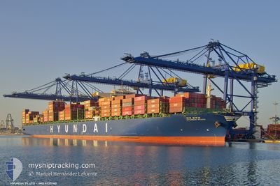
HYUNDAI PLUTO
Cargo

Current Trip
| Time Travelled | 17 days |
|---|---|
| Remaining Time | --- |
| Distance Travelled | 5164.24 nm |
| Remaining Distance | --- |
| AVG Speed | 15.7 Knop |
| MAX Speed | 20.5 Knop |
| AVG Wind | 13.3 knots |
| MAX Wind | 22.9 knots |
| MIN Temp | 16.3°C / 61.34°F |
| MAX Temp | 28.2°C / 82.76°F |
| Djupgående | 11.2 m |
| Position mottagen | 3 d sen |
Current Position
| Longitud | 18.44346° |
|---|---|
| Latitude | -34.56121° |
| Status | Under way using engine |
| Fart | 16.4 Knop |
| Kurs | 114.3° |
| Område | South Atlantic Ocean |
| Station | T-AIS |
| Position mottagen | 3 d sen |
Information
The current position of HYUNDAI PLUTO is in South Atlantic Ocean with coordinates -34.56121° / 18.44346° as reported on 2025-06-05 20:23 by AIS to our vessel tracker app. The vessel's current speed is 16.4 Knop
The vessel HYUNDAI PLUTO (IMO: 9725160, MMSI: 232018901) is a Cargo It's sailing under the flag of [GB] United Kingdom.
In this page you can find informations about the vessels current position, last detected port calls, and current voyage information. If the vessels is not in coverage by AIS you will find the latest position.
The current position of HYUNDAI PLUTO is detected by our AIS receivers and we are not responsible for the reliability of the data. The last position was recorded while the vessel was in Coverage by the Ais receivers of our vessel tracking app.
The current draught of HYUNDAI PLUTO as reported by AIS is 11.2 meters
Weather
| Temperature | 16.9°C / 62.42°F |
|---|---|
| Wind Speed | 9 knots |
| Direction | 304° NW |
| Pressure | 1019.7 hPa |
| Humidity | 71.5 % |
| Cloud Coverage | 3 % |


Featured Company
Last Port Calls
| Port | Arrival | Departure | Time In Port |
|---|---|---|---|
| 2025-05-22 15:25 | 2025-05-23 09:02 | 17 h | |
| 2025-05-12 23:23 | 2025-05-14 17:53 | 1 d | |
| 2025-05-04 17:03 | 2025-05-08 00:33 | 3 d | |
| 2025-04-27 06:04 | 2025-04-28 08:57 | 1 d | |
| 2025-04-25 00:22 | 2025-04-26 07:25 | 1 d | |
| 2025-04-23 05:00 | 2025-04-23 20:36 | 15 h |
Most Visited Ports (Last year)
| Port | Arrivals | |
|---|---|---|
| 5 | ||
| 4 | ||
| 4 | ||
| 3 | ||
| 3 | ||
| 3 |
Last Trips
| Origin | Departure | Destination | Arrival | Distance | |
|---|---|---|---|---|---|
| 2025-05-14 17:53 | 2025-05-22 15:25 | 1566.78 nm | |||
| 2025-05-08 00:33 | 2025-05-12 23:23 | 1026.55 nm | |||
| 2025-04-28 08:57 | 2025-05-04 17:03 | 470.36 nm | |||
| 2025-04-26 07:25 | 2025-04-27 06:04 | 186.09 nm | |||
| 2025-04-23 20:36 | 2025-04-25 00:22 | 409.26 nm | |||
| 2025-03-27 03:24 | 2025-04-23 05:00 | 9727.50 nm |
Events
| Tid | Event | Detaljer | Position / Dest | Information |
|---|---|---|---|---|
| 2025-06-05 20:29 | Status ändrad | Default Under way using engine |
-34.57127 / 18.47146
CAPE TOWN
|
Fart: 16.4 kn Kurs: 114.3° |
| 2025-06-05 20:23 | UTANFÖR täckningsområde |
-34.56121 / 18.44346
South Atlantic Ocean
CAPE TOWN
|
Fart: 16.4 kn Kurs: 114.3° |
|
| 2025-06-05 19:34 | Status ändrad | Under way using engine Default |
-34.44331 / 18.23046
CAPE TOWN
|
Fart: 15.6 kn Kurs: 143° |
| 2025-06-05 19:33 | Status ändrad | Default Under way using engine |
-34.43954 / 18.22682
CAPE TOWN
|
Fart: 15.5 kn Kurs: 143.8° |
| 2025-06-05 19:08 | Status ändrad | Under way using engine Default |
-34.35301 / 18.15242
CAPE TOWN
|
Fart: 16.2 kn Kurs: 142° |
| 2025-06-05 19:03 | Status ändrad | Default Under way using engine |
-34.33513 / 18.13714
CAPE TOWN
|
Fart: 16.3 kn Kurs: 142.6° |
| 2025-06-05 17:32 | Status ändrad | Under way using engine Default |
-34.02273 / 17.84613
CAPE TOWN
|
Fart: 16.5 kn Kurs: 142° |
| 2025-06-05 17:30 | Status ändrad | Default Under way using engine |
-34.01564 / 17.83938
CAPE TOWN
|
Fart: 16.4 kn Kurs: 141.9° |
| 2025-06-05 17:18 | Byter havsområde | South African part of the South Atlantic Ocean Guinea Bissau part of the North Atlantic Ocean |
-33.97663 / 17.80359
South Atlantic Ocean
CAPE TOWN
|
Fart: 16.6 kn Kurs: 145.7° |
| 2025-06-05 17:18 | Status ändrad | Under way using engine Default |
-33.97597 / 17.80305
CAPE TOWN
|
Fart: 16.6 kn Kurs: 144° |