
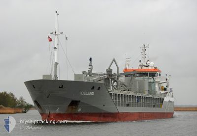
ICELAND
General Cargo
Current Trip
| Time Travelled | 23 h, 4 mins |
|---|---|
| Remaining Time | 4 h, 18 mins |
| Distance Travelled | 277.09 nm |
| Remaining Distance | 57.05 nm |
| AVG Speed | 12.2 Knop |
| MAX Speed | 12.9 Knop |
| AVG Wind | 19.5 knots |
| MAX Wind | 24 knots |
| MIN Temp | -0.9°C / 30.38°F |
| MAX Temp | 2.9°C / 37.22°F |
| Djupgående | 6 m |
| Position mottagen | Nu |
Current Position
| Longitud | 13.16569° |
|---|---|
| Latitude | 55.26036° |
| Status | Under way using engine |
| Fart | 12.5 Knop |
| Kurs | 274.5° |
| Område | Baltic Sea |
| Station | T-AIS |
| Position mottagen | Nu |
Info
Information
The current position of ICELAND is in Baltic Sea with coordinates 55.26036° / 13.16569° as reported on 2025-02-11 08:12 by AIS to our vessel tracker app. The vessel's current speed is 12.5 Knop and is heading at the port of LANDSKRONA. The estimated time of arrival as calculated by MyShipTracking vessel tracking app is 2025-02-11 12:31 LT
The vessel ICELAND (IMO: 9341782, MMSI: 246546000) is a General Cargo that was built in 2006 ( 19 År gammal ). It's sailing under the flag of [NL] Netherlands.
In this page you can find informations about the vessels current position, last detected port calls, and current voyage information. If the vessels is not in coverage by AIS you will find the latest position.
The current position of ICELAND is detected by our AIS receivers and we are not responsible for the reliability of the data. The last position was recorded while the vessel was in Coverage by the Ais receivers of our vessel tracking app.
The current draught of ICELAND as reported by AIS is 6 meters
Weather
| Temperature | 2.6°C / 36.68°F |
|---|---|
| Wind Speed | 24 knots |
| Direction | 103° ESE |
| Pressure | 1035.3 hPa |
| Humidity | 71 % |
| Cloud Coverage | 6 % |
Featured Company
Last Port Calls
| Port | Arrival | Departure | Time In Port |
|---|---|---|---|
| 2025-02-09 08:37 | 2025-02-10 09:09 | 1 d | |
| 2025-02-08 11:20 | 2025-02-08 12:05 | 44 m | |
| 2025-02-07 00:13 | 2025-02-08 00:53 | 1 d | |
| 2025-02-06 19:21 | 2025-02-06 19:44 | 22 m | |
| 2025-02-03 23:13 | 2025-02-05 14:45 | 1 d | |
| 2025-02-01 08:45 | 2025-02-02 09:38 | 1 d | |
| 2025-01-29 08:49 | 2025-01-30 15:45 | 1 d | |
| 2025-01-25 19:29 | 2025-01-27 20:53 | 2 d | |
| 2025-01-23 22:00 | 2025-01-24 11:14 | 13 h | |
| 2025-01-08 20:41 | 2025-01-22 13:36 | 13 d |
Last Trips
| Origin | Departure | Destination | Arrival | Distance | |
|---|---|---|---|---|---|
| 2025-02-08 13:05 | 2025-02-09 10:37 | 196.78 nm | |||
| 2025-02-08 01:53 | 2025-02-08 12:20 | 48.98 nm | |||
| 2025-02-06 20:44 | 2025-02-07 01:13 | 49.38 nm | |||
| 2025-02-05 16:45 | 2025-02-06 20:21 | 209.54 nm | |||
| 2025-02-02 10:38 | 2025-02-04 01:13 | 390.23 nm | |||
| 2025-01-30 17:45 | 2025-02-01 09:45 | 385.87 nm | |||
| 2025-01-27 22:53 | 2025-01-29 10:49 | 344.94 nm | |||
| 2025-01-24 12:14 | 2025-01-25 21:29 | 324.02 nm | |||
| 2025-01-22 15:36 | 2025-01-23 23:00 | 321.90 nm | |||
| 2025-01-07 18:21 | 2025-01-08 22:41 | 324.51 nm |
Events
| Tid | Event | Detaljer | Position / Dest | Information |
|---|---|---|---|---|
| 2025-02-11 07:24 | Status ändrad | Under way using engine Default |
55.24948 / 13.45811
SELAA
|
Fart: 12.3 kn Kurs: 270° |
| 2025-02-11 07:17 | Status ändrad | Default Under way using engine |
55.24815 / 13.49603
SELAA
|
Fart: 12.5 kn Kurs: 274.7° |
| 2025-02-11 03:35 | Byter havsområde | Swedish part of the Baltic Sea Danish part of the Kattegat |
55.45057 / 14.67025
Baltic Sea
SELAA
|
Fart: 12.2 kn Kurs: 238.5° |
| 2025-02-11 01:38 | Byter havsområde | Danish part of the Kattegat Swedish part of the Baltic Sea |
55.62890 / 15.29949
Kattegat
SELAA
|
Fart: 12.4 kn Kurs: 251.5° |
| 2025-02-10 22:18 | Djupgående ändrat | 6 4.4 |
55.79988 / 16.46768
SELAA
|
Fart: 12.5 kn Kurs: 255.5° |
| 2025-02-10 22:18 | Destination ändrad | SELAA LVLPX |
55.79988 / 16.46768
SELAA
|
Fart: 12.5 kn Kurs: 255.5° |
| 2025-02-10 22:18 | ETA ändrat | 2025/02/11 12:30 2025/02/08 23:00 |
55.79988 / 16.46768
SELAA
|
Fart: 12.5 kn Kurs: 255.5° |
| 2025-02-10 21:47 | Status ändrad | Under way using engine Default |
55.82471 / 16.64740
LVLPX
|
Fart: 12.3 kn Kurs: 256° |
| 2025-02-10 21:33 | I täckningsområde |
55.82306 / 16.63575
Baltic Sea
|
Fart: 12.1 kn Kurs: 255.8° |
|
| 2025-02-10 09:09 | AVGÅTT HAMN |
|
56.53358 / 20.94858
LVLPX
|
Fart: 9.3 kn Kurs: 247° |