
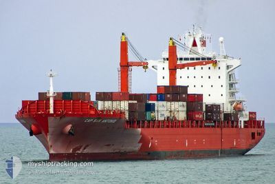
IRENES RESOLVE
Container Ship
Current Trip
BR_PNG
| Time Travelled | 3 days |
|---|---|
| Remaining Time | --- |
| Distance Travelled | 1464.07 nm |
| Remaining Distance | --- |
| AVG Speed | 18 Knop |
| MAX Speed | 19 Knop |
| AVG Wind | 8.1 knots |
| MAX Wind | 17.5 knots |
| MIN Temp | 23.7°C / 74.66°F |
| MAX Temp | 26.8°C / 80.24°F |
| Djupgående | 10.3 m |
| Position mottagen | 3 d sen |
Current Position
| Longitud | -47.81846° |
|---|---|
| Latitude | -25.82400° |
| Status | Under way using engine |
| Fart | 18.2 Knop |
| Kurs | 110° |
| Område | South Atlantic Ocean |
| Station | T-AIS |
| Position mottagen | 3 d sen |
Info
Information
The current position of IRENES RESOLVE is in South Atlantic Ocean with coordinates -25.82400° / -47.81846° as reported on 2025-02-04 14:10 by AIS to our vessel tracker app. The vessel's current speed is 18.2 Knop
The vessel IRENES RESOLVE (IMO: 9227273, MMSI: 636015524) is a Container Ship that was built in 2001 ( 24 År gammal ). It's sailing under the flag of [LR] Liberia.
In this page you can find informations about the vessels current position, last detected port calls, and current voyage information. If the vessels is not in coverage by AIS you will find the latest position.
The current position of IRENES RESOLVE is detected by our AIS receivers and we are not responsible for the reliability of the data. The last position was recorded while the vessel was in Coverage by the Ais receivers of our vessel tracking app.
The current draught of IRENES RESOLVE as reported by AIS is 10.3 meters
Weather
| Temperature | 25.4°C / 77.72°F |
|---|---|
| Wind Speed | 2 knots |
| Direction | 302° WNW |
| Pressure | 1017 hPa |
| Humidity | 73.8 % |
| Cloud Coverage | 16 % |
Featured Company
Last Port Calls
| Port | Arrival | Departure | Time In Port |
|---|---|---|---|
| 2025-02-03 12:32 | 2025-02-04 11:21 | 22 h | |
| 2025-01-30 21:12 | 2025-01-31 15:36 | 18 h | |
| 2025-01-20 08:34 | 2025-01-22 02:55 | 1 d | |
| 2025-01-15 07:20 | 2025-01-15 15:16 | 7 h | |
| 2025-01-09 05:18 | 2025-01-13 02:16 | 3 d | |
| 2024-12-27 00:35 | 2024-12-27 20:17 | 19 h | |
| 2024-12-20 01:57 | 2024-12-20 05:40 | 3 h | |
| 2024-12-19 00:20 | 2024-12-19 10:45 | 10 h | |
| 2024-12-15 15:06 | 2024-12-16 15:24 | 1 d |
Last Trips
| Origin | Departure | Destination | Arrival | Distance | |
|---|---|---|---|---|---|
| 2025-01-31 12:36 | 2025-02-03 09:32 | 178.58 nm | |||
| 2025-01-22 03:55 | 2025-01-30 18:12 | 3615.85 nm | |||
| 2025-01-15 17:16 | 2025-01-20 09:34 | 2063.87 nm | |||
| 2025-01-13 04:16 | 2025-01-15 09:20 | 419.18 nm | |||
| 2024-12-27 17:17 | 2025-01-09 07:18 | 4334.52 nm | |||
| 2024-12-20 02:40 | 2024-12-26 21:35 | 230.19 nm | |||
| 2024-12-19 07:45 | 2024-12-19 22:57 | 13.68 nm | |||
| 2024-12-16 12:24 | 2024-12-18 21:20 | 164.02 nm | |||
| 2024-11-26 12:33 | 2024-12-15 12:06 | 3690.62 nm |
Events
| Tid | Event | Detaljer | Position / Dest | Information |
|---|---|---|---|---|
| 2025-02-04 14:12 | Status ändrad | Default Under way using engine |
-25.82680 / -47.81007
BR_PNG
|
Fart: 18.2 kn Kurs: 110° |
| 2025-02-04 14:10 | Status ändrad | Under way using engine Default |
-25.82400 / -47.81846
BR_PNG
|
Fart: 18.2 kn Kurs: 110° |
| 2025-02-04 14:10 | I täckningsområde |
-25.82400 / -47.81846
South Atlantic Ocean
|
Fart: 18.2 kn Kurs: 110° |
|
| 2025-02-04 14:10 | UTANFÖR täckningsområde |
-25.82400 / -47.81846
South Atlantic Ocean
|
Fart: 18.2 kn Kurs: 110° |
|
| 2025-02-04 11:21 | AVGÅTT HAMN |
|
-25.49693 / -48.50001
BR_PNG
|
Fart: 1.7 kn Kurs: 35° |
| 2025-02-04 11:09 | STARTAR förflyttning |
-25.49935 / -48.50280
[BR] PARANAGUA
|
Fart: 3.1 kn Kurs: 293° |
|
| 2025-02-03 12:42 | STOPPAR förflyttning |
-25.50018 / -48.49690
[BR] PARANAGUA
|
Fart: Kurs: 261° |
|
| 2025-02-03 12:32 | ANLÄNDER HAMN |
|
-25.49855 / -48.49266
[BR] PARANAGUA
|
Fart: 7.6 kn Kurs: 258° |
| 2025-02-03 09:53 | STARTAR förflyttning | 16.62 nm, South East of ILHA DO MEL |
-25.72196 / -48.07144
BR_PNG
|
Fart: 3.5 kn Kurs: 137° |
| 2025-02-01 07:16 | STOPPAR förflyttning | 16.57 nm, South East of ILHA DO MEL |
-25.72291 / -48.07344
BR_PNG
|
Fart: 0.3 kn Kurs: 82° |