
JAG RISHI
Cargo
Current Trip
| Time Travelled | 4 days |
|---|---|
| Remaining Time | 4 days |
| Distance Travelled | 993.86 nm |
| Remaining Distance | 1133.86 nm |
| AVG Speed | 10.8 Knop |
| MAX Speed | 12.2 Knop |
| AVG Wind | 12.1 knots |
| MAX Wind | 25 knots |
| MIN Temp | 23.6°C / 74.48°F |
| MAX Temp | 29.6°C / 85.28°F |
| Djupgående | 6.2 m |
| Position mottagen | 1 d sen |
Current Position
| Longitud | 80.50508° |
|---|---|
| Latitude | 5.69997° |
| Status | Under way using engine |
| Fart | 10.6 Knop |
| Kurs | 84° |
| Område | Indian Ocean |
| Station | T-AIS |
| Position mottagen | 1 d sen |
Info
Information
The current position of JAG RISHI is in Indian Ocean with coordinates 5.69997° / 80.50508° as reported on 2025-02-10 02:47 by AIS to our vessel tracker app. The vessel's current speed is 10.6 Knop and is heading at the port of SINGAPORE. The estimated time of arrival as calculated by MyShipTracking vessel tracking app is 2025-02-16 13:00 LT
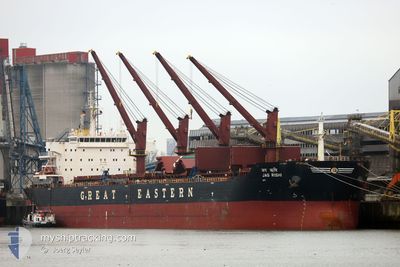
The vessel JAG RISHI (IMO: 9456343, MMSI: 419000242) is a Cargo It's sailing under the flag of [IN] India.
In this page you can find informations about the vessels current position, last detected port calls, and current voyage information. If the vessels is not in coverage by AIS you will find the latest position.
The current position of JAG RISHI is detected by our AIS receivers and we are not responsible for the reliability of the data. The last position was recorded while the vessel was in Coverage by the Ais receivers of our vessel tracking app.
The current draught of JAG RISHI as reported by AIS is 6.2 meters
Weather
| Temperature | 28°C / 82.4°F |
|---|---|
| Wind Speed | 13 knots |
| Direction | 44° NE |
| Pressure | 1012.4 hPa |
| Humidity | 75.4 % |
| Cloud Coverage | 10 % |
Featured Company
Last Port Calls
| Port | Arrival | Departure | Time In Port |
|---|---|---|---|
| 2025-02-02 00:31 | 2025-02-06 22:54 | 4 d | |
| 2025-01-22 12:57 | 2025-01-24 05:29 | 1 d | |
| 2025-01-18 06:56 | 2025-01-21 09:03 | 3 d | |
| 2025-01-08 00:32 | 2025-01-09 07:55 | 1 d | |
| 2024-12-31 23:47 | 2025-01-05 05:13 | 4 d | |
| 2024-12-23 17:39 | 2024-12-26 09:22 | 2 d | |
| 2024-12-14 21:03 | 2024-12-20 13:46 | 5 d | |
| 2024-12-01 14:14 | 2024-12-04 02:00 | 2 d |
Last Trips
| Origin | Departure | Destination | Arrival | Distance | |
|---|---|---|---|---|---|
| 2025-01-24 05:29 | 2025-02-02 00:31 | 1398.18 nm | |||
| 2025-01-21 09:03 | 2025-01-22 12:57 | 325.01 nm | |||
| 2025-01-09 07:55 | 2025-01-18 06:56 | 1168.22 nm | |||
| 2025-01-05 05:13 | 2025-01-08 00:32 | 40.28 nm | |||
| 2024-12-26 09:22 | 2024-12-31 23:47 | 1395.49 nm | |||
| 2024-12-20 13:46 | 2024-12-23 17:39 | 81.90 nm | |||
| 2024-12-04 02:00 | 2024-12-14 21:03 | 2128.29 nm | |||
| 2024-11-10 03:10 | 2024-12-01 14:14 | 2253.69 nm |
Events
| Tid | Event | Detaljer | Position / Dest | Information |
|---|---|---|---|---|
| 2025-02-10 02:58 | Status ändrad | Default Under way using engine |
5.69542 / 80.53685
SGSIN
|
Fart: 10.6 kn Kurs: 84° |
| 2025-02-10 02:47 | UTANFÖR täckningsområde |
5.69997 / 80.50508
Indian Ocean
SGSIN
|
Fart: 10.6 kn Kurs: 84° |
|
| 2025-02-10 02:43 | Status ändrad | Under way using engine Default |
5.69900 / 80.49212
SGSIN
|
Fart: 10.8 kn Kurs: 88° |
| 2025-02-10 02:41 | Status ändrad | Default Under way using engine |
5.69888 / 80.48615
SGSIN
|
Fart: 10.9 kn Kurs: 88° |
| 2025-02-10 02:01 | Byter havsområde | Sri Lankan part of the Indian Ocean Sri Lankan part of the Laccadive Sea |
5.70898 / 80.36587
Indian Ocean
SGSIN
|
Fart: 11 kn Kurs: 100° |
| 2025-02-10 00:44 | Destination ändrad | SGSIN COLOMBO |
5.75770 / 80.13847
SGSIN
|
Fart: 10.6 kn Kurs: 110° |
| 2025-02-10 00:44 | ETA ändrat | 2025/02/15 23:00 2025/02/08 04:00 |
5.75770 / 80.13847
SGSIN
|
Fart: 10.6 kn Kurs: 110° |
| 2025-02-10 00:23 | Status ändrad | Under way using engine Default |
5.77978 / 80.08198
COLOMBO
|
Fart: 10.3 kn Kurs: 108° |
| 2025-02-10 00:23 | I täckningsområde |
5.77793 / 80.08647
Laccadive Sea
|
Fart: 10.5 kn Kurs: 112° |
|
| 2025-02-09 16:45 | STARTAR förflyttning | 10.3 nm, West of COLOMBO |
6.93115 / 79.66620
COLOMBO
|
Fart: 6.5 kn Kurs: 194° |