
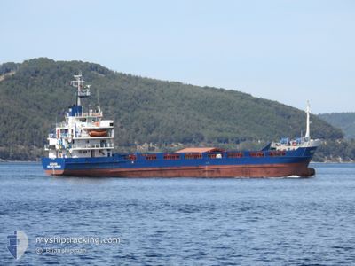
JAGUAR
General Cargo
Current Trip
EREGLI.
| Time Travelled | 9 days |
|---|---|
| Remaining Time | --- |
| Distance Travelled | 309.43 nm |
| Remaining Distance | --- |
| AVG Speed | 6.4 Knop |
| MAX Speed | 9.2 Knop |
| AVG Wind | 9.5 knots |
| MAX Wind | 17 knots |
| MIN Temp | 0.3°C / 32.54°F |
| MAX Temp | 9.9°C / 49.82°F |
| Djupgående | 5.7 m |
| Position mottagen | 20 d sen |
Current Position
| Longitud | 29.56190° |
|---|---|
| Latitude | 41.26686° |
| Status | Under way using engine |
| Fart | 8.3 Knop |
| Kurs | 89.8° |
| Område | Black Sea |
| Station | T-AIS |
| Position mottagen | 20 d sen |
Info
Information
The current position of JAGUAR is in Black Sea with coordinates 41.26686° / 29.56190° as reported on 2025-01-21 01:58 by AIS to our vessel tracker app. The vessel's current speed is 8.3 Knop
The vessel JAGUAR (IMO: 7726990, MMSI: 511942000) is a General Cargo that was built in 1978 ( 47 År gammal ). It's sailing under the flag of [PW] Palau.
In this page you can find informations about the vessels current position, last detected port calls, and current voyage information. If the vessels is not in coverage by AIS you will find the latest position.
The current position of JAGUAR is detected by our AIS receivers and we are not responsible for the reliability of the data. The last position was recorded while the vessel was in Coverage by the Ais receivers of our vessel tracking app.
The current draught of JAGUAR as reported by AIS is 5.7 meters
Weather
| Temperature | 2.4°C / 36.32°F |
|---|---|
| Wind Speed | 12 knots |
| Direction | 352° N |
| Pressure | 1029.2 hPa |
| Humidity | 51.9 % |
| Cloud Coverage | 100 % |
Featured Company
Last Port Calls
| Port | Arrival | Departure | Time In Port |
|---|---|---|---|
| 2025-01-31 06:04 | 2025-02-01 22:45 | 1 d | |
| 2024-12-19 22:16 | 2025-01-17 15:13 | 28 d | |
| 2024-12-16 06:53 | 2024-12-16 08:36 | 1 h | |
| 2024-12-02 11:18 |
Last Trips
| Origin | Departure | Destination | Arrival | Distance | |
|---|---|---|---|---|---|
| 2025-01-17 17:13 | 2025-01-31 09:04 | 499.40 nm | |||
| 2024-12-16 11:36 | 2024-12-20 00:16 | 331.60 nm | |||
| 2024-12-02 14:18 | 2024-12-16 09:53 | 735.13 nm |
Events
| Tid | Event | Detaljer | Position / Dest | Information |
|---|---|---|---|---|
| 2025-02-05 08:44 | STARTAR förflyttning | 8.72 nm, North of TULCEA |
45.31917 / 28.85995
EREGLI.
|
Fart: 4.8 kn Kurs: 134° |
| 2025-02-04 16:01 | STOPPAR förflyttning | 8.83 nm, North of TULCEA |
45.32240 / 28.85388
EREGLI.
|
Fart: 0.1 kn Kurs: 285° |
| 2025-02-04 05:45 | STARTAR förflyttning | 7.05 nm, East of SULINA |
45.16372 / 29.81365
EREGLI.
|
Fart: 4.4 kn Kurs: 4° |
| 2025-02-03 04:43 | STOPPAR förflyttning | 7.09 nm, East of SULINA |
45.15942 / 29.81482
EREGLI.
|
Fart: Kurs: 290° |
| 2025-02-01 22:45 | AVGÅTT HAMN |
|
41.27906 / 31.38234
EREGLI.
|
Fart: 5.8 kn Kurs: 281° |
| 2025-02-01 22:27 | STARTAR förflyttning |
41.26730 / 31.41443
[TR] EREGLI
|
Fart: 3.5 kn Kurs: 334° |