
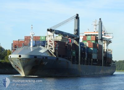
JAN
Container Ship
Current Trip
| Time Travelled | 8 days |
|---|---|
| Remaining Time | 40 mins |
| Distance Travelled | 1142.04 nm |
| Remaining Distance | 4.43 nm |
| AVG Speed | 9.6 Knop |
| MAX Speed | 17.2 Knop |
| AVG Wind | 9.6 knots |
| MAX Wind | 19.8 knots |
| MIN Temp | 2.1°C / 35.78°F |
| MAX Temp | 18.3°C / 64.94°F |
| Djupgående | 7 m |
| Position mottagen | Nu |
Current Position
| Longitud | 23.59850° |
|---|---|
| Latitude | 37.88883° |
| Status | Under way using engine |
| Fart | 1.5 Knop |
| Kurs | 65° |
| Område | Aegean Sea |
| Station | T-AIS |
| Position mottagen | Nu |
Information
The current position of JAN is in Aegean Sea with coordinates 37.88883° / 23.59850° as reported on 2025-02-23 21:31 by AIS to our vessel tracker app. The vessel's current speed is 1.5 Knop and is heading at the port of PIRAEUS. The estimated time of arrival as calculated by MyShipTracking vessel tracking app is 2025-02-23 22:12 LT
The vessel JAN (IMO: 9477335, MMSI: 255805788) is a Container Ship that was built in 2009 ( 16 År gammal ). It's sailing under the flag of [PT] Portugal.
In this page you can find informations about the vessels current position, last detected port calls, and current voyage information. If the vessels is not in coverage by AIS you will find the latest position.
The current position of JAN is detected by our AIS receivers and we are not responsible for the reliability of the data. The last position was recorded while the vessel was in Coverage by the Ais receivers of our vessel tracking app.
The current draught of JAN as reported by AIS is 7 meters
Weather
| Temperature | 6.5°C / 43.7°F |
|---|---|
| Wind Speed | 4 knots |
| Direction | 60° ENE |
| Pressure | 1033.1 hPa |
| Humidity | 70.6 % |
| Cloud Coverage | 47 % |
Featured Company
Last Port Calls
| Port | Arrival | Departure | Time In Port |
|---|---|---|---|
| 2025-02-11 22:59 | 2025-02-15 14:15 | 3 d | |
| 2025-02-08 15:28 | 2025-02-09 22:03 | 1 d | |
| 2025-01-30 06:44 | 2025-02-04 18:17 | 5 d | |
| 2025-01-26 03:09 | 2025-01-27 06:48 | 1 d | |
| 2025-01-19 23:28 | 2025-01-22 17:33 | 2 d | |
| 2025-01-10 13:05 | 2025-01-11 19:22 | 1 d | |
| 2025-01-01 19:20 | 2025-01-05 22:46 | 4 d | |
| 2024-12-19 20:20 | 2024-12-20 17:49 | 21 h | |
| 2024-12-17 17:51 | 2024-12-18 08:48 | 14 h | |
| 2024-12-07 14:01 | 2024-12-13 22:03 | 6 d |
Last Trips
| Origin | Departure | Destination | Arrival | Distance | |
|---|---|---|---|---|---|
| 2025-02-09 23:03 | 2025-02-11 23:59 | 241.82 nm | |||
| 2025-02-04 19:17 | 2025-02-08 16:28 | 390.74 nm | |||
| 2025-01-27 07:48 | 2025-01-30 07:44 | 386.18 nm | |||
| 2025-01-22 18:33 | 2025-01-26 04:09 | 234.13 nm | |||
| 2025-01-11 21:22 | 2025-01-20 00:28 | 1266.33 nm | |||
| 2025-01-05 23:46 | 2025-01-10 15:05 | 1116.34 nm | |||
| 2024-12-20 19:49 | 2025-01-01 20:20 | 1304.61 nm | |||
| 2024-12-18 10:48 | 2024-12-19 22:20 | 521.11 nm | |||
| 2024-12-13 23:03 | 2024-12-17 19:51 | 1401.04 nm | |||
| 2024-11-28 06:52 | 2024-12-07 15:01 | 1122.53 nm |
Events
| Tid | Event | Detaljer | Position / Dest | Information |
|---|---|---|---|---|
| 2025-02-23 20:35 | STARTAR förflyttning | 2.55 nm, South East of PERANI |
37.87700 / 23.53200
GRPIR
|
Fart: 3.1 kn Kurs: 78° |
| 2025-02-23 20:27 | Status ändrad | Under way using engine At anchor |
37.87693 / 23.52855
GRPIR
|
Fart: 0.1 kn Kurs: 88° |
| 2025-02-23 12:16 | ETA ändrat | 2025/02/18 20:00 2026/01/01 20:00 |
37.87717 / 23.53000
GRPIR
|
Fart: 0.1 kn Kurs: 238° |
| 2025-02-23 12:10 | ETA ändrat | 2026/01/01 20:00 2025/02/18 20:00 |
37.87728 / 23.52978
GRPIR
|
Fart: 0.1 kn Kurs: 228° |
| 2025-02-23 03:45 | I täckningsområde |
37.87450 / 23.52817
Aegean Sea
|
Fart: 0.1 kn Kurs: 304° |
|
| 2025-02-23 02:33 | UTANFÖR täckningsområde |
37.87470 / 23.52841
Aegean Sea
|
Fart: 0.1 kn Kurs: 262° |
|
| 2025-02-23 02:21 | I täckningsområde |
37.87470 / 23.52841
Aegean Sea
|
Fart: 0.1 kn Kurs: 262° |
|
| 2025-02-23 01:12 | UTANFÖR täckningsområde |
37.87465 / 23.52769
Aegean Sea
|
Fart: 0.1 kn Kurs: 146° |
|
| 2025-02-22 21:21 | ETA ändrat | 2025/02/18 20:00 2026/01/01 20:00 |
37.87484 / 23.52684
GRPIR
|
Fart: 0.2 kn Kurs: 47° |
| 2025-02-22 21:15 | ETA ändrat | 2026/01/01 20:00 2025/02/18 20:00 |
37.87483 / 23.52667
GRPIR
|
Fart: 0.1 kn Kurs: 39° |