
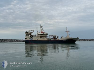
JUNIOR
Trawler
Current Trip
| Time Travelled | 7 days |
|---|---|
| Remaining Time | 11 h, 17 mins |
| Distance Travelled | 875.35 nm |
| Remaining Distance | 128.78 nm |
| AVG Speed | 11.1 Knop |
| MAX Speed | 12.6 Knop |
| AVG Wind | 20.3 knots |
| MAX Wind | 32.8 knots |
| MIN Temp | -4.6°C / 23.72°F |
| MAX Temp | 2°C / 35.6°F |
| Djupgående | 7 m |
| Position mottagen | 1 m sen |
Current Position
| Longitud | 12.70140° |
|---|---|
| Latitude | 55.97457° |
| Status | Under way sailing |
| Fart | 11.4 Knop |
| Kurs | 332.8° |
| Område | Kattegat |
| Station | T-AIS |
| Position mottagen | 1 m sen |
Info
Information
The current position of JUNIOR is in Kattegat with coordinates 55.97457° / 12.70140° as reported on 2026-01-10 14:16 by AIS to our vessel tracker app. The vessel's current speed is 11.4 Knop and is heading at the port of SKAGEN. The estimated time of arrival as calculated by MyShipTracking vessel tracking app is 2026-01-11 02:34 LT
The vessel JUNIOR (IMO: 9202455, MMSI: 219030955) is a Trawler that was built in 2001 ( 25 År gammal ). It's sailing under the flag of [DK] Denmark.
In this page you can find informations about the vessels current position, last detected port calls, and current voyage information. If the vessels is not in coverage by AIS you will find the latest position.
The current position of JUNIOR is detected by our AIS receivers and we are not responsible for the reliability of the data. The last position was recorded while the vessel was in Coverage by the Ais receivers of our vessel tracking app.
The current draught of JUNIOR as reported by AIS is 7 meters
Weather
| Temperature | -4.6°C / 23.72°F |
|---|---|
| Wind Speed | 13 knots |
| Direction | 16° NNE |
| Pressure | 1018.8 hPa |
| Humidity | 70.4 % |
| Cloud Coverage | --- |
Featured Company
Events
| Tid | Event | Detaljer | Position / Dest | Information |
|---|---|---|---|---|
| 2026-01-10 13:23 | Byter havsområde | Swedish part of the Kattegat Danish part of the Kattegat |
55.81633 / 12.72218
Kattegat
|
Fart: 10.5 kn Kurs: 13.8° |
| 2026-01-10 11:35 | Byter havsområde | Danish part of the Kattegat Swedish part of the Kattegat |
55.49192 / 12.70583
Kattegat
|
Fart: 11.1 kn Kurs: 2.2° |
| 2026-01-10 10:45 | Byter havsområde | Swedish part of the Kattegat Swedish part of the Baltic Sea |
55.34328 / 12.66503
Kattegat
|
Fart: 10.4 kn Kurs: 2.7° |
| 2026-01-10 09:37 | Destination ändrad | SKAGEN FISHINGGROUND |
55.25960 / 12.95343
SKAGEN
|
Fart: 10.7 kn Kurs: 270° |
| 2026-01-10 09:37 | Status ändrad | Under way sailing Engaged in Fishing |
55.25960 / 12.95343
FISHINGGROUND
|
Fart: 11 kn Kurs: 271.4° |
| 2026-01-10 03:11 | Byter havsområde | Swedish part of the Baltic Sea Danish part of the Kattegat |
55.52298 / 14.78337
Baltic Sea
|
Fart: 10.7 kn Kurs: 238.1° |
| 2026-01-10 01:43 | Byter havsområde | Danish part of the Kattegat Swedish part of the Baltic Sea |
55.64110 / 15.23022
Kattegat
|
Fart: 11.6 kn Kurs: 242.9° |
| 2026-01-09 23:28 | I täckningsområde |
55.86398 / 15.90033
Baltic Sea
|
Fart: 12.2 kn Kurs: 236° |
|
| 2026-01-09 15:07 | UTANFÖR täckningsområde |
57.10187 / 17.40545
Baltic Sea
|
Fart: 11.1 kn Kurs: 206.4° |
|
| 2026-01-09 06:22 | I täckningsområde |
58.28833 / 19.48677
Baltic Sea
|
Fart: 11.9 kn Kurs: 227.1° |