
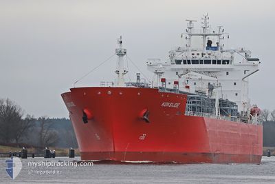
KOKSIJDE
Tanker
Current Trip
| Time Travelled | 15 h, 38 mins |
|---|---|
| Remaining Time | 9 h, 57 mins |
| Distance Travelled | 132.42 nm |
| Remaining Distance | 149.67 nm |
| AVG Speed | 8.6 Knop |
| MAX Speed | 15.7 Knop |
| AVG Wind | 7.2 knots |
| MAX Wind | 9 knots |
| MIN Temp | 3.1°C / 37.58°F |
| MAX Temp | 6.4°C / 43.52°F |
| Djupgående | 8.5 m |
| Position mottagen | 1 m sen |
Current Position
| Longitud | 12.26426° |
|---|---|
| Latitude | 54.50436° |
| Status | Under way using engine |
| Fart | 15 Knop |
| Kurs | 21.8° |
| Område | Baltic Sea |
| Station | T-AIS |
| Position mottagen | 1 m sen |
Info
Information
The current position of KOKSIJDE is in Baltic Sea with coordinates 54.50436° / 12.26426° as reported on 2025-02-28 22:54 by AIS to our vessel tracker app. The vessel's current speed is 15 Knop and is heading at the port of KARLSHAMN. The estimated time of arrival as calculated by MyShipTracking vessel tracking app is 2025-03-01 09:53 LT
The vessel KOKSIJDE (IMO: 9719305, MMSI: 205743000) is a Tanker It's sailing under the flag of [BE] Belgium.
In this page you can find informations about the vessels current position, last detected port calls, and current voyage information. If the vessels is not in coverage by AIS you will find the latest position.
The current position of KOKSIJDE is detected by our AIS receivers and we are not responsible for the reliability of the data. The last position was recorded while the vessel was in Coverage by the Ais receivers of our vessel tracking app.
The current draught of KOKSIJDE as reported by AIS is 8.5 meters
Weather
| Temperature | 4.1°C / 39.38°F |
|---|---|
| Wind Speed | 7 knots |
| Direction | 325° NW |
| Pressure | 1026.6 hPa |
| Humidity | 91 % |
| Cloud Coverage | 100 % |
Featured Company
Last Port Calls
| Port | Arrival | Departure | Time In Port |
|---|---|---|---|
| 2025-02-28 07:53 | 2025-02-28 08:18 | 25 m | |
| 2025-02-23 19:23 | 2025-02-24 22:08 | 1 d | |
| 2025-02-16 18:58 | 2025-02-20 04:35 | 3 d | |
| 2025-02-04 17:59 | 2025-02-05 13:55 | 19 h | |
| 2025-01-20 07:33 | 2025-01-21 08:37 | 1 d | |
| 2025-01-12 15:22 | 2025-01-15 05:15 | 2 d | |
| 2025-01-06 09:58 | 2025-01-09 20:25 | 3 d | |
| 2024-12-31 21:51 | 2025-01-02 03:22 | 1 d | |
| 2024-12-17 18:01 | 2024-12-20 19:49 | 3 d | |
| 2024-12-11 03:43 | 2024-12-12 04:00 | 1 d |
Most Visited Ports (Last year)
| Port | Arrivals | |
|---|---|---|
| 12 | ||
| 7 | ||
| 5 | ||
| 4 | ||
| 3 | ||
| 3 |
Last Trips
| Origin | Departure | Destination | Arrival | Distance | |
|---|---|---|---|---|---|
| 2025-02-24 22:08 | 2025-02-28 07:53 | 473.53 nm | |||
| 2025-02-20 04:35 | 2025-02-23 19:23 | 958.66 nm | |||
| 2025-02-05 13:55 | 2025-02-16 18:58 | 3473.58 nm | |||
| 2025-01-21 08:37 | 2025-02-04 17:59 | 4017.88 nm | |||
| 2025-01-15 05:15 | 2025-01-20 07:33 | 45.99 nm | |||
| 2025-01-09 20:25 | 2025-01-12 15:22 | 785.61 nm | |||
| 2025-01-02 03:22 | 2025-01-06 09:58 | 430.51 nm | |||
| 2024-12-20 19:49 | 2024-12-31 21:51 | 1107.32 nm | |||
| 2024-12-12 04:00 | 2024-12-17 18:01 | 1188.98 nm | |||
| 2024-12-09 11:53 | 2024-12-11 03:43 | 454.26 nm |
Events
| Tid | Event | Detaljer | Position / Dest | Information |
|---|---|---|---|---|
| 2025-02-28 22:19 | Byter havsområde | German part of the Baltic Sea Danish part of the Baltic Sea |
54.40698 / 12.10658
Baltic Sea
DEBRB>SEKAN
|
Fart: 15.2 kn Kurs: 89° |
| 2025-02-28 20:43 | Byter havsområde | Danish part of the Baltic Sea German part of the Baltic Sea |
54.49836 / 11.44748
Baltic Sea
DEBRB>SEKAN
|
Fart: 15.3 kn Kurs: 113.1° |
| 2025-02-28 19:07 | Byter havsområde | German part of the Baltic Sea Danish part of the Baltic Sea |
54.56280 / 10.78044
Baltic Sea
DEBRB>SEKAN
|
Fart: 15.2 kn Kurs: 80.2° |
| 2025-02-28 18:46 | Byter havsområde | Danish part of the Baltic Sea German part of the Baltic Sea |
54.55213 / 10.63325
Baltic Sea
DEBRB>SEKAN
|
Fart: 14.5 kn Kurs: 86.3° |
| 2025-02-28 17:37 | Byter havsområde | German part of the Baltic Sea German part of the North Sea |
54.46550 / 10.26049
Baltic Sea
DEBRB>SEKAN
|
Fart: 9.5 kn Kurs: 25.5° |
| 2025-02-28 16:48 | STARTAR förflyttning | 1.34 nm, South West of STICKENHΟRN SPORT |
54.36502 / 10.14522
DEBRB>SEKAN
|
Fart: 3.1 kn Kurs: 103° |
| 2025-02-28 16:35 | Status ändrad | Under way using engine Moored |
54.36573 / 10.14030
DEBRB>SEKAN
|
Fart: Kurs: 104° |
| 2025-02-28 16:23 | Status ändrad | Moored Under way using engine |
54.36573 / 10.14030
DEBRB>SEKAN
|
Fart: Kurs: 104° |
| 2025-02-28 16:11 | STOPPAR förflyttning | 1.41 nm, South West of STICKENHΟRN SPORT |
54.36574 / 10.14039
DEBRB>SEKAN
|
Fart: 0.3 kn Kurs: 105° |
| 2025-02-28 10:16 | Status ändrad | Under way using engine Default |
54.11886 / 9.32827
DEBRB>SEKAN
|
Fart: 5.7 kn Kurs: 356° |