
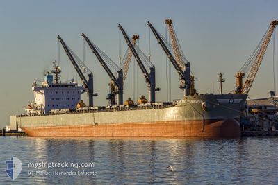
KYRA PANAGHIA
Bulk Carrier
Current Trip
| Time Travelled | 8 days |
|---|---|
| Remaining Time | 5 days |
| Distance Travelled | 1046.85 nm |
| Remaining Distance | 1632.65 nm |
| AVG Speed | 12.4 Knop |
| MAX Speed | 21.4 Knop |
| AVG Wind | 10.3 knots |
| MAX Wind | 21 knots |
| MIN Temp | 6.3°C / 43.34°F |
| MAX Temp | 20.3°C / 68.54°F |
| Djupgående | 13.1 m |
| Position mottagen | 4 m sen |
Current Position
| Longitud | 27.16386° |
|---|---|
| Latitude | 33.21283° |
| Status | Under way using engine |
| Fart | 11.9 Knop |
| Kurs | 288.8° |
| Område | Mediterranean Sea - Eastern Basin |
| Station | T-AIS |
| Position mottagen | 4 m sen |
Info
Information
The current position of KYRA PANAGHIA is in Mediterranean Sea - Eastern Basin with coordinates 33.21283° / 27.16386° as reported on 2025-03-14 23:21 by AIS to our vessel tracker app. The vessel's current speed is 11.9 Knop and is heading at the port of ALGECIRAS. The estimated time of arrival as calculated by MyShipTracking vessel tracking app is 2025-03-20 16:56 LT
The vessel KYRA PANAGHIA (IMO: 9647277, MMSI: 636015710) is a Bulk Carrier that was built in 2012 ( 13 År gammal ). It's sailing under the flag of [LR] Liberia.
In this page you can find informations about the vessels current position, last detected port calls, and current voyage information. If the vessels is not in coverage by AIS you will find the latest position.
The current position of KYRA PANAGHIA is detected by our AIS receivers and we are not responsible for the reliability of the data. The last position was recorded while the vessel was in Coverage by the Ais receivers of our vessel tracking app.
The current draught of KYRA PANAGHIA as reported by AIS is 13.1 meters
Weather
| Temperature | 19.2°C / 66.56°F |
|---|---|
| Wind Speed | 8 knots |
| Direction | 109° ESE |
| Pressure | 1019.1 hPa |
| Humidity | 71.9 % |
| Cloud Coverage | --- |
Featured Company
Last Port Calls
| Port | Arrival | Departure | Time In Port |
|---|---|---|---|
| 2025-03-10 15:48 | 2025-03-13 22:46 | 3 d | |
| 2025-02-27 05:38 | 2025-03-06 03:23 | 6 d | |
| 2025-02-13 23:15 | 2025-02-14 00:07 | 52 m | |
| 2025-02-07 11:10 | 2025-02-13 22:06 | 6 d | |
| 2025-01-25 23:50 | 2025-01-31 23:44 | 5 d | |
| 2025-01-04 07:33 |
Most Visited Ports (Last year)
| Port | Arrivals | |
|---|---|---|
| 2 | ||
| 2 | ||
| 1 | ||
| 1 | ||
| 1 | ||
| 1 |
Last Trips
| Origin | Departure | Destination | Arrival | Distance | |
|---|---|---|---|---|---|
| 2025-03-06 03:23 | 2025-03-10 15:48 | 737.86 nm | |||
| 2025-02-14 00:07 | 2025-02-27 05:38 | 3182.06 nm | |||
| 2025-02-13 22:06 | 2025-02-13 23:15 | 6.05 nm | |||
| 2025-01-31 23:44 | 2025-02-07 11:10 | 310.74 nm | |||
| 2025-01-04 07:33 | 2025-01-25 23:50 | 4793.65 nm |
Events
| Tid | Event | Detaljer | Position / Dest | Information |
|---|---|---|---|---|
| 2025-03-14 14:09 | Destination ändrad | ESALG GIGIB |
32.67520 / 29.25200
ESALG
|
Fart: 11.6 kn Kurs: 282.6° |
| 2025-03-14 14:06 | I täckningsområde |
32.67438 / 29.25631
Mediterranean Sea - Eastern Basin
GIGIB
|
Fart: 11.7 kn Kurs: 282.9° |
|
| 2025-03-14 08:22 | Status ändrad | Default Under way using engine |
32.43967 / 30.39434
GIGIB
|
Fart: 11.7 kn Kurs: 289.1° |
| 2025-03-14 08:16 | UTANFÖR täckningsområde |
32.43401 / 30.41582
Mediterranean Sea - Eastern Basin
GIGIB
|
Fart: 11.7 kn Kurs: 289.1° |
|
| 2025-03-14 08:03 | Status ändrad | Under way using engine Default |
32.42100 / 30.46073
GIGIB
|
Fart: 11.6 kn Kurs: 287° |
| 2025-03-14 07:34 | Status ändrad | Default Under way using engine |
32.39388 / 30.57005
GIGIB
|
Fart: 12.3 kn Kurs: 288.4° |
| 2025-03-14 07:14 | Status ändrad | Under way using engine Default |
32.37172 / 30.64992
GIGIB
|
Fart: 12.6 kn Kurs: 286° |
| 2025-03-14 07:01 | I täckningsområde |
32.37454 / 30.63954
Mediterranean Sea - Eastern Basin
GIGIB
|
Fart: 12.5 kn Kurs: 287.7° |
|
| 2025-03-14 05:01 | Status ändrad | Default Under way using engine |
32.23297 / 31.13737
GIGIB
|
Fart: 11 kn Kurs: 293.4° |
| 2025-03-14 04:54 | UTANFÖR täckningsområde |
32.22410 / 31.16365
Mediterranean Sea - Eastern Basin
GIGIB
|
Fart: 11 kn Kurs: 293.4° |