

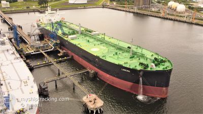
LANCING
Tanker

Current Trip
| Time Travelled | 7 days |
|---|---|
| Remaining Time | --- |
| Distance Travelled | 1050.54 nm |
| Remaining Distance | --- |
| AVG Speed | 10.3 Knop |
| MAX Speed | 12.4 Knop |
| AVG Wind | 13.2 knots |
| MAX Wind | 24.5 knots |
| MIN Temp | 4.5°C / 40.1°F |
| MAX Temp | 10.1°C / 50.18°F |
| Djupgående | 13.5 m |
| Position mottagen | 4 m sen |
Current Position
| Longitud | 18.88051° |
|---|---|
| Latitude | 54.43919° |
| Status | At anchor |
| Fart | |
| Kurs | 340° |
| Område | Baltic Sea |
| Station | T-AIS |
| Position mottagen | 4 m sen |
Information
The current position of LANCING is in Baltic Sea with coordinates 54.43919° / 18.88051° as reported on 2025-04-01 02:41 by AIS to our vessel tracker app. The vessel's current speed is 0 Knop
The vessel LANCING (IMO: 9792046, MMSI: 311000766) is a Tanker It's sailing under the flag of [BS] Bahamas.
In this page you can find informations about the vessels current position, last detected port calls, and current voyage information. If the vessels is not in coverage by AIS you will find the latest position.
The current position of LANCING is detected by our AIS receivers and we are not responsible for the reliability of the data. The last position was recorded while the vessel was in Coverage by the Ais receivers of our vessel tracking app.
The current draught of LANCING as reported by AIS is 13.5 meters
Weather
| Temperature | 5°C / 41°F |
|---|---|
| Wind Speed | 12 knots |
| Direction | 354° N |
| Pressure | 1024.9 hPa |
| Humidity | 90.5 % |
| Cloud Coverage | 95 % |


Featured Company
Last Port Calls
| Port | Arrival | Departure | Time In Port |
|---|---|---|---|
| 2025-03-22 19:51 | 2025-03-24 22:39 | 2 d | |
| 2025-02-22 07:01 | 2025-02-23 11:10 | 1 d |
Last Trips
| Origin | Departure | Destination | Arrival | Distance | |
|---|---|---|---|---|---|
| 2025-02-23 11:10 | 2025-03-22 19:51 | 1060.31 nm | |||
| 2025-01-20 13:40 | 2025-02-22 07:01 | 1008.36 nm |
Events
| Tid | Event | Detaljer | Position / Dest | Information |
|---|---|---|---|---|
| 2025-04-01 02:03 | Status ändrad | At anchor Default |
54.43924 / 18.88068
GBHPT>PLGDN
|
Fart: Kurs: 336° |
| 2025-04-01 02:00 | Status ändrad | Default At anchor |
54.43924 / 18.88069
GBHPT>PLGDN
|
Fart: Kurs: 334° |
| 2025-04-01 01:45 | Status ändrad | At anchor Default |
54.43923 / 18.88067
GBHPT>PLGDN
|
Fart: Kurs: 337° |
| 2025-04-01 01:41 | Status ändrad | Default At anchor |
54.43923 / 18.88064
GBHPT>PLGDN
|
Fart: Kurs: 339° |
| 2025-04-01 01:27 | Status ändrad | At anchor Default |
54.43919 / 18.88032
GBHPT>PLGDN
|
Fart: Kurs: 345° |
| 2025-04-01 01:24 | Status ändrad | Default At anchor |
54.43920 / 18.88025
GBHPT>PLGDN
|
Fart: Kurs: 346° |
| 2025-04-01 00:57 | Status ändrad | At anchor Default |
54.43919 / 18.88016
GBHPT>PLGDN
|
Fart: Kurs: 343° |
| 2025-04-01 00:54 | Status ändrad | Default At anchor |
54.43919 / 18.88021
GBHPT>PLGDN
|
Fart: Kurs: 342° |
| 2025-04-01 00:33 | Status ändrad | At anchor Default |
54.43922 / 18.88040
GBHPT>PLGDN
|
Fart: Kurs: 340° |
| 2025-04-01 00:29 | Status ändrad | Default At anchor |
54.43923 / 18.88039
GBHPT>PLGDN
|
Fart: Kurs: 340° |