
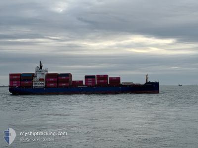
LANGENESS
Cargo A
Current Trip
| Time Travelled | 2 days |
|---|---|
| Remaining Time | 10 h, 1 mins |
| Distance Travelled | 591.24 nm |
| Remaining Distance | 95.31 nm |
| AVG Speed | 10.8 Knop |
| MAX Speed | 16.1 Knop |
| AVG Wind | 11.9 knots |
| MAX Wind | 23 knots |
| MIN Temp | -3.9°C / 24.98°F |
| MAX Temp | 3.4°C / 38.12°F |
| Djupgående | 9.3 m |
| Position mottagen | 2 m sen |
Current Position
| Longitud | 3.40609° |
|---|---|
| Latitude | 52.32199° |
| Status | Under way using engine |
| Fart | 9.2 Knop |
| Kurs | 212.9° |
| Område | North Sea |
| Station | T-AIS |
| Position mottagen | 2 m sen |
Info
Information
The current position of LANGENESS is in North Sea with coordinates 52.32199° / 3.40609° as reported on 2025-02-19 03:37 by AIS to our vessel tracker app. The vessel's current speed is 9.2 Knop and is heading at the port of ANTWERP. The estimated time of arrival as calculated by MyShipTracking vessel tracking app is 2025-02-19 13:40 LT
The vessel LANGENESS (IMO: 9944778, MMSI: 305540000) is a Cargo A It's sailing under the flag of [AG] Antigua Barbuda.
In this page you can find informations about the vessels current position, last detected port calls, and current voyage information. If the vessels is not in coverage by AIS you will find the latest position.
The current position of LANGENESS is detected by our AIS receivers and we are not responsible for the reliability of the data. The last position was recorded while the vessel was in Coverage by the Ais receivers of our vessel tracking app.
The current draught of LANGENESS as reported by AIS is 9.3 meters
Weather
| Temperature | 2.2°C / 35.96°F |
|---|---|
| Wind Speed | 20 knots |
| Direction | 126° SE |
| Pressure | 1021.5 hPa |
| Humidity | 61.1 % |
| Cloud Coverage | 86 % |
Featured Company
Last Port Calls
| Port | Arrival | Departure | Time In Port |
|---|---|---|---|
| 2025-02-16 04:25 | 2025-02-16 16:25 | 12 h | |
| 2025-02-13 22:15 | 2025-02-15 17:22 | 1 d | |
| 2025-02-13 03:32 | 2025-02-13 16:25 | 12 h | |
| 2025-02-11 08:42 | 2025-02-12 04:56 | 20 h | |
| 2025-02-04 01:38 | 2025-02-06 14:40 | 2 d | |
| 2025-01-30 13:29 | 2025-01-30 23:28 | 9 h | |
| 2025-01-26 04:29 | 2025-01-26 15:36 | 11 h | |
| 2025-01-24 22:40 | 2025-01-25 17:23 | 18 h | |
| 2025-01-22 16:41 | 2025-01-23 14:30 | 21 h | |
| 2025-01-20 15:44 | 2025-01-22 08:28 | 1 d |
Most Visited Ports (Last year)
| Port | Arrivals | |
|---|---|---|
| 27 | ||
| 11 | ||
| 11 | ||
| 10 | ||
| 9 | ||
| 9 |
Last Trips
| Origin | Departure | Destination | Arrival | Distance | |
|---|---|---|---|---|---|
| 2025-02-15 18:22 | 2025-02-16 05:25 | 108.52 nm | |||
| 2025-02-13 17:25 | 2025-02-13 23:15 | 90.58 nm | |||
| 2025-02-12 05:56 | 2025-02-13 04:32 | 122.69 nm | |||
| 2025-02-06 15:40 | 2025-02-11 09:42 | 498.61 nm | |||
| 2025-01-31 00:28 | 2025-02-04 02:38 | 101.10 nm | |||
| 2025-01-26 16:36 | 2025-01-30 14:29 | 711.71 nm | |||
| 2025-01-25 18:23 | 2025-01-26 05:29 | 107.50 nm | |||
| 2025-01-23 15:30 | 2025-01-24 23:40 | 90.42 nm | |||
| 2025-01-22 09:28 | 2025-01-22 17:41 | 114.17 nm | |||
| 2025-01-18 06:00 | 2025-01-20 16:44 | 495.53 nm |
Events
| Tid | Event | Detaljer | Position / Dest | Information |
|---|---|---|---|---|
| 2025-02-19 03:37 | Status ändrad | Under way using engine Default |
52.32199 / 3.40609
BEANR
|
Fart: 9.3 kn Kurs: 214° |
| 2025-02-19 03:33 | I täckningsområde |
52.32199 / 3.40609
North Sea
BEANR
|
Fart: 9.2 kn Kurs: 212.9° |
|
| 2025-02-18 22:12 | Status ändrad | Default Under way using engine |
53.00760 / 4.08320
BEANR
|
Fart: 9.3 kn Kurs: 229.7° |
| 2025-02-18 22:12 | UTANFÖR täckningsområde |
53.00785 / 4.08370
North Sea
BEANR
|
Fart: 9.3 kn Kurs: 229.7° |
|
| 2025-02-18 21:40 | Status ändrad | Under way using engine Default |
53.06133 / 4.18644
BEANR
|
Fart: 9.3 kn Kurs: 228° |
| 2025-02-18 21:32 | Status ändrad | Default Under way using engine |
53.07534 / 4.21361
BEANR
|
Fart: 9.3 kn Kurs: 227° |
| 2025-02-18 21:04 | Status ändrad | Under way using engine Default |
53.12393 / 4.30644
BEANR
|
Fart: 9.6 kn Kurs: 225° |
| 2025-02-18 20:39 | Status ändrad | Default Under way using engine |
53.16868 / 4.38643
BEANR
|
Fart: 9.5 kn Kurs: 216.9° |
| 2025-02-18 19:53 | Byter havsområde | Dutch part of the North Sea Danish part of the North Sea |
53.27219 / 4.47818
North Sea
BEANR
|
Fart: 9 kn Kurs: 204.5° |
| 2025-02-18 19:53 | Status ändrad | Under way using engine Default |
53.27219 / 4.47818
BEANR
|
Fart: 9 kn Kurs: 203° |