
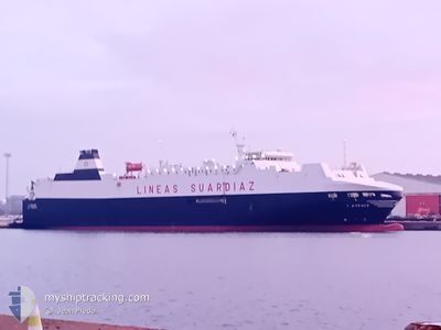
LAUDACE
Vehicles Carrier
Current Trip
| Trip Time | 1 day |
|---|---|
| Trip Distance | 510.79 nm |
| AVG Speed | 15.4 Knop |
| MAX Speed | 20.4 Knop |
| Djupgående | 5.8 m |
| AVG Wind | 16.7 knots |
| MAX Wind | 22.7 knots |
| MIN Temp | 6.2°C / 43.16°F |
| MAX Temp | 13.8°C / 56.84°F |
| Position mottagen | 1 m sen |
Current Position
| Longitud | -8.74226° |
|---|---|
| Latitude | 42.23457° |
| Status | Under way using engine |
| Fart | |
| Kurs | 59° |
| Område | North Atlantic Ocean |
| Station | T-AIS |
| Position mottagen | 1 m sen |
Info
Information
The current position of LAUDACE is in North Atlantic Ocean with coordinates 42.23457° / -8.74226° as reported on 2026-01-08 10:16 by AIS to our vessel tracker app. The vessel's current speed is 0 Knop and is currently inside the port of VIGO.
The vessel LAUDACE (IMO: 9187318, MMSI: 224876000) is a Vehicles Carrier that was built in 1999 ( 27 År gammal ). It's sailing under the flag of [ES] Spain.
In this page you can find informations about the vessels current position, last detected port calls, and current voyage information. If the vessels is not in coverage by AIS you will find the latest position.
The current position of LAUDACE is detected by our AIS receivers and we are not responsible for the reliability of the data. The last position was recorded while the vessel was in Coverage by the Ais receivers of our vessel tracking app.
The current draught of LAUDACE as reported by AIS is 5.8 meters
Weather
| Temperature | 10.5°C / 50.9°F |
|---|---|
| Wind Speed | 10 knots |
| Direction | 188° S |
| Pressure | 1028.3 hPa |
| Humidity | 90.2 % |
| Cloud Coverage | 100 % |
Featured Company
Last Port Calls
| Port | Arrival | Departure | Time In Port |
|---|---|---|---|
| 2026-01-08 06:02 | |||
| 2026-01-05 21:10 | 2026-01-07 00:20 | 1 d | |
| 2025-12-30 23:21 | 2026-01-04 10:38 | 4 d | |
| 2025-12-28 17:37 | 2025-12-29 14:24 | 20 h | |
| 2025-12-25 09:45 | 2025-12-27 13:58 | 2 d | |
| 2025-12-23 22:01 | 2025-12-24 06:22 | 8 h | |
| 2025-12-21 18:26 | 2025-12-22 18:13 | 23 h | |
| 2025-12-20 00:05 | 2025-12-20 14:16 | 14 h | |
| 2025-12-18 12:43 | 2025-12-18 20:24 | 7 h | |
| 2025-12-16 22:07 | 2025-12-17 06:25 | 8 h |
Last Trips
| Origin | Departure | Destination | Arrival | Distance | |
|---|---|---|---|---|---|
| 2026-01-07 00:20 | 2026-01-08 06:02 | 510.79 nm | |||
| 2026-01-04 10:38 | 2026-01-05 21:10 | 610.61 nm | |||
| 2025-12-29 14:24 | 2025-12-30 23:21 | 588.24 nm | |||
| 2025-12-27 13:58 | 2025-12-28 17:37 | 486.78 nm | |||
| 2025-12-24 06:22 | 2025-12-25 09:45 | 511.59 nm | |||
| 2025-12-22 18:13 | 2025-12-23 22:01 | 487.23 nm | |||
| 2025-12-20 14:16 | 2025-12-21 18:26 | 511.72 nm | |||
| 2025-12-18 20:24 | 2025-12-20 00:05 | 487.31 nm | |||
| 2025-12-17 06:25 | 2025-12-18 12:43 | 512.02 nm | |||
| 2025-12-15 18:36 | 2025-12-16 22:07 | 486.53 nm |
Events
| Tid | Event | Detaljer | Position / Dest | Information |
|---|---|---|---|---|
| 2026-01-08 05:12 | STOPPAR förflyttning |
42.23479 / -8.74203
[ES] VIGO
|
Fart: 0.3 kn Kurs: 62° |
|
| 2026-01-08 05:02 | ANLÄNDER HAMN |
|
42.23622 / -8.75012
[ES] VIGO
|
Fart: 6.6 kn Kurs: 93.5° |
| 2026-01-08 04:40 | Status ändrad | Under way using engine Default |
42.23179 / -8.85317
ES VGO
|
Fart: 18.1 kn Kurs: 172° |
| 2026-01-08 04:32 | I täckningsområde |
42.23179 / -8.85317
North Atlantic Ocean
ES VGO
|
Fart: 19.5 kn Kurs: 94.3° |
|
| 2026-01-07 21:13 | Status ändrad | Default Under way using engine |
43.75141 / -9.36009
ES VGO
|
Fart: 17.6 kn Kurs: 235.6° |
| 2026-01-07 21:06 | Byter havsområde | Spanish part of the North Atlantic Ocean French part of the Bay of Biscay |
43.76956 / -9.32366
North Atlantic Ocean
ES VGO
|
Fart: 17.6 kn Kurs: 235.6° |
| 2026-01-07 21:06 | Status ändrad | Under way using engine Default |
43.76956 / -9.32366
ES VGO
|
Fart: 17.5 kn Kurs: 236° |
| 2026-01-07 21:06 | I täckningsområde |
43.76956 / -9.32366
North Atlantic Ocean
ES VGO
|
Fart: 17.6 kn Kurs: 235.6° |
|
| 2026-01-07 21:06 | UTANFÖR täckningsområde |
43.76956 / -9.32366
North Atlantic Ocean
ES VGO
|
Fart: 17.6 kn Kurs: 235.6° |
|
| 2026-01-07 02:45 | UTANFÖR täckningsområde |
46.73383 / -3.25741
Bay of Biscay
ES VGO
|
Fart: 16.7 kn Kurs: 233.8° |