

LEONIDAS Z
Cargo

Current Trip
COBUN
| Time Travelled | 1 day |
|---|---|
| Remaining Time | --- |
| Distance Travelled | 22.77 nm |
| Remaining Distance | --- |
| AVG Speed | 14.8 Knop |
| MAX Speed | 16.3 Knop |
| AVG Wind | 3.4 knots |
| MAX Wind | 4 knots |
| MIN Temp | 23.7°C / 74.66°F |
| MAX Temp | 27.9°C / 82.22°F |
| Djupgående | 10.2 m |
| Position mottagen | 1 d sen |
Current Position
| Longitud | -80.07780° |
|---|---|
| Latitude | 9.63996° |
| Status | Under way using engine |
| Fart | 16.1 Knop |
| Kurs | 277.7° |
| Område | Caribbean Sea |
| Station | T-AIS |
| Position mottagen | 1 d sen |
Information
The current position of LEONIDAS Z is in Caribbean Sea with coordinates 9.63996° / -80.07780° as reported on 2025-06-02 11:34 by AIS to our vessel tracker app. The vessel's current speed is 16.1 Knop
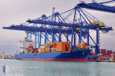
The vessel LEONIDAS Z (IMO: 9963528, MMSI: 538010119) is a Cargo It's sailing under the flag of [MH] Marshall Is.
In this page you can find informations about the vessels current position, last detected port calls, and current voyage information. If the vessels is not in coverage by AIS you will find the latest position.
The current position of LEONIDAS Z is detected by our AIS receivers and we are not responsible for the reliability of the data. The last position was recorded while the vessel was in Coverage by the Ais receivers of our vessel tracking app.
The current draught of LEONIDAS Z as reported by AIS is 10.2 meters
Weather
| Temperature | 27.9°C / 82.22°F |
|---|---|
| Wind Speed | 3 knots |
| Direction | 42° NE |
| Pressure | 1011.3 hPa |
| Humidity | 75.1 % |
| Cloud Coverage | 98 % |


Featured Company
Last Port Calls
| Port | Arrival | Departure | Time In Port |
|---|---|---|---|
| 2025-06-01 18:01 | 2025-06-02 04:54 | 10 h | |
| 2025-05-21 19:32 | |||
| 2025-05-17 23:54 | |||
| 2025-05-03 05:53 | 2025-05-04 02:10 | 20 h | |
| 2025-04-29 17:38 | 2025-05-02 17:49 | 3 d | |
| 2025-04-26 20:37 | 2025-04-28 09:45 | 1 d | |
| 2025-04-25 11:24 | 2025-04-25 19:24 | 7 h | |
| 2025-04-22 20:41 | 2025-04-23 20:04 | 23 h | |
| 2025-04-13 11:28 | 2025-04-13 22:42 | 11 h | |
| 2025-04-10 12:16 | 2025-04-11 01:06 | 12 h |
Last Trips
| Origin | Departure | Destination | Arrival | Distance | |
|---|---|---|---|---|---|
| 2025-05-04 02:10 | 2025-05-17 23:54 | 5015.55 nm | |||
| 2025-05-02 17:49 | 2025-05-03 05:53 | 82.32 nm | |||
| 2025-04-28 09:45 | 2025-04-29 17:38 | 542.53 nm | |||
| 2025-04-25 19:24 | 2025-04-26 20:37 | 354.01 nm | |||
| 2025-04-23 20:04 | 2025-04-25 11:24 | 625.09 nm | |||
| 2025-04-13 22:42 | 2025-04-22 20:41 | 3405.88 nm | |||
| 2025-04-11 01:06 | 2025-04-13 11:28 | 639.48 nm | |||
| 2025-03-30 08:03 | 2025-04-10 12:16 | 695.27 nm |
Events
| Tid | Event | Detaljer | Position / Dest | Information |
|---|---|---|---|---|
| 2025-06-02 11:34 | UTANFÖR täckningsområde |
9.63996 / -80.07780
Caribbean Sea
|
Fart: 16.1 kn Kurs: 277.7° |
|
| 2025-06-02 09:54 | AVGÅTT HAMN |
|
9.36997 / -79.89225
COBUN
|
Fart: 3.1 kn Kurs: 276° |
| 2025-06-02 09:51 | STARTAR förflyttning |
9.36933 / -79.88908
[PA] COLON
|
Fart: 3.1 kn Kurs: 276° |
|
| 2025-06-02 09:43 | Status ändrad | Under way using engine Moored |
9.36987 / -79.88498
[PA] COLON
|
Fart: Kurs: 245° |
| 2025-06-02 04:25 | I täckningsområde |
9.36983 / -79.88496
Caribbean Sea
[PA] COLON
|
Fart: Kurs: 27.8° |
|
| 2025-06-02 03:22 | UTANFÖR täckningsområde |
9.36984 / -79.88494
Caribbean Sea
[PA] COLON
|
Fart: Kurs: 353.5° |
|
| 2025-06-01 23:01 | Status ändrad | Moored Under way using engine |
9.36982 / -79.88505
[PA] COLON
|
Fart: 0.7 kn Kurs: 246° |
| 2025-06-01 23:01 | STOPPAR förflyttning |
9.36982 / -79.88505
[PA] COLON
|
Fart: 0.2 kn Kurs: 249° |
|
| 2025-06-01 23:01 | ANLÄNDER HAMN |
|
9.36982 / -79.88505
[PA] COLON
|
Fart: 0.7 kn Kurs: 246° |
| 2025-06-01 22:20 | STARTAR förflyttning | 3.04 nm, North of COLON |
9.42075 / -79.90412
COBUN
|
Fart: 6.7 kn Kurs: 133.7° |